
The interaction between groundwater and that on the surface is not understood well. Its aspects are both complex and in want of better ways to measure such things as stream flow. There is a need for newer methods to be found in order that we can more fully understand these systems and help maintain them.
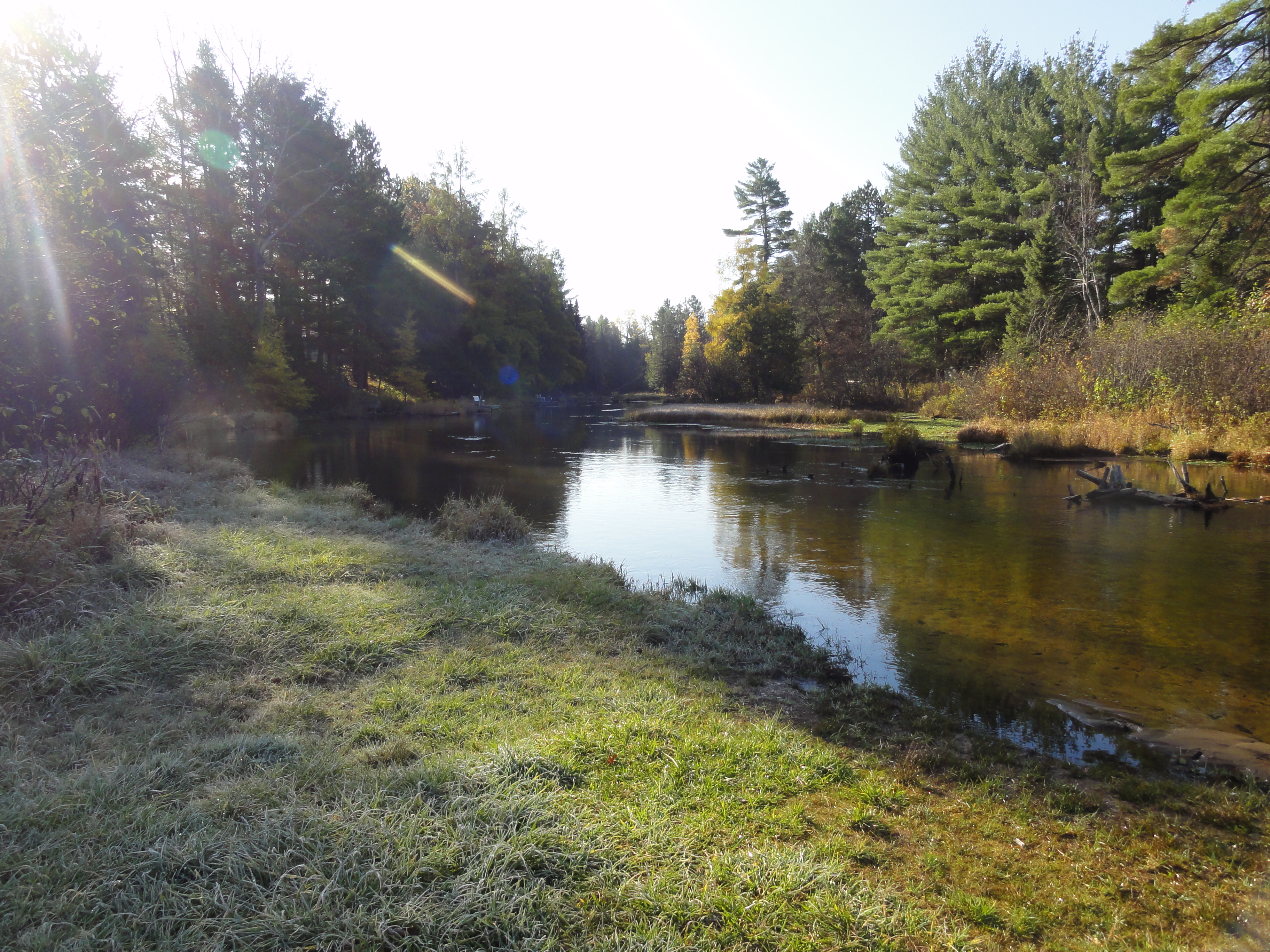
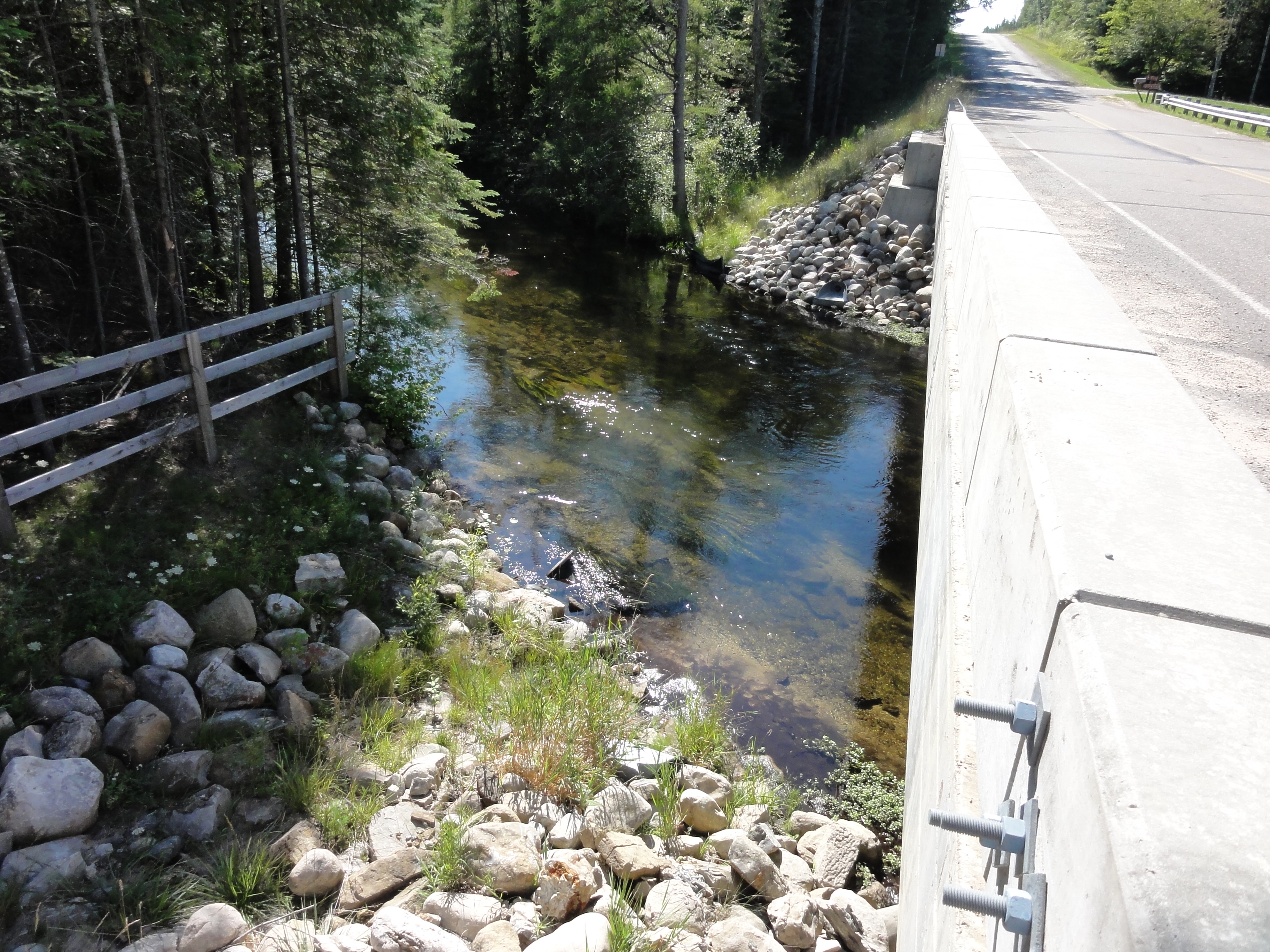
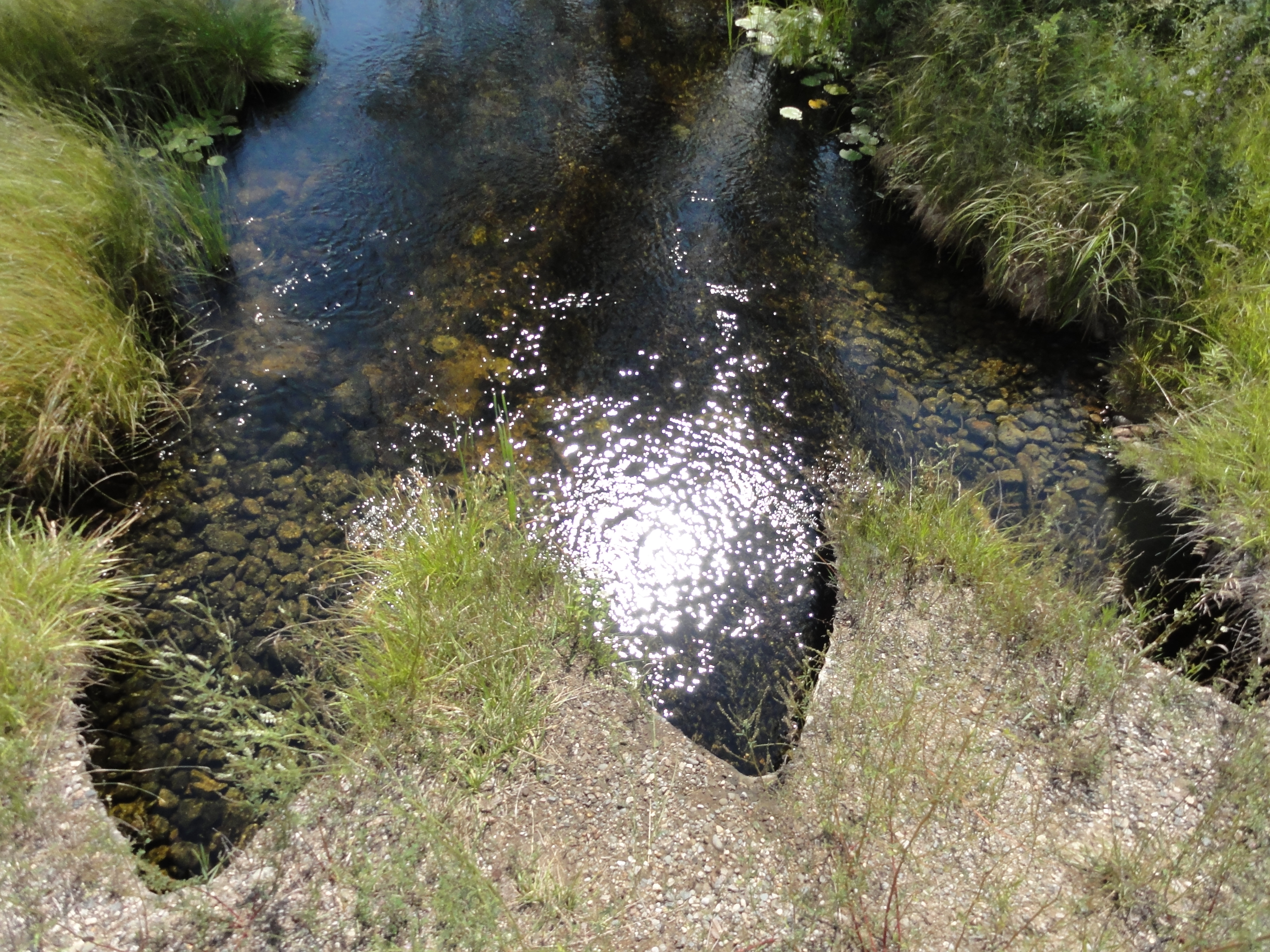
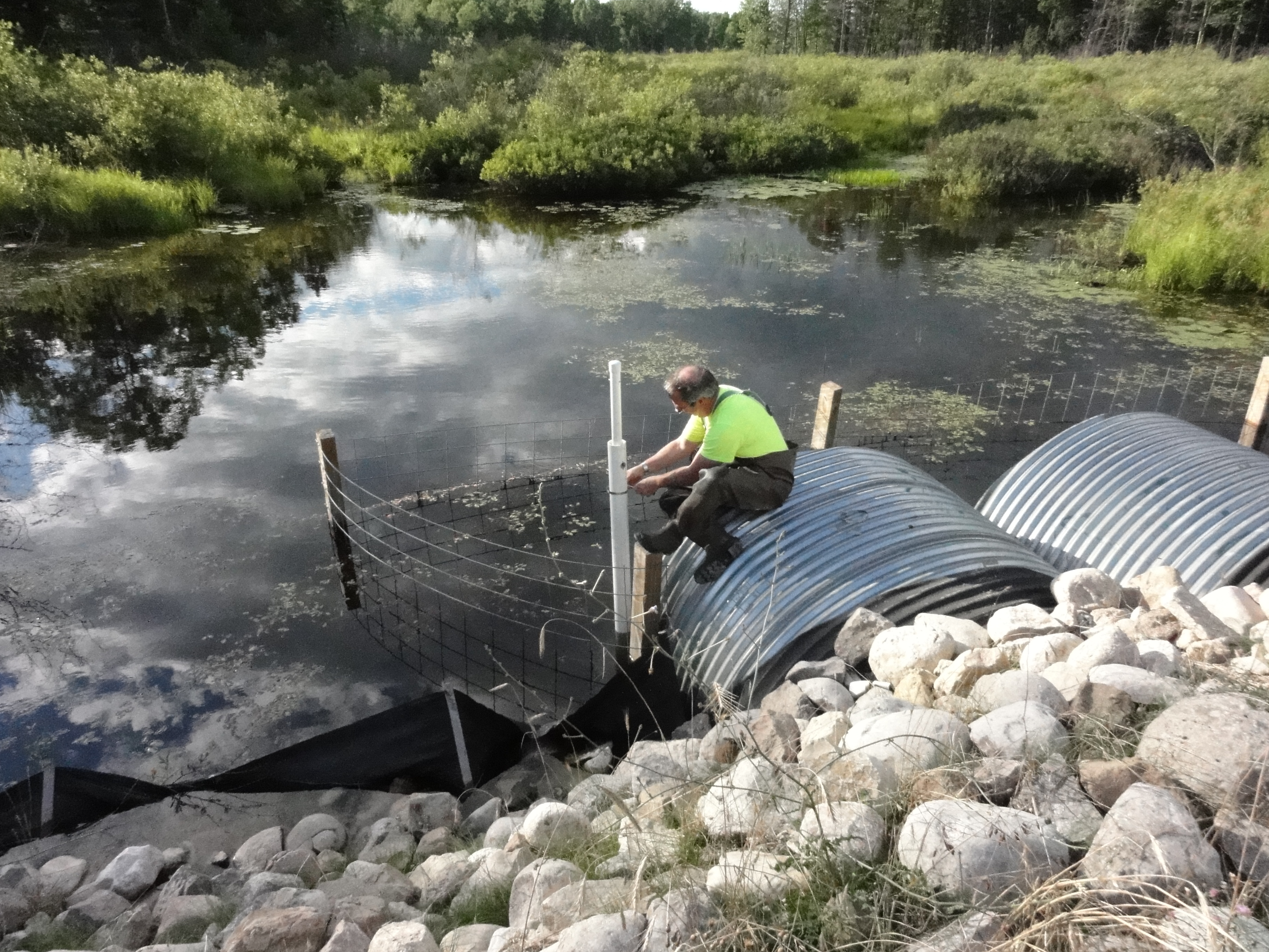
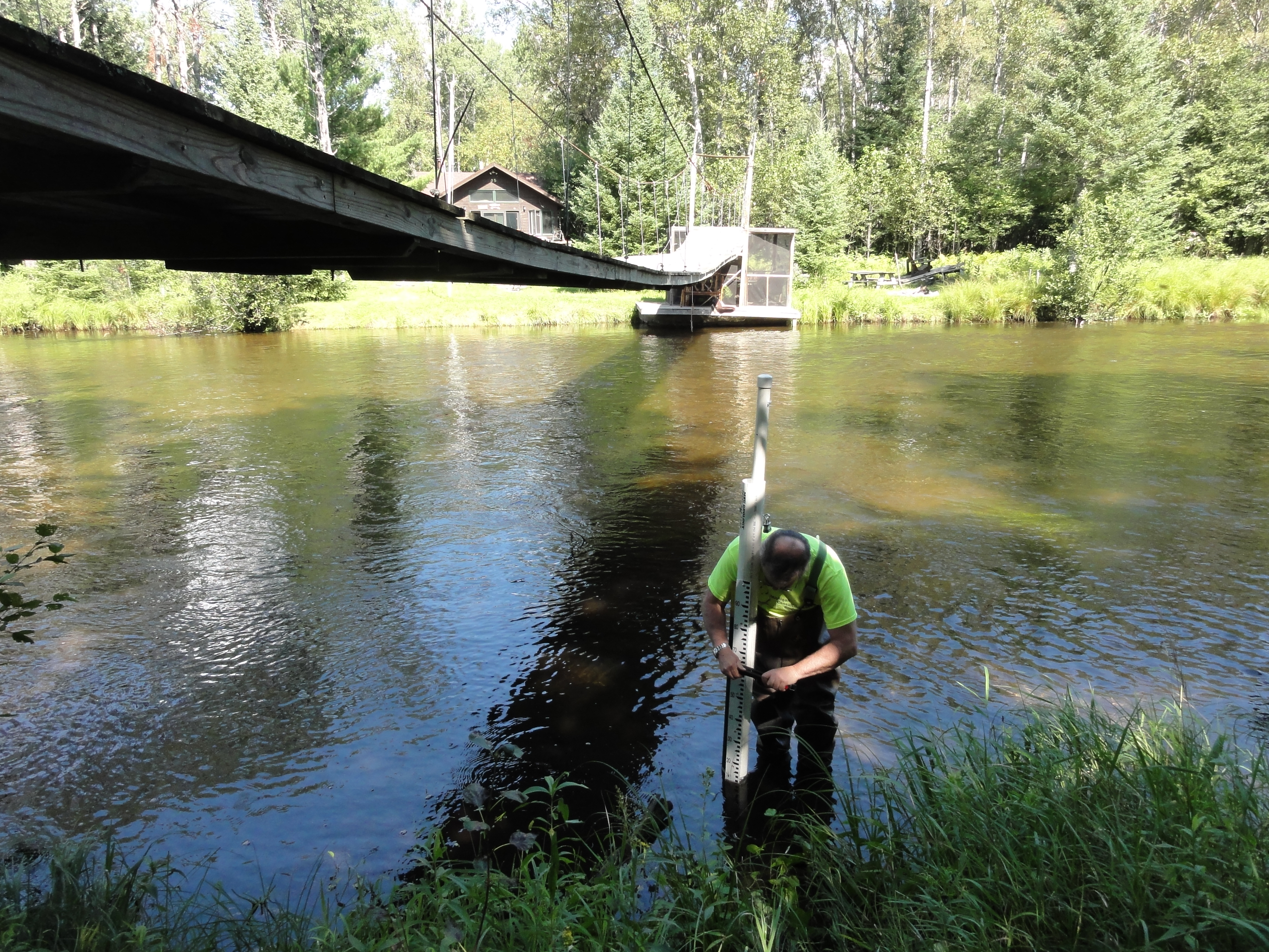
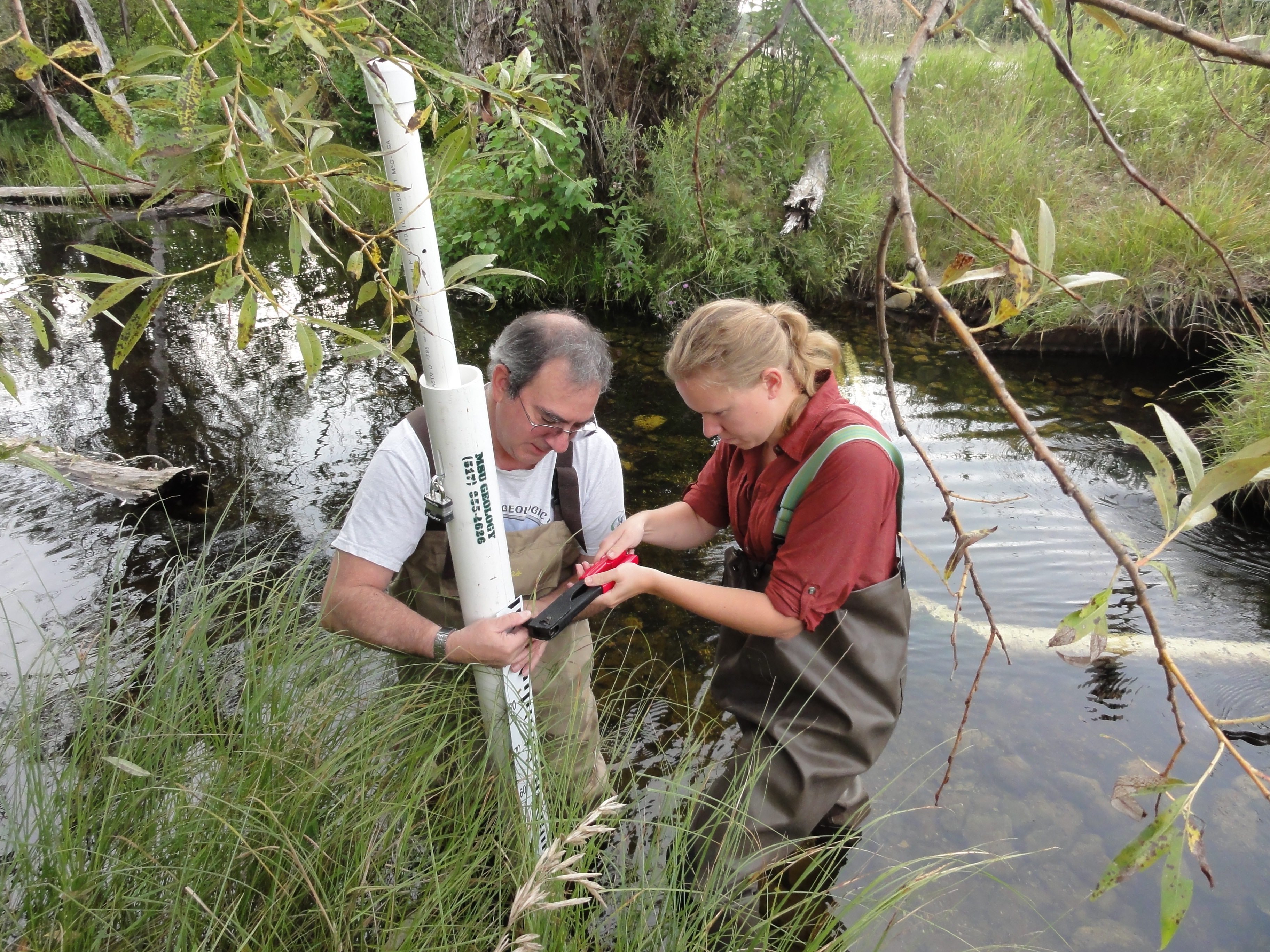
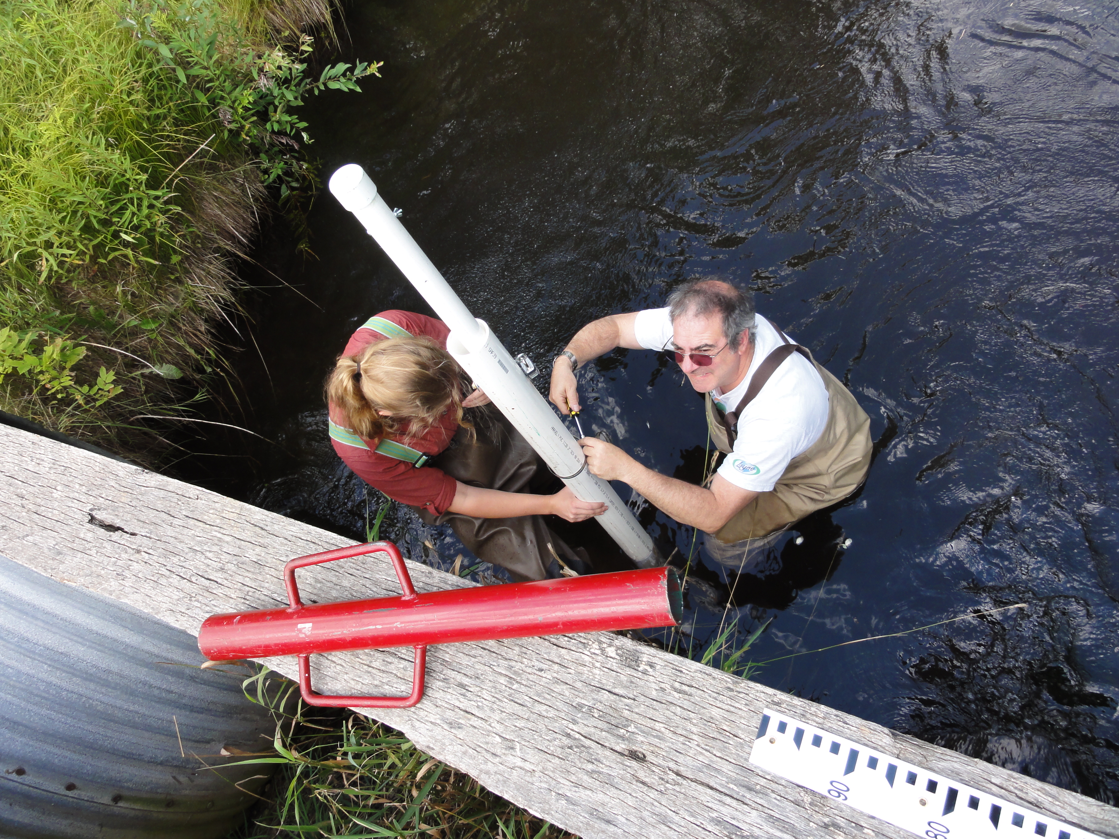
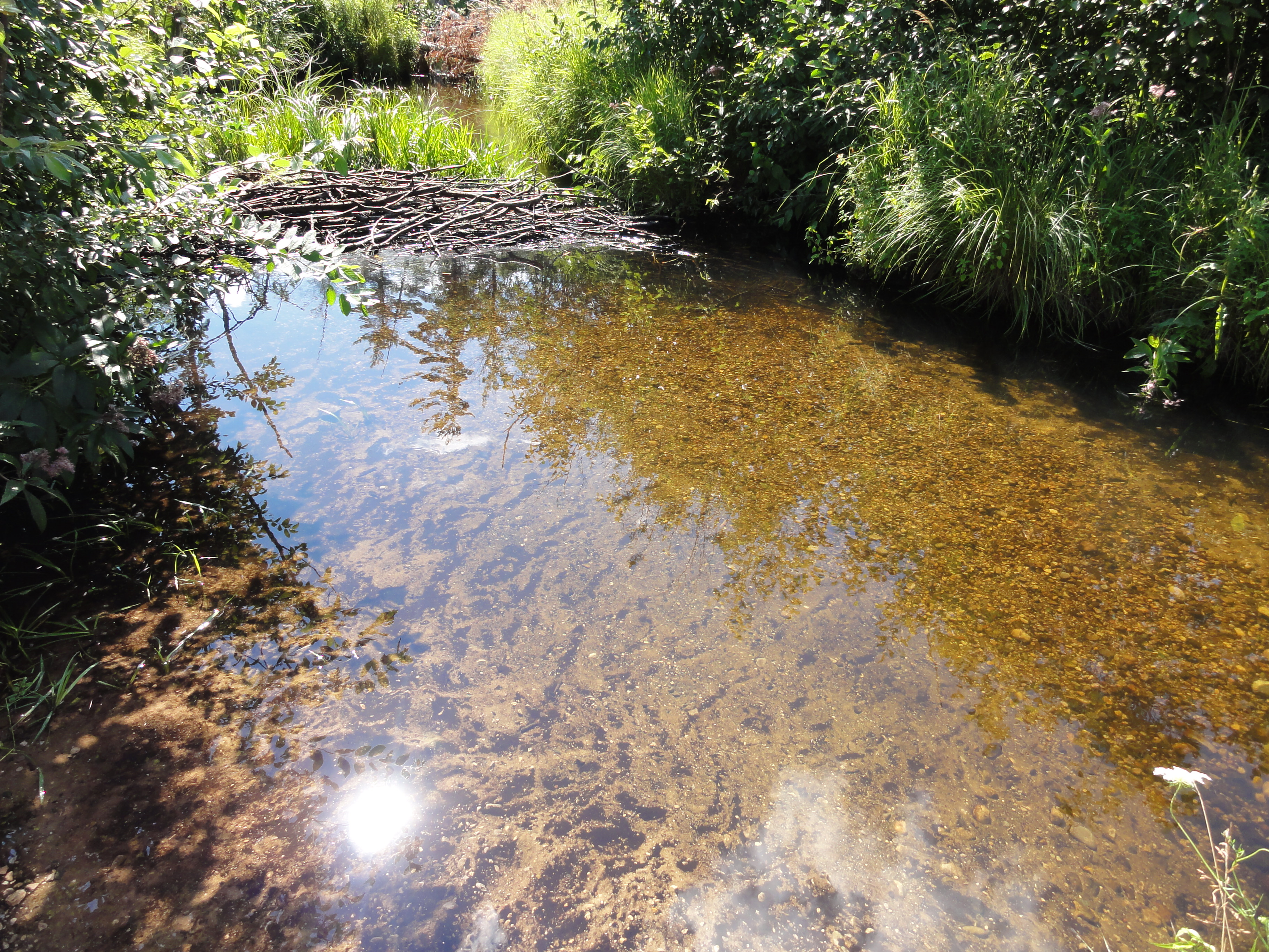
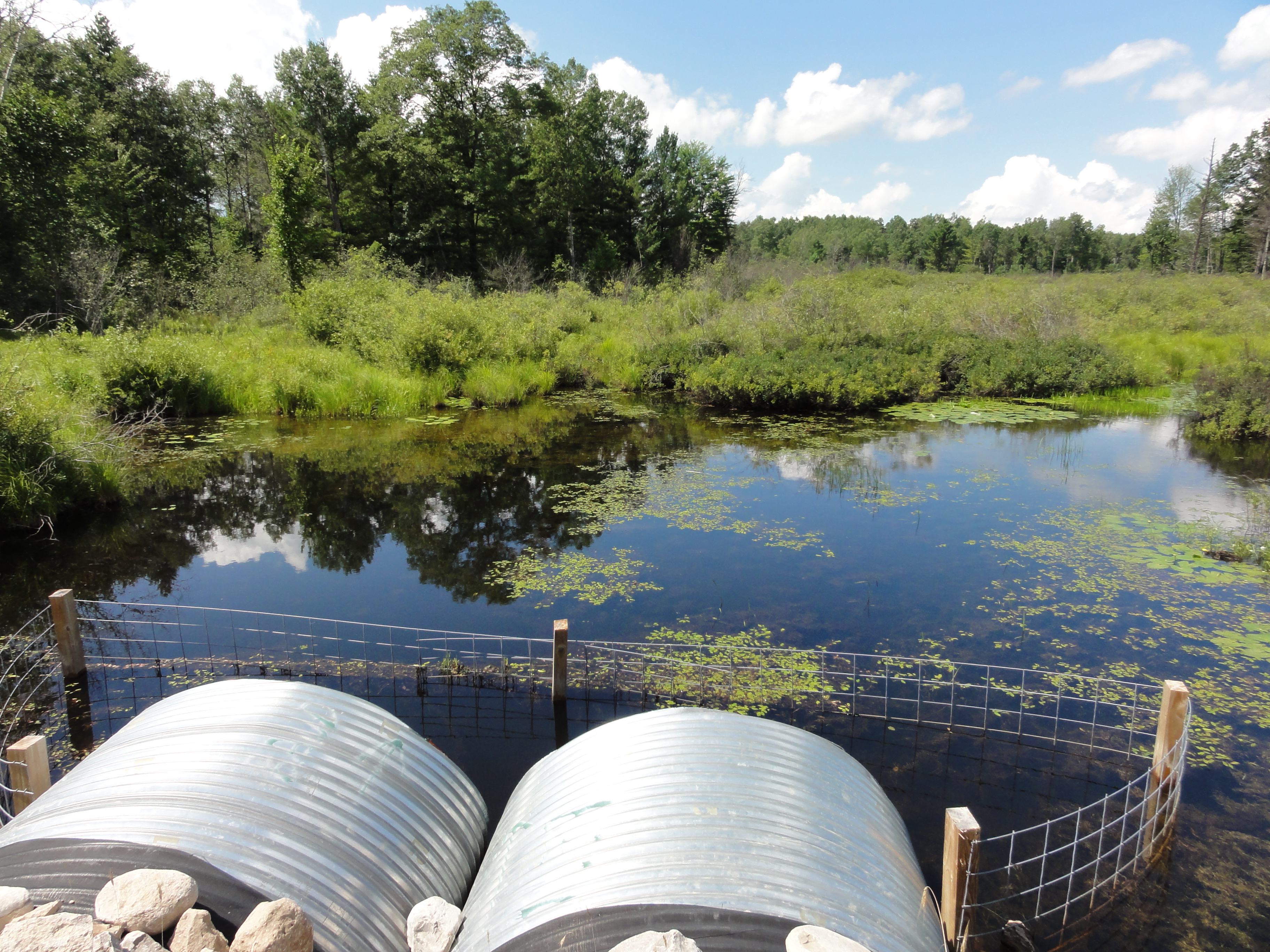
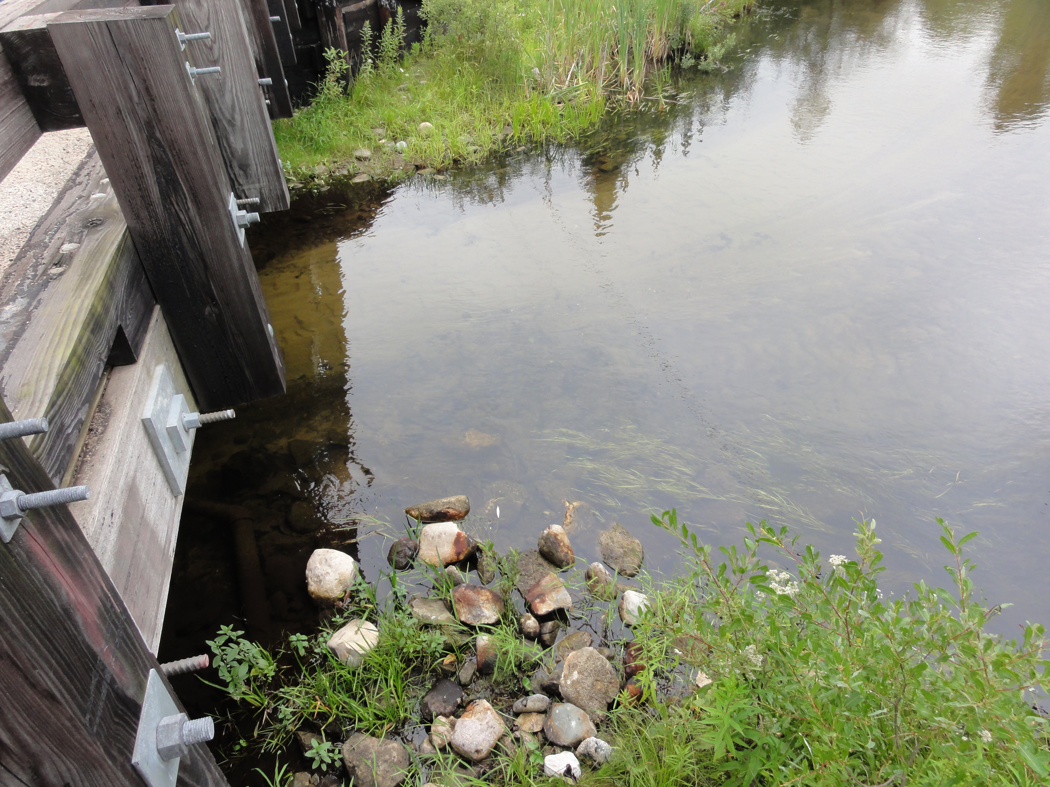
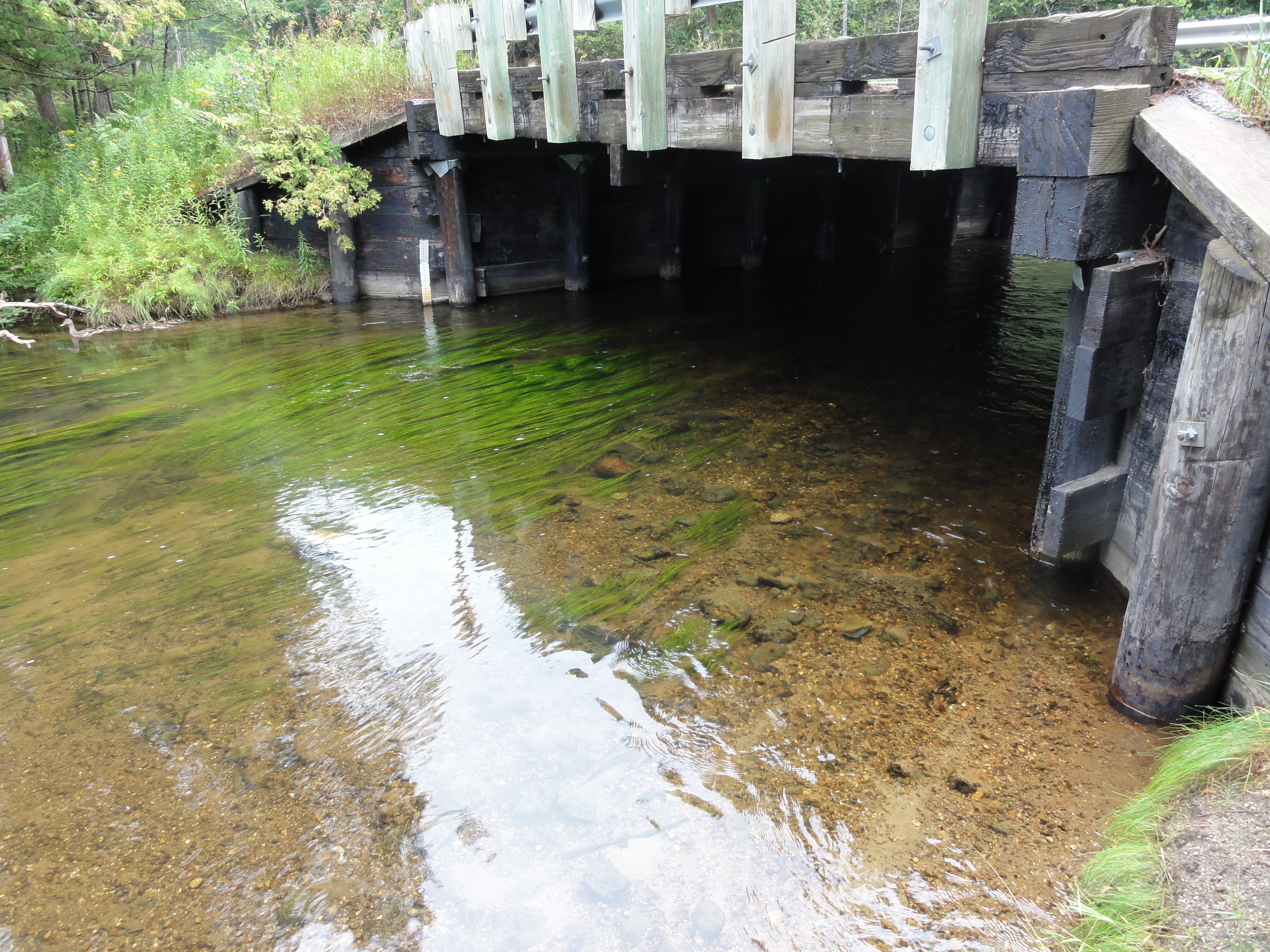
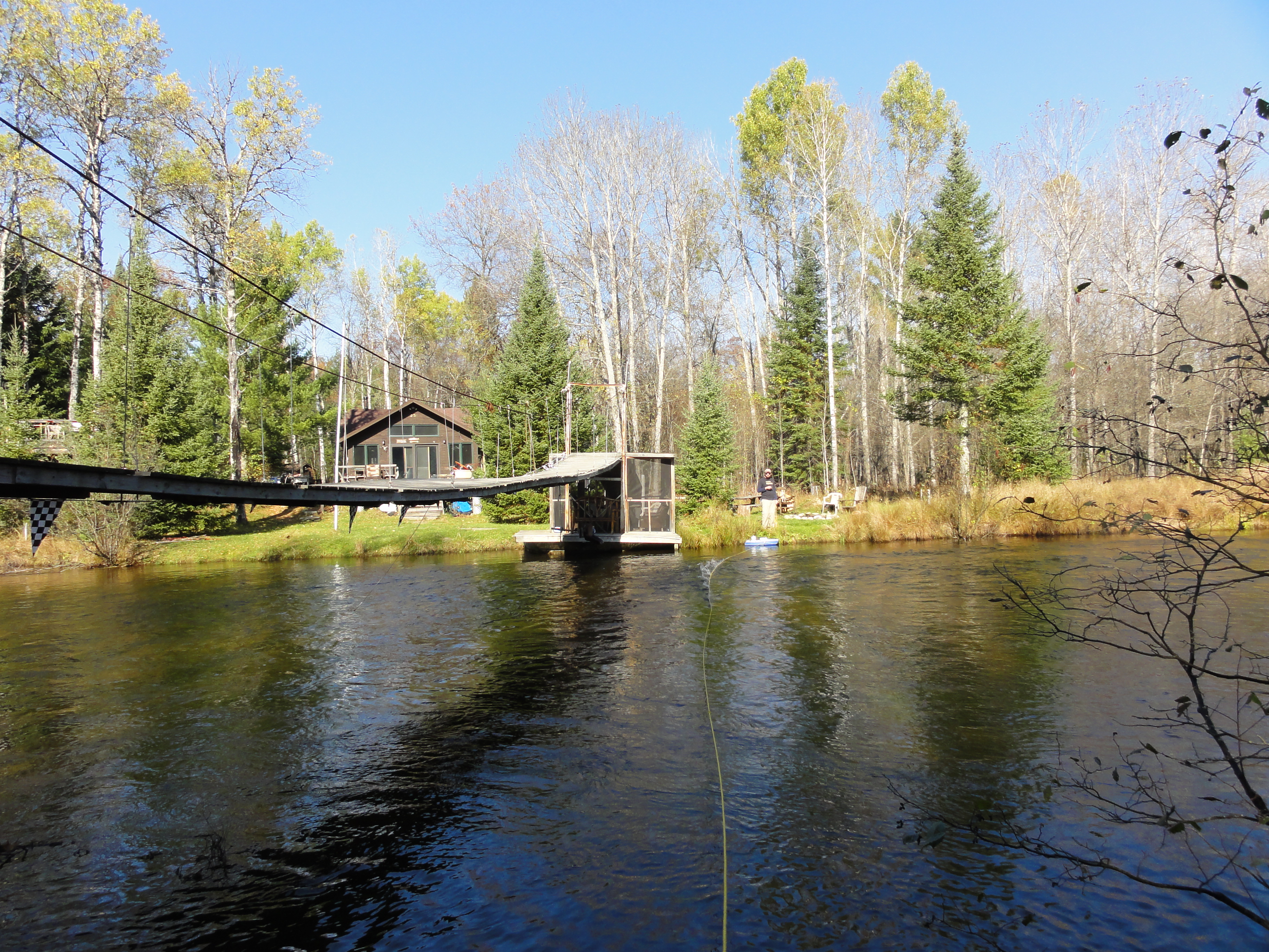
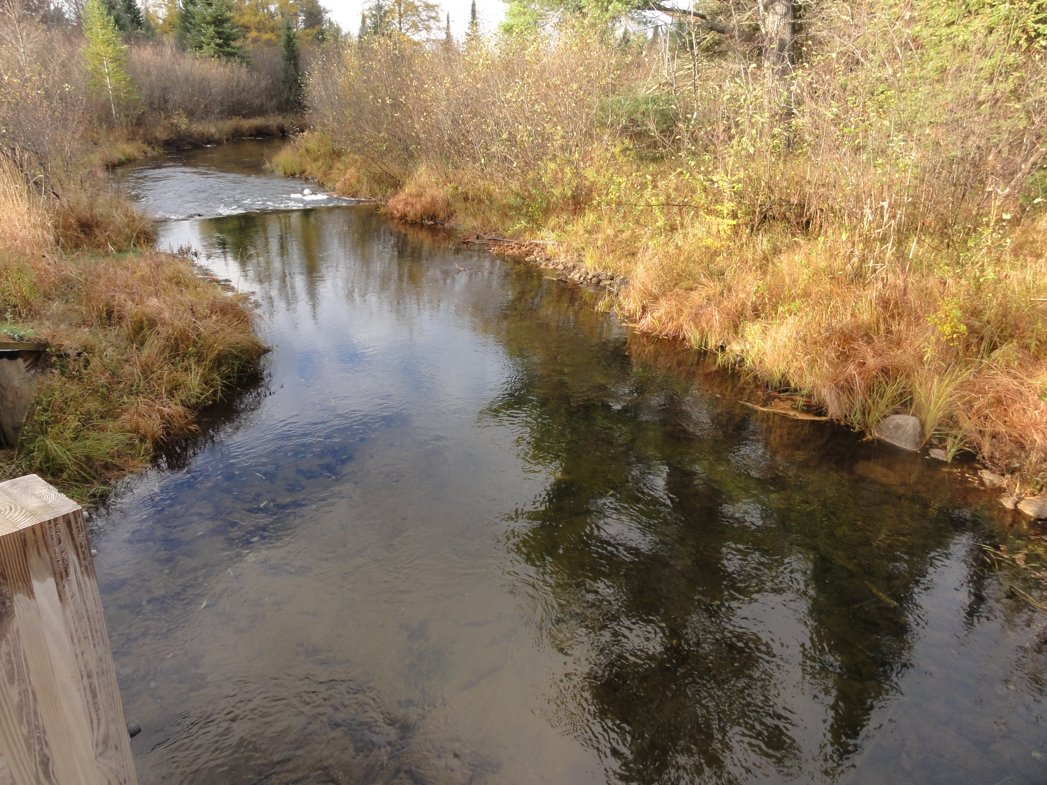
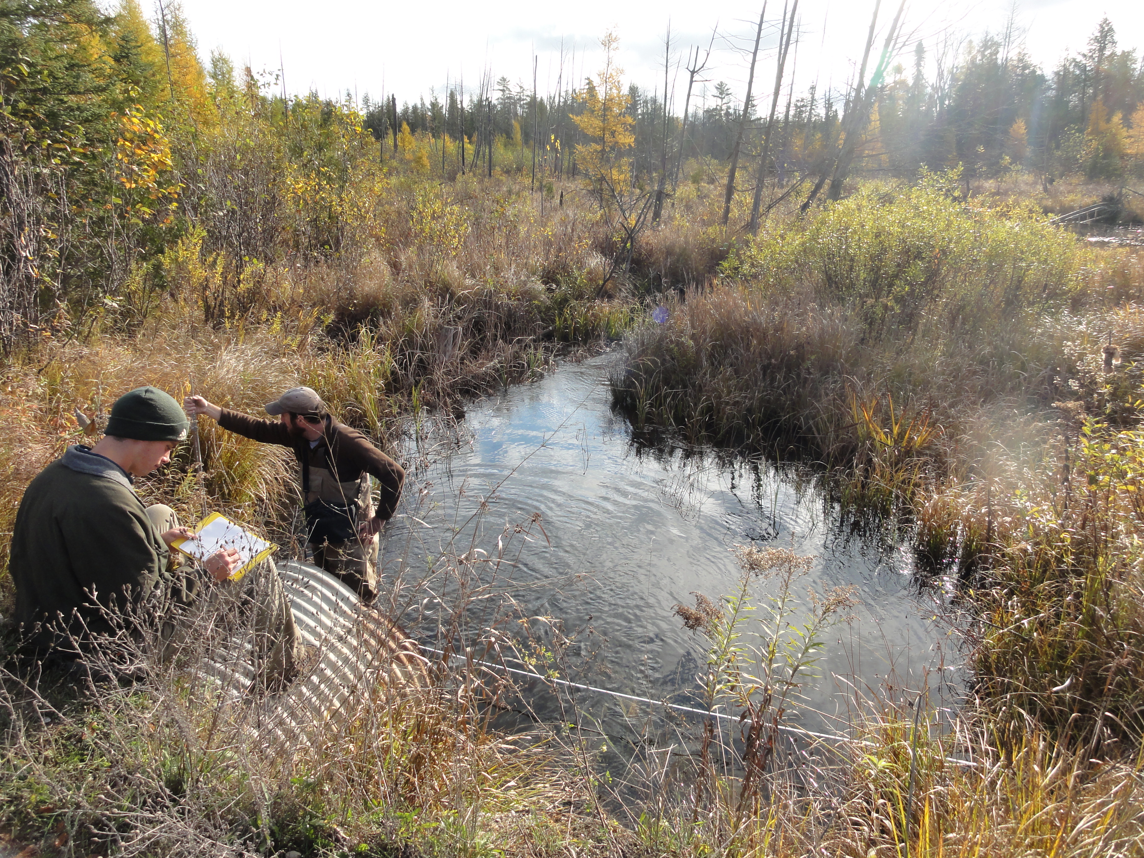
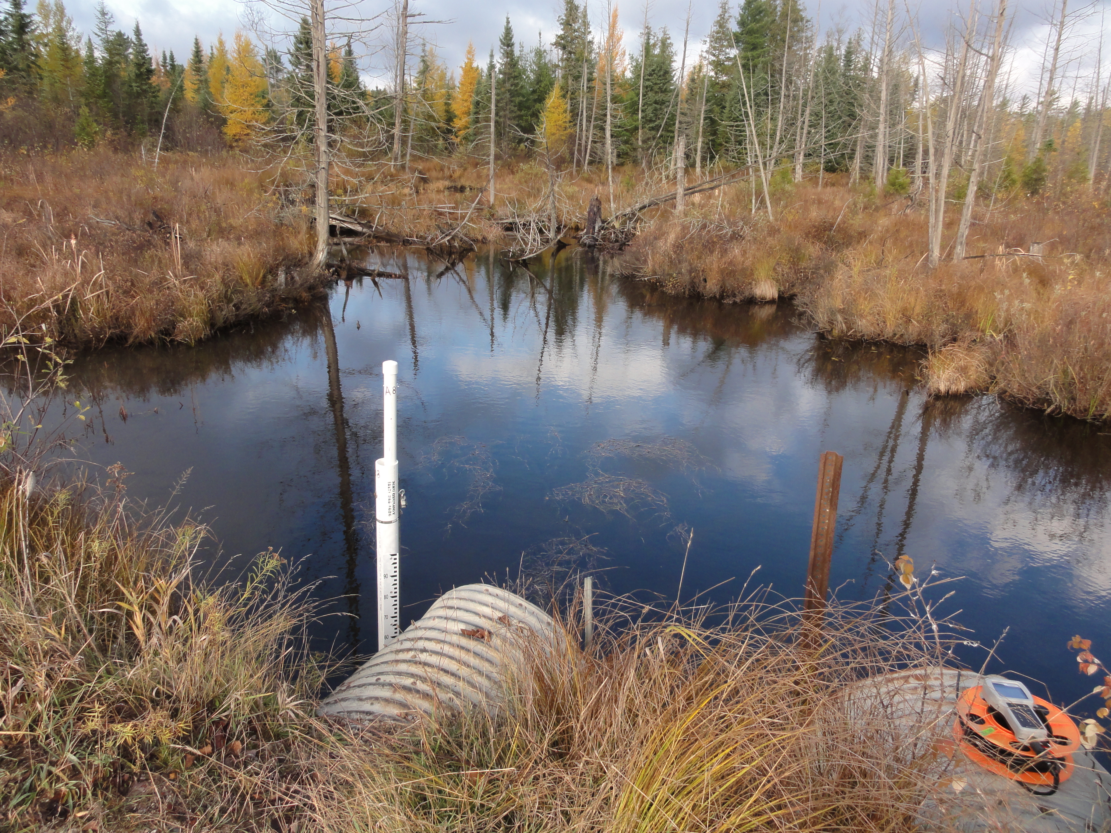
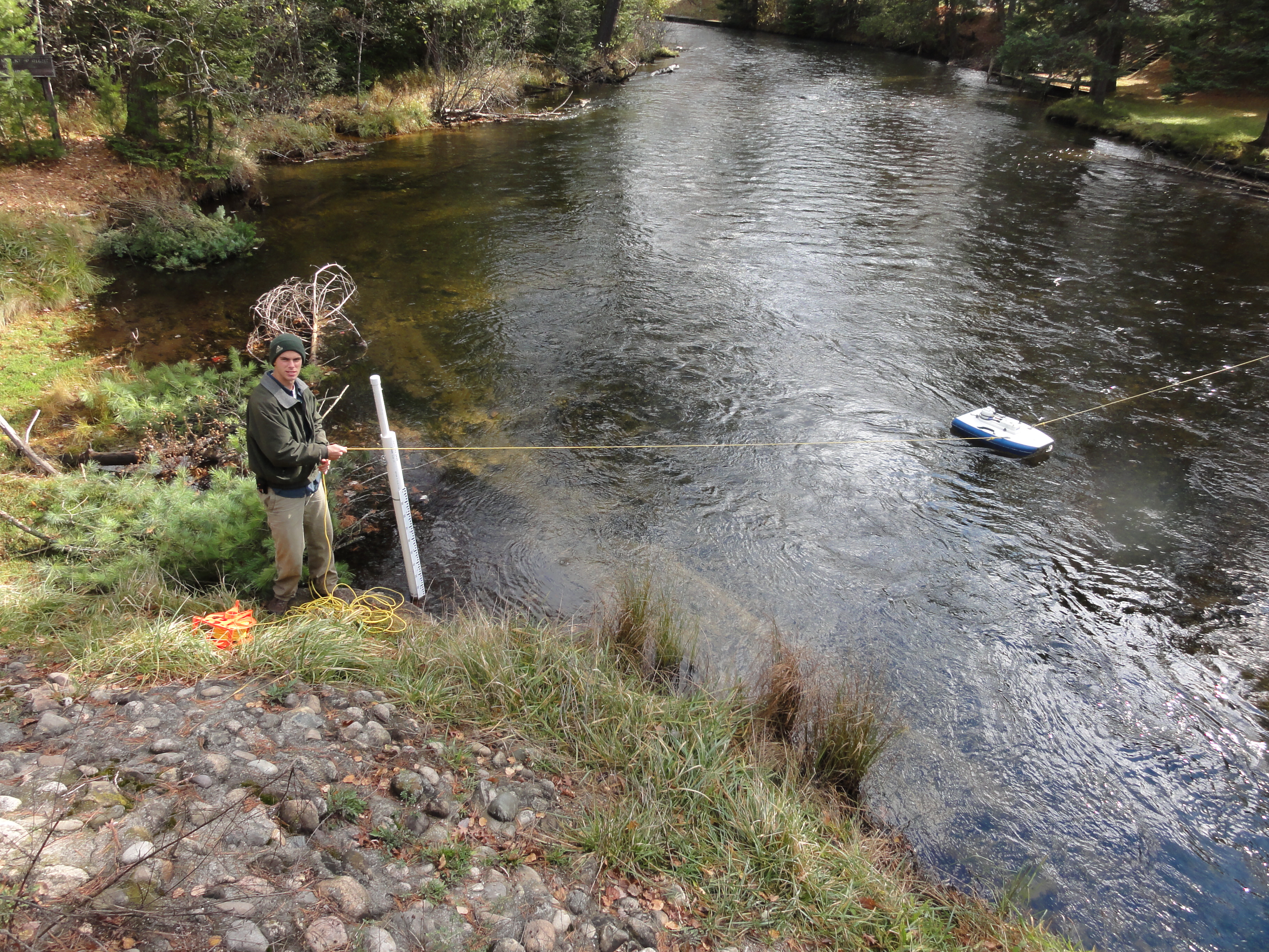
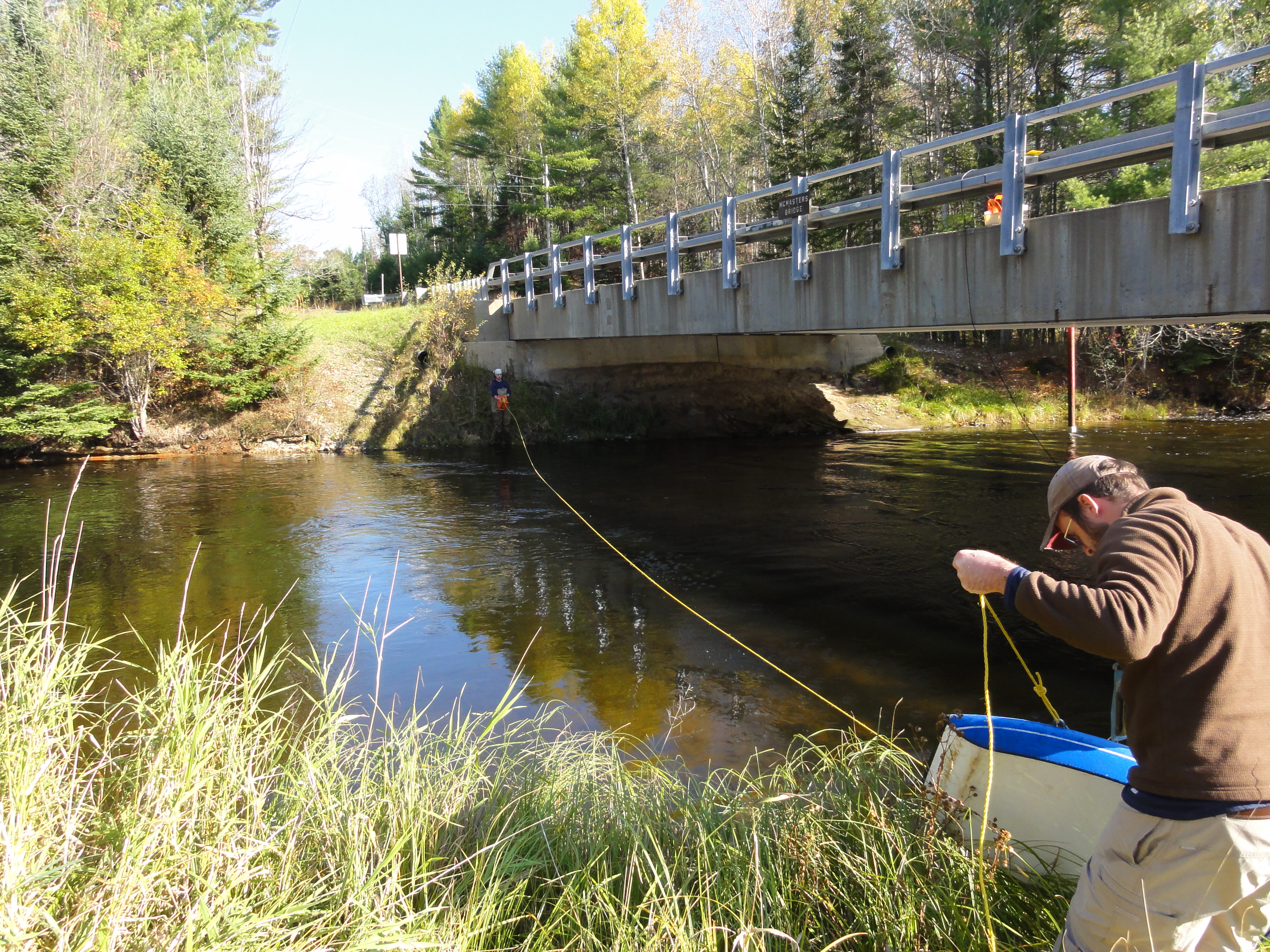
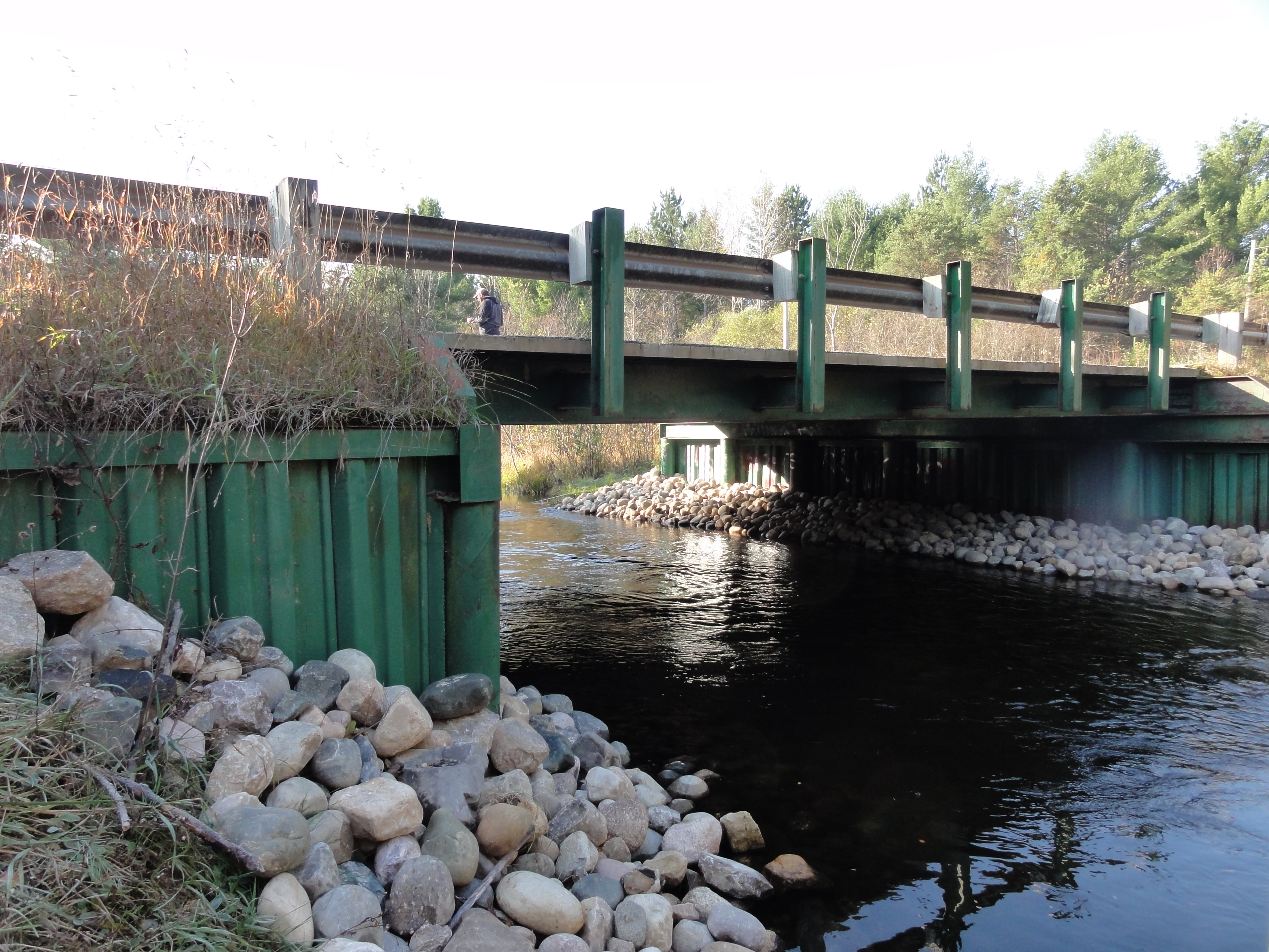
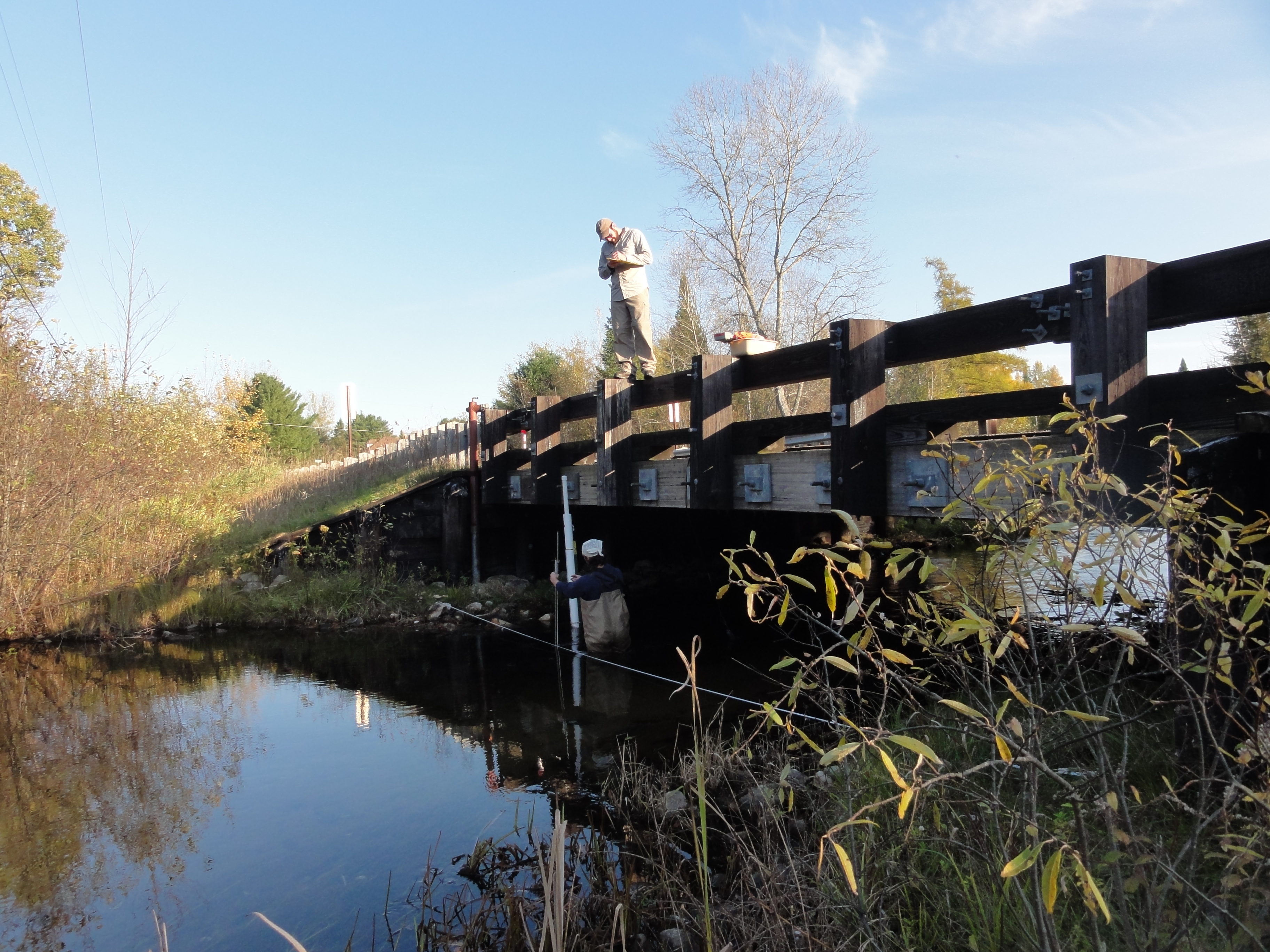
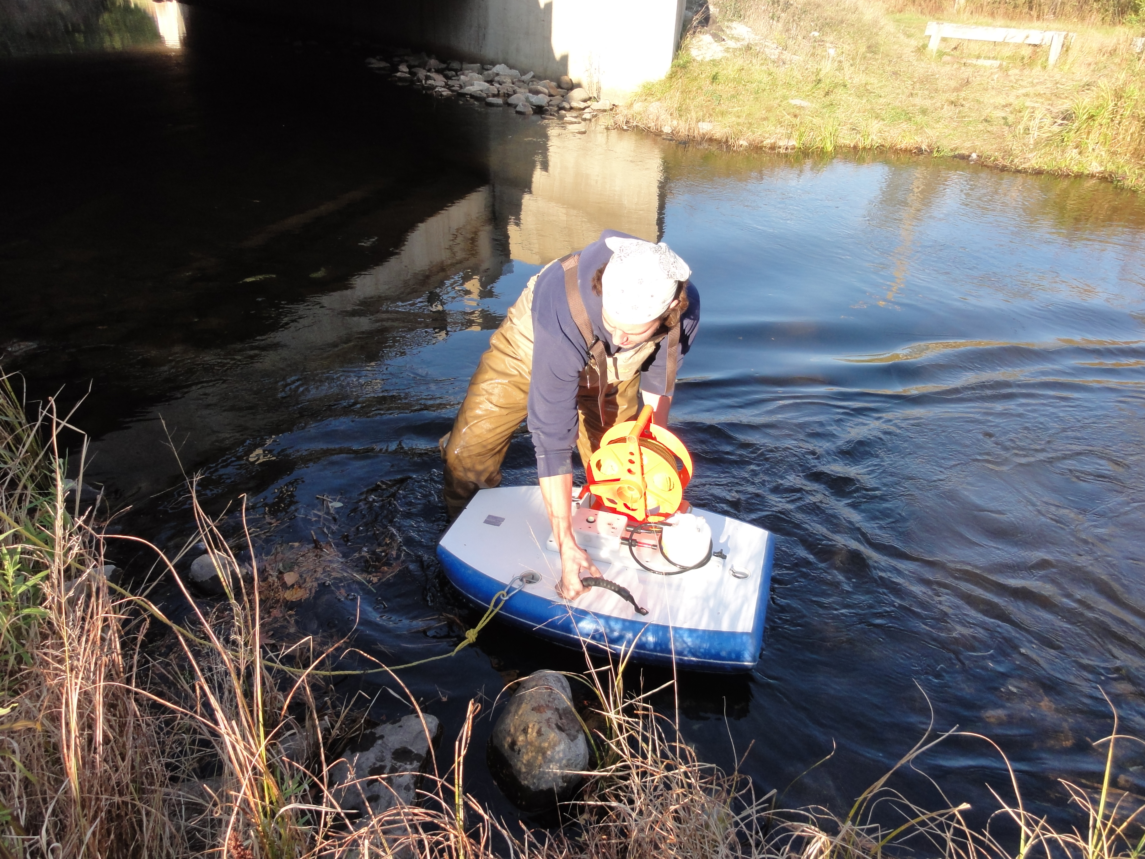
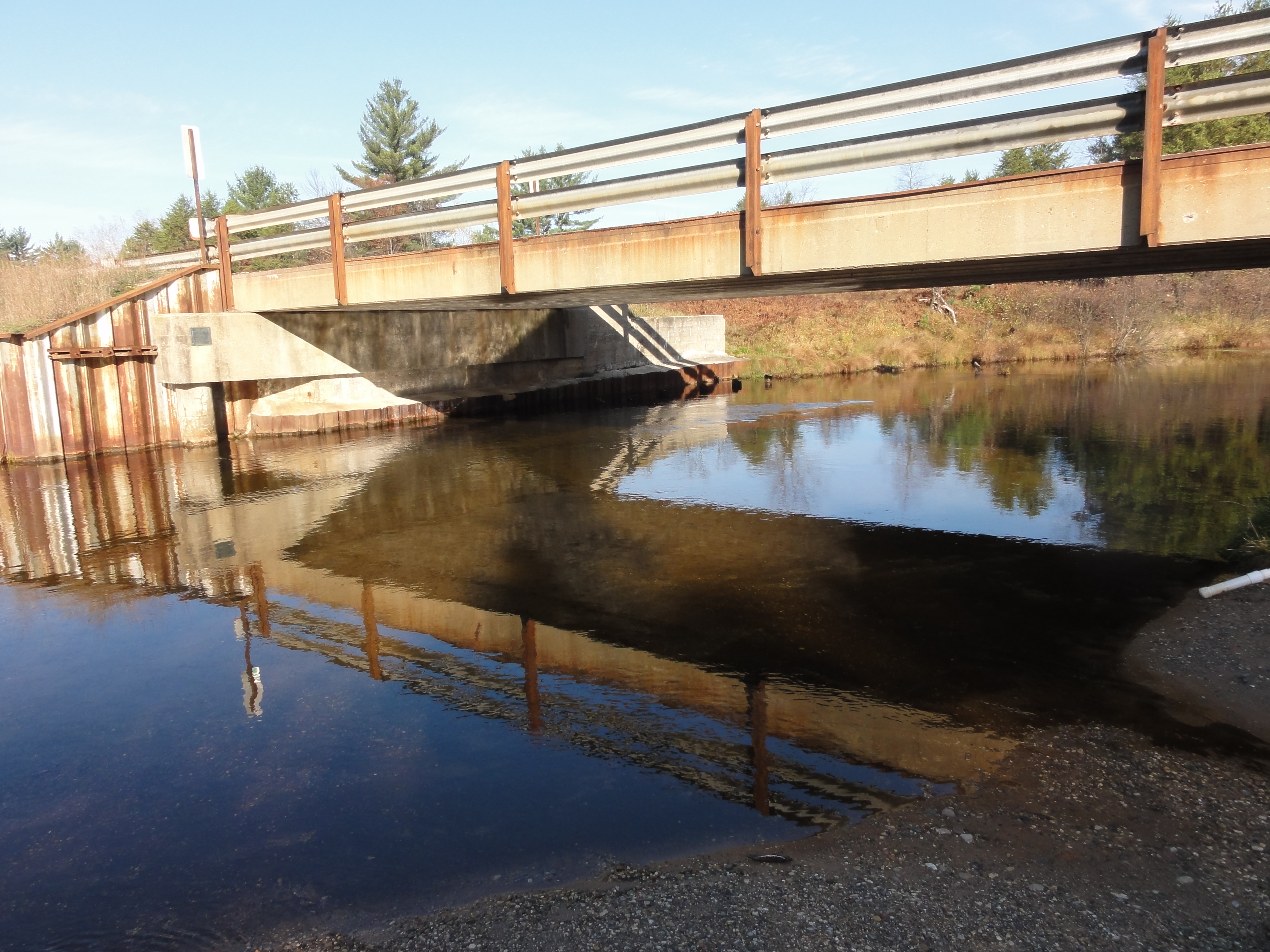
![]() Through looking at both the Au Sable and Manistee River basins’ headwaters, our objective of this project is to develop methods to increase our knowledge of temperature, stream flow rates, groundwater recharge rates, etc. in these areas. In a two year span, forty gages are to be installed in both the headwaters of the Manistee and the Au Sable rivers. Though the state does have groundwater assessment tools out there, the system is not focused on the headwaters. We are creating a much denser network to narrow in on these specific places in the river system to add to the overall knowledge of rivers.
Through looking at both the Au Sable and Manistee River basins’ headwaters, our objective of this project is to develop methods to increase our knowledge of temperature, stream flow rates, groundwater recharge rates, etc. in these areas. In a two year span, forty gages are to be installed in both the headwaters of the Manistee and the Au Sable rivers. Though the state does have groundwater assessment tools out there, the system is not focused on the headwaters. We are creating a much denser network to narrow in on these specific places in the river system to add to the overall knowledge of rivers.
By creating a detailed network of stream gaging in these two areas, we hope this will in turn provide a basis for further research projects. Our findings will be able to help in dealing with the above such measurements in areas across the lower Peninsula of Michigan, more specifically in the areas of groundwater and recharge processes. Also, by assessing the use of such gages, we can analyze other impacts on the headwaters, such as climate changes, land use changes, and possible managing methods for various fisheries statewide.
The procedure for this project is as follows:
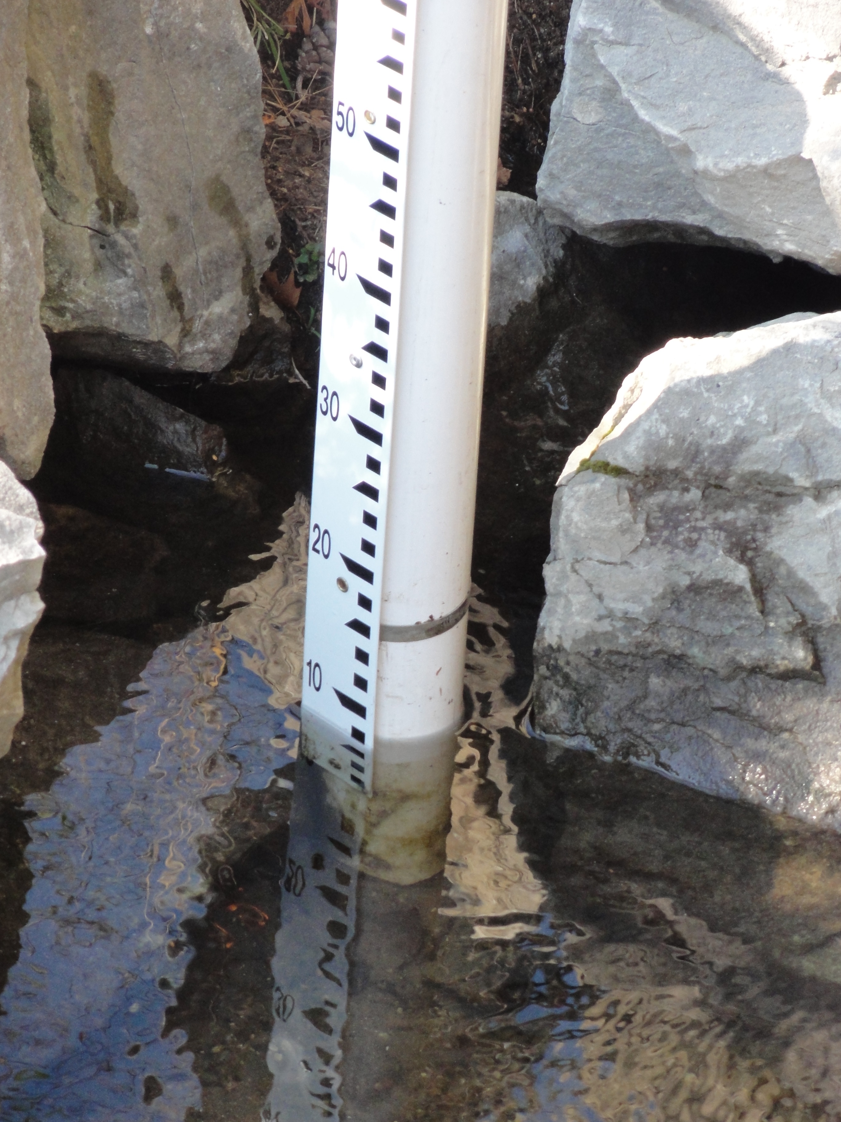
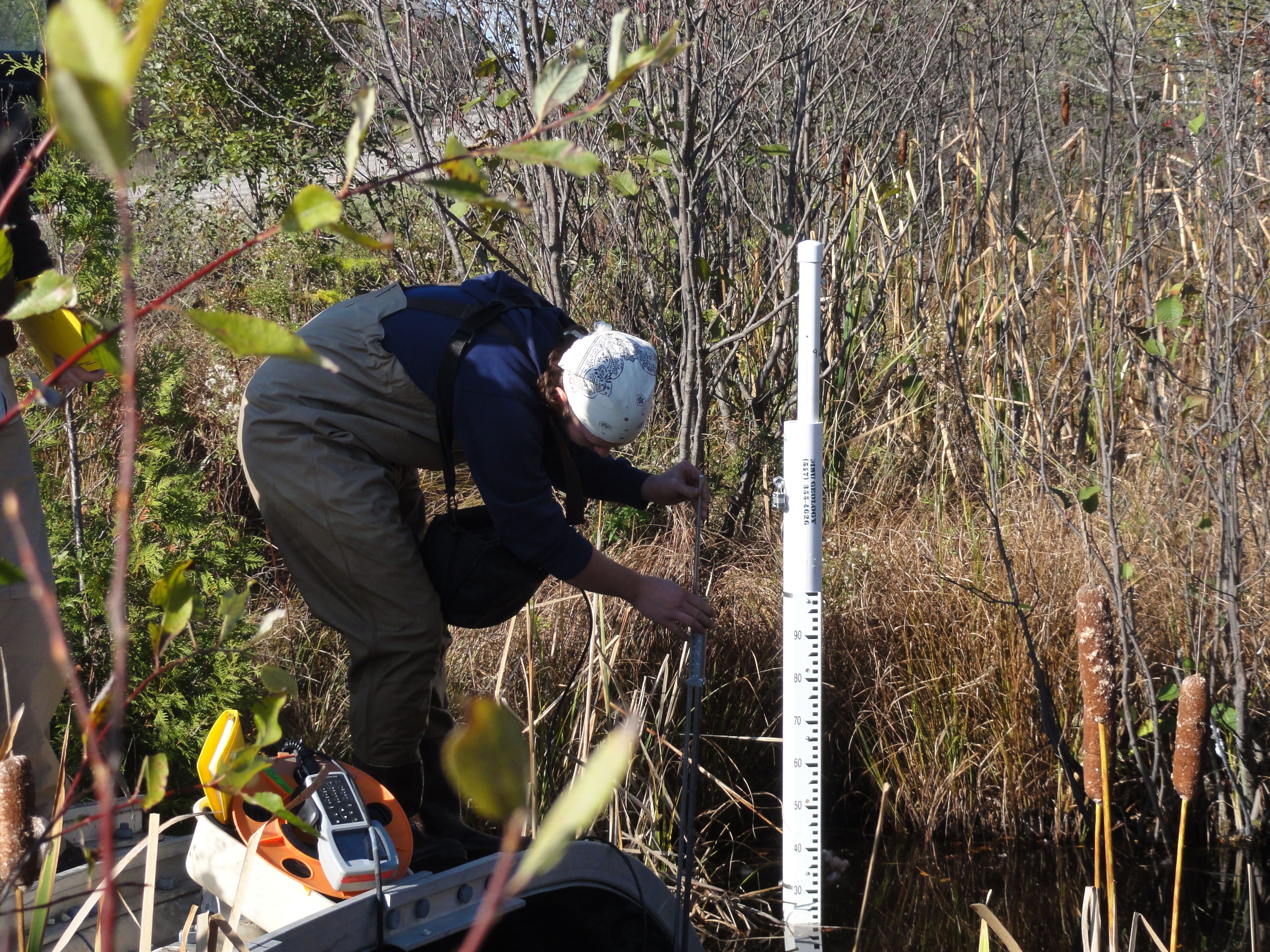
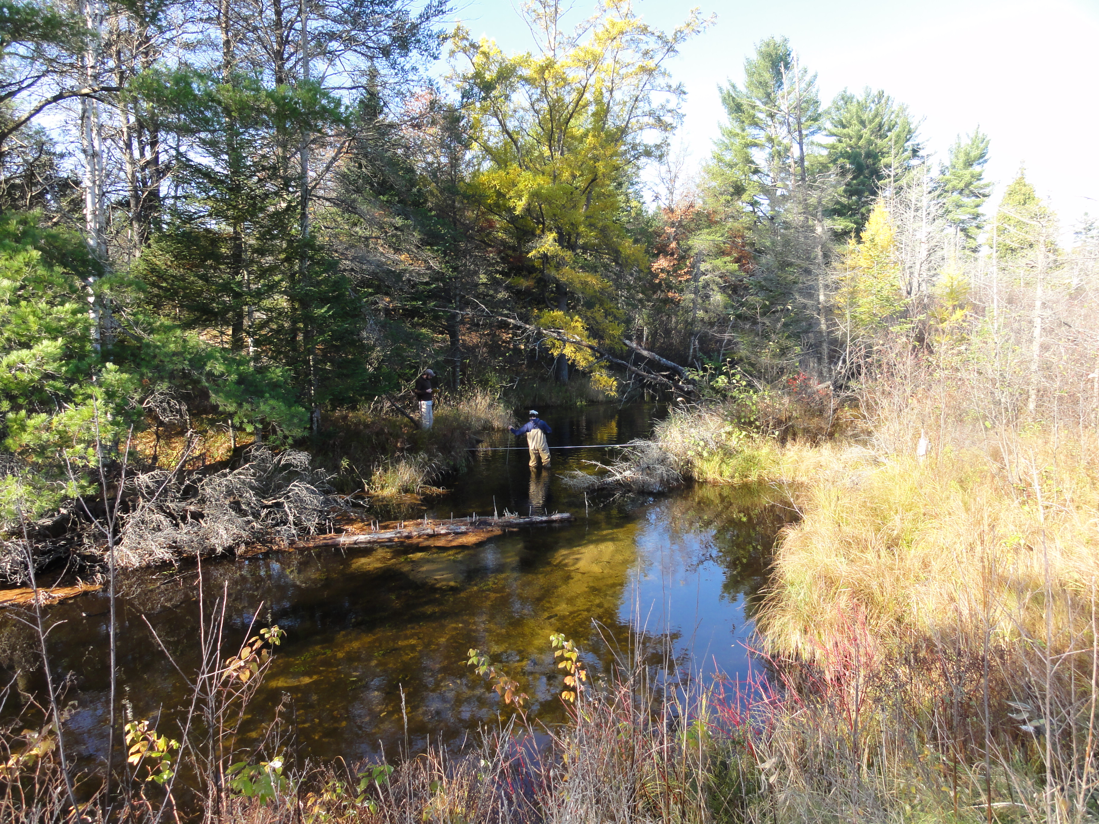
Task 1: Install Stream Gauging Stations
Task 2: Collect Stream Flow Measurements
Task 3: Monitor Basic in Stream Chemistry (conductivity, pH, temperature, ORP)
Task 4: Write Report
The PI for this project is Dr. David Hyndman. Funding is provided from both the State and the Anglers of the Au Sable for a two year study.
Project Photos:
]]>

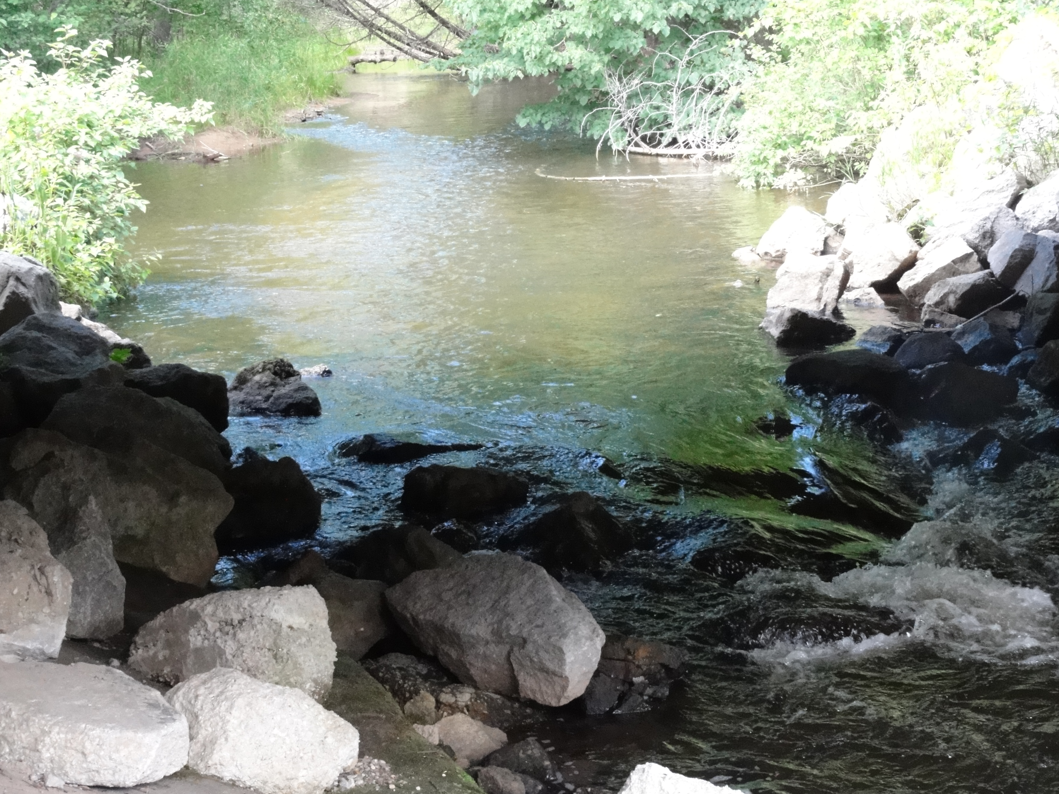
Looking at Higgins Lake in Roscommon County, this project is analyzing the implications of a control structure dam on both the lake itself and the Cut River. Effects of erosion have been found and yet little study has been done on the structure’s role in the environment. This could play a large effect on not only the lake and river wildlife, but the economy and environment of the surrounding human population as well. The Higgins Lake Property Owners Association (HLPOA) made these possible implications and their concerns clear when they brought this issue to the Michigan Department of Natural Resources and Environment’s (MDNRE) Fisheries Division.
Higgins Lake has large economic benefits to the surrounding economy and is significant in both fishing and recreation. These were among the reasons HLPOA became concerned with the structure’s impacts in the first place. They fear that the control structure will diminish these benefits. This study aims to identify how water level management scenarios might impact fish habitat on Higgins Lake and the Cut River.
This study looks to accumulate data by analyzing the local vegetation, hydrology, weather, and wildlife. With this data, we will be better able to understand the implications of the control structure and how to prevent harm on the area’s bio-system. Furthermore, we will be looking at the possible effects of removing the control structure and returning both Higgins Lake and the Cut River to their natural conditions. All of this data will be combined, allowing us to be able to give those who are stakeholders in these areas the information they need when it comes to deciding what must be done: leave the dam alone or remove it.
Funded by the Michigan DNR and the Higgins Lake Foundation, on March 4, 2012, this project received a $100,000 grant for two years. The partners in the grant proposals are Mike Wiley at the University of Michigan and the Huron Pines Inc.
]]>

Six Word Summary:
Extreme Events Change Nutrient Delivery, Blooms
Furthering steps taken by a past EPA Grant, this project is looking at predicting harmful algal blooms using remote sensing, hydrologic models, and landscape features. With current extreme events, such as droughts and storms, caused by climate change, we want to assess how they will impact both water quality and algal blooms management. Looking into the relationship between extreme events and water quality, we hope to increase the variety of tools at our disposal. This will in turn help us to not only better understand this relationship, but also allow us to have a better knowledge of the impacts on water quality and algal blooms by different extreme events.
Algal blooms are caused by both microbial pathogens and excess nutrients that gather due to increased runoff during storms. Droughts also usually increase water temperatures, calmer weather, and high concentrations of nutrients, leading to algal blooms as well. The blooms can be harmful to both animals and humans, as in the area of quality of drinking water, and they have been estimated to cost the U.S. around 2.2 to 4.6 billion dollars per year in economic damages. Frequency of algal blooms has been increasing along with extreme events, and with such risks to animals, human health, and the economy, we want to look at how various regions and their water qualities will be impacted by extreme events in order to better manage algal blooms.
Three main tasks are associated with this project:
- Look at the history of algal blooms in different hydrological regions and how they have been tied to various extreme events in the past.
- Using models, possible causes of algal blooms by extreme events will be analyzed, as well as what influences climate change will have on algal biomass.
- Draw up statistical models that can be used on a nationwide basis in order to study various management strategies and their effects on possible extreme events’ vulnerabilities.
All this will be done is several ways. As stated above, the history of various lake water quality change and watershed land use will be analyzed through satellite imagery. Using Landsat, images as far back as 1972, and MODIS, along with USGS gaging stations, we can find the history of water quality and the amount of algal biomass in various lakes over a period of time. This project will hone in on four different hydrologic regions: the Lower Peninsula, the High Plains Aquifer, the Kentucky-Oklahoma corridor, and the California mountains and Central Valley. These areas were chosen due to our prediction that there will be large discrepancies among the algal biomasses’ responses to various extreme events. By this, we are trying to better understand how to predict algal blooms, how to better manage algal blooms, and how to better understand the impact of extreme events in various regions.
The PI for this project is Jane Stevenson. The co PIs are David Hyndman, Nathan Moore, and Jiaguo Qi. This project is funded by the EPA and received a grant on December 22, 2011 for $750,000.
]]>
On October 26, 2012 Dave Hyndman gave a plenary session talk at the 5th annual Freshwater Summit in Traverse City, MI. ]]>
 Personal History
I grew up along the southern edge of the Adirondack Park in upstate New York, spending each summer outside – swimming in lakes, catching crayfish, climbing trees, etc. etc. Fortunately, those experiences gave me an intense appreciation for the quality of the environment and directed my career path towards the earth sciences. As an undergraduate at Brockport, I was lucky enough to study and research within the Water Resources Department while simultaneously gaining problem solving and programming skills as a Physics major. My desire to combine these interests led me to Hydrogeophysics here at MSU, where I’ve been able to apply my diverse abilities to develop models that help us understand how different factors influence the behavior of water in the environment.
Research Interests
I’m interested in using geophysical techniques and modeling to investigate how water moves in the shallow subsurface beyond point scales. Plant-water interactions play a huge role in controlling how water is distributed in the vadose-zone, but are traditionally difficult to quantify. Using non-invasive methods we can get a close look at the system without disturbing it. This kind of information is critical to anticipate how changes in land use and climate will influence future water balances. I’m currently focused on coupling hydrological and geophysical models to optimize root-uptake functions.
Education
- PhD Candidate 2012-Present, Environmental Geosciences, Michigan State University
- BS Physics 2012, The College at Brockport, State University of New York
- BS Water Resources 2012, The College at Brockport, State University of New York
Recent Abstracts
- Kuhl, A.S., Hyndman, D.W., 2015, Quantifying impacts of solute transport on time lapse ERT at a Michigan ecotone. American Geophysical Union Chapman Conference, Valencia, Spain. https://agu.confex.com/agu/15chapman4/webprogram/Paper59158.html
- Kuhl, A.S., Hyndman, D.W., Van Dam, R.L., 2013, A Coupled Hydrogeophysical Modeling Approach to Estimate Soil Moisture Redistribution in the Face of Land Use Changes. American Geophysical Union Fall Meeting, San Francisco, CA. http://abstractsearch.agu.org/meetings/2013/FM/H51F-1253.html
- Kuhl, A.S., Hyndman, D.W., Van Dam, R.L., 2013, Improving root distribution models through a novel coupled hydrogeophysical approach, ESPP Research Symposium: Water for a Sustainable World, East Lansing, MI. http://www.espp.msu.edu/events/past_symposium.php
- Kuhl, A.S., Van Dam, R.L., 2013, Coupled Inversion of Electrical Resistivity and Hydrological Models to Quantify Soil Moisture Dynamics Below a Michigan Ecotone. Geological Society of America North-Central Meeting, Kalamazoo, MI. https://gsa.confex.com/gsa/2013NC/webprogram/Paper218744.html
- Kuhl, A.S., Richards, P.L., 2012, Identifying Shallow Bedrock on the Onondaga Fm Using Ground Penetrating Radar. Geological Society of America Northeastern Section Meeting. Hartford, CT. https://gsa.confex.com/gsa/2012NE/finalprogram/abstract_200881.htm
- Kuhl, A.S., 2012, Physical Concepts of GPR. Rochester Symposium for Undergraduate Physics Students. Albany, NY.
Complete CV
Download my complete CV (updated 08/01/2017).
]]>
Personal History
During my undergraduate studies at Illinois State University, I worked as a research assistant for the Geology department’s paleontologist and also as a tutor for an introductory level geology course. After earning my degree, I worked for a petroleum company in southern Illinois managing and monitoring multi-formation water injection wells used in secondary recovery of hydrocarbons.
Research Interests
My research focuses on the possible impacts of biofuel crop production and climate change on future water quality and quantity. More specifically, I am attempting to determine how various cellulosic biofuel feedstocks will affect the water balance when compared to one another as well as more traditional grain-based feedstocks. To do this, I work with data collected from biofuel crop test plots and integrate it with state-of-the-art hydrogeologic models to simulated crop, soil, and water interactions.
Education
- B.S. Geology, Illinois State University, 2011
Complete CV
Download my complete CV.
]]>His project was titled: “Predicting the Impacts of Climate Change on Agricultural Yields in the Maumee River Watershed.” ]]>
Blaze has been working at the Lab since Summer of 2011, and after a competitive external search was selected to fill this newly-created position.
]]>This project is EPA funded. The PI is Jane Stevenson. The co-PIs are David Hyndman, Nathan Moore, and Jiaguo Qi.