I am a research technologist focused on supporting the lab in a variety of projects, and primarily focus on field work involving surface and groundwater in Northern Michigan. I am split part time between the MSU Hydrogeology lab and the Watershed Science and Ecohydrology Lab (PI Dr. Jay Zarnetske). My research interests include surface and groundwater interaction, urban water quality, and the intersection of hydrological and ecological processes.
]]>Kendall. My research aims to understand how inputs of cold groundwater into
streams can provide thermal refuge habitat for cold water fish species in
warming streams. I use a combination of modeling and data collected from field
deployed sensors to explore how a warming climate will affect these streams, and if
they can remain viable habitat for cold water fish species in Michigan. An improved
understanding of how temperature changes in these habitats during peak water
annual water temperatures is needed to understand future fish survival. By
exploring the future viability of thermal refuge in cold water habitat, I hope to
contribute to informing effective conservation and management efforts.
I received my Bachelor’s in Environmental Science and Policy from Clarkson
University. My previous research experience has involved studying the growth and
spread of aquatic invasive species in Northern New York. During my Bachelor’s
degree I participated in Clarkson University’s Adirondack Semester Program, where I
participated in a research project examining mercury deposition in Vernal Pools from
the St. Lawrence River to the Adirondack State Park. Outside of academia, I’m
passionate about a variety of outdoor activities including hiking, mountain biking,
and nature photography.
- Understanding the hydrologic footprint of irrigated agricultural practices across the US, using model / data synthesis to understand paths toward sustainability.
- Fusing integrated hydrologic models with remote sensing estimates of water storage to develop nowcast and reanalysis of groundwater levels and streamflow across the Great Lakes Region.
- Quantifying the combined effects of changes in land use and climate on hydrology across a region experiencing rapid urbanization.
- Developing hydrology, energy, agriculture, and ecosystem models to better understand the footprint of solar arrays, which are being rapidly installed in agricultural lands.
Applicants must have expertise in programming (such as Python, MATLAB, R, or FORTRAN), and a strong publication record. Prior hydrologic modeling experience is also required. Familiarity with groundwater modeling, data science, and spatial data analysis are desired.
The initial positions are for one year (renewable based on performance). The MSU position will be a Postdoctoral Research Associate, with a long-term growth trajectory that could include promotion to Research Assistant Professor. At UTD, we are hiring at the Research Scientist level, however exceptional candidates with a strong record of successful grants may be hired as a Research Assistant Professor. These positions require writing peer-reviewed publications and research proposals to extend their position and help grow this interdisciplinary research team.
To apply, please submit: 1) an application letter detailing research interests and experiences, 2) a curriculum vitae, and 3) names and contact information for 3 references at:
- UT Dallas: Research Scientist (https://jobs.utdallas.edu/postings/24731), or Research Assistant Professor (https://jobs.utdallas.edu/hr/postings/24711)
- MSU (careers.msu.edu, posting #820561).
Please apply for only one of these positions. The search will remain open until suitable candidates are found, with a primary review of applications beginning on January 15, 2024. We will continue to review applicants after that date as well. For more information on the research conducted by this group, please visit hydrogeology.msu.edu. For other inquiries email Dr. Anthony Kendall at MSU (kendal30@msu.edu).
University of Texas at Dallas and Michigan State University are Equal Employment Opportunity/Affirmative Action employers. All qualified applicants will receive consideration for employment without regard to race, color, religion, sex, national origin, disability or protected veteran status or any other characteristic protected by law and University policies.
]]>Research Interests
 I am a PhD student in the Hydrogeology Lab working with Dr. Anthony D. Kendall. My research aims to better understand three renewable energy landscape subject areas: 1) agricultural security through placement, 2) agricultural and pollinator security through management, and 3) water security through placement and management. To achieve these goals, I use big-data and machine learning analysis with a collection of remotely sensed, survey/census, and modeled data across time and space. A deeper understanding of these practices will help inform future energy infrastructure to mitigate negative effects of our energy needs and possibly regenerate consequences of historical anthropogenic land use. As part of this effort, I am helping develop a field-network of instrumented and managed ground-mounted solar installations in Michigan and across the United States, and invite any external interest for collaboration in this effort. I am also broadly interested in regenerative apiculture, and how regenerative honey production and beekeeping can alter our agricultural landscape for the better.
I received my Bachelors in Geological Sciences from Hope College, and my Masters in Geological Sciences from MSU. My previous research experience includes studying agrisolar co-location in California’s Central Valley and investigating the balance between induced nutritional losses and water security through fallowing of irrigated cropland. During my Master’s degree, I also participated in NASA’s DEVELOP Program at NASA Langley, where I studied salt marsh vulnerability in South Carolina. Aside from academia, I have an astonishingly wonderful wife, Karey, who promotes local and sustainable food consumptions for Taste the Local Difference. I also have an adorable dog aptly named HoneyBee, and enjoy homebrewing mead, the world’s oldest alcoholic beverage.
Education
MSc 2021, Michigan State University, Geological Sciences
Thesis: Detection and Assessment of Food, Energy, and Water Impacts of Solar Photovoltaic Co-Location in the California’s Central Valley
Advisor: Dr. David W. Hyndman
BS 2019, Hope College, Geological Sciences
Publications
Stid, J.T., Shukla, S., Anctil, A., Kendall, A.D., Rapp, J., & Hyndman, D.W. (2022). Solar array placement, electricity generation, and cropland displacement across California’s Central Valley. Science of The Total Environment, 835, 155240. https://doi.org/10.1016/j.scitotenv.2022.155240
]]>
Research Interest
My research domain spans from field to basin scale hydrological modelling with a wide range of hydrological models (both numerical and conceptual). In particular, investigating wetlands’ hydrologic and hydraulic interactions with surrounding environments (e.g. rivers and aquifers) has been a preferable area to me over the last couple of years. Under my PhD work, I have developed a variant of Soil and Water Assessment Tool (SWAT) model to enhance SWAT’s capability in simulating riparian wetlands’ hydrology. My research also includes treatment (downscaling and bias correction) of raw Global Climate Model (GCM) generated data and assessing climate change effects on terrestrial water distribution. My current research is simulating groundwater recharge in an Amazonian experimental ranch where I am using the numerical HYDRUS model.
Education
PhD 2017: University College London (UCL), UK; Department of Geography (Wetland Hydrology Unit)
MS 2011: North Dakota State University, USA; Agricultural and Biosystems Engineering Dept.
MS 2006: Bangladesh Agricultural University, Bangladesh; Irrigation and Water Management Dept.
BS 2004: Bangladesh Agricultural University, Bangladesh; Faculty of Agricultural Engineering and Technology.
Selected Publications
Rahman, M. M., Thompson, J. R, and Flower, R. J. 2019. Hydrological impacts of climate change on river-wetland systems in the Upper Meghna River Basin (Bangladesh and India) and their implications for rice cultivation. Hydrological Sciences Journal. DOI: 10.1080/02626667.2019.1676427
Rahman, M. M., Thompson, J. R, and Flower, R. J. 2016. An enhanced SWAT wetland module to quantify hydraulic interactions between riparian depressional wetlands, rivers and aquifers. Environmental Modelling and Software, vol: 84, p: 263-289. doi.org/10.1016/j.envsoft.2016.07.003
Rahman, M. M., Z. Lin, X. Jia, D. D. Steele, and T. M. DeSutter. 2014. Impact of subsurface drainage on streamflows in the Red River of the North basin. Journal of Hydrology, vol: 511, p: 474-483. doi.org/10.1016/j.jhydrol.2014.01.070
]]>**Michigan State University and the Kansas Geological Survey/University of Kansas**
Position 1: Groundwater Sustainability Pathways for the High Plains Aquifer
Seeking a postdoctoral scholar with a passion for groundwater sustainability and a penchant for thinking big to help envision a sustainable future for the High Plains Aquifer. The successful candidate will lead integrated land surface-groundwater modelling efforts to evaluate agricultural practices for the past and future of the High Plains Aquifer at multiple spatial and temporal scales. The postdoc will be based at the Kansas Geological Survey (University of Kansas) and have the opportunity to collaborate widely within multi-institution NSF INFEWS and USDA NIFA projects to produce high-impact research.
This position is funded for 2 years with the opportunity for extension pending performance and funding availability, and includes an annual research/travel budget to support professional development. The preferred start date is September 2019 with flexibility for the right candidate. For more information, please contact Sam Zipper (samzipper@ku.edu).
- Full job posting: http://employment.ku.edu/staff/13903BR
Position 2: Food, Energy, and Water in the Amazon and Mekong River Basins
Seeking a postdoctoral scholar ready to take on large-scale modeling challenges in data-limited regions. The Amazon and Mekong River Basins are undergoing rapid hydrologic, climatic, and land use changes, affecting two of the world’s most important hydrologic systems and the people and ecosystems dependent upon them. The postdoc will lead integrated surface- and groundwater-modelling efforts at both watershed and regional basin scales to better understand these vital systems, and how they are affected directly by dams and indirectly via land use and climate changes. The successful candidate will interact with two large, interdisciplinary project teams including multiple US institutions as well as international collaborators.
This position is funded for 2 years with the opportunity for extension pending performance and funding availability. The start date for this position can be as early as May 2019, with flexibility for the right candidate. For more information, please contact David Hyndman (hyndman@msu.edu). For more information on the research group, please visit hydrogeology.msu.edu.
Position 3: Water, Agriculture, and Nutrients in the Great Lakes Basin and California Central Valley
Seeking a postdoctoral scholar eager to quantify the role of agricultural practices in water and nutrient cycling in diverse agricultural landscapes spanning the US and Canadian Great Lakes Basin, as well as California’s Central Valley. The postdoc will lead efforts to develop integrated surface- and groundwater-models for these two regions, and to integrate new capabilities into those models. In particular we are looking to add explicit nutrient cycling and transport, informed by existing nutrient surface application and statistical transport models. We are working in those regions with a variety of collaborators in disciplines including remote sensing, ecology, agronomy, sociology, and economics to better understand the role that agriculture plays in water resources.
This position is funded for 2 years with the opportunity for extension pending performance and funding availability. The start date for this position can be as early as May 2019, with flexibility for the right candidate. For more information, please contact David Hyndman (hyndman@msu.edu). For more information on the research group, please visit hydrogeology.msu.edu.
Application Details and Required Qualifications
Common qualifications for all three positions include:
- expertise in groundwater and/or land surface modelling;
- ability to work both independently and collaboratively;
- strong communication skills as evidenced by peer-reviewed publications/conference presentations; and
- a water-related Ph.D. by the start date.
Experience with integrated models, GIS, and high-performance computing are considered a plus.
Unique qualifications by position include:
- Position 1: Coding experience (any of Python, R, FORTRAN, MATLAB, C, etc.) is strongly desired, experience working in irrigated agricultural landscapes is a plus
- Position 2: Coding experience (any of Python, R, FORTRAN, MATLAB, C, etc.) is required, knowledge of dam operations and management is a plus.
- Position 3: Coding experience (any of Python, R, FORTRAN, MATLAB, C, etc.) is required, knowledge of irrigated agricultural landscapes and snow hydrology is a plus.
To apply, send Sam Zipper (samzipper@ku.edu) an email with the subject line ‘Water Postdoc’ and the following materials as a single PDF file:
- Short (1-2 page) cover letter including which position(s) you would like to be considered for, why you are excited about them, and how you meet the qualifications.
- Full CV.
- Contact information for 3 references.
If you are interested in position 1, please also submit materials via the KU HR portal to http://employment.ku.edu/staff/13903BR – you can use the same cover letter for all 3 positions.
For full consideration, submit your application by April 15, but review of applications will continue until suitable candidates are found.
Michigan State University is an Equal Employment Opportunity/Affirmative Action employer. All qualified applicants will receive consideration for employment without regard to race, color, religion, sex, national origin, disability or protected veteran status or any other characteristic protected by law and University policy.
The University of Kansas prohibits discrimination on the basis of race, color, ethnicity, religion, sex, national origin, age, ancestry, disability, status as a veteran, sexual orientation, marital status, parental status, gender identity, gender expression and genetic information in the University’s programs and activities. The following person has been designated to handle inquiries regarding the non-discrimination policies: Executive Director of the Office of Institutional Opportunity and Access, IOA@ku.edu, 1246 W. Campus Road, Room 153A, Lawrence, KS, 66045, (785)864-6414, 711 TTY. http://policy.ku.edu/IOA/nondiscrimination
]]> Research Interests
My research is focused on the geochemistry of modern and ancient sediments. Specifically, I employ a wide variety of tools including stable isotope and trace element geochemistry to reconstruct ancient environments. My previous work was focused on low-oxygen settings and understanding the role of anoxia on local and global ocean chemistry and ecology. Ongoing projects include reconstructing sulfur cycling in methane seep environments and the depositional history of the organic-rich Monterey Formation and its impact on and role in Miocene climate. Current work at Michigan State includes using nitrate nitrogen and oxygen isotopes to determine nitrogen sources to Michigan rivers, and using boron isotopes to quantify septic contamination in freshwater systems.
Education
Ph.D. The University of California Riverside, Earth Science
Graduate Advisor: Timothy W. Lyons
Dissertation Title: Proxy Applications for Reconstructing Carbon and Sulfur Cycling in Ancient Marine Environments
B.S. The University of Georgia, Geology
Recent Publications
Hancock, L.G., Hardisty, D.S., Behl R.J., and Lyons T.W., 2019, A multi-basin redox reconstruction for the Miocene Monterey Formation, California, USA: Palaeogeography, Palaeoclimatology, Palaeoecology., v. 520, p. 114-127, 10.1016/j.palaeo.2019.01.031.
Feenstra, E.J., Birgel, D., Heindel, K., Wehrmann, L.M., Jaramillo-Vogel, D., Grobety, B., Frank, N., Hancock, L.G., Van Rooij D., Peckmann, J., and Foubert A., in review, Constraining the formation of authigenic carbonates in a recent seepage affected cold-water coral mound by lipid biomarkers: Geobiology.
Walker, S.E., Hancock, L.G., Bowser, S.S., 2017, Diversity, biogeography, body size, and fossil record of parasitic and suspected parasitic foraminifera: A review: Journal of Foraminiferal Research, v. 47, p. 35-56.
Tarhan, L.G., Haddad, E., Solon, C.M., Dahl, R.M., Hancock, L.G, Henry, S.E., Joel, L.V., and Thompson, T.J., Droser, M.L., 2016, Seafloor colonization in the earliest Paleozoic: evidence from the Cambrian of Death Valley: Proceedings of the Death Valley Natural History Association, p. 3-27.
Loyd, S.J., Sample, J., Tripati, R.E, Defliese, W.F., Brooks, K., Hovland, M., Torres, M., Marlow, J., Hancock, L.G., Martin, R., Lyons, T.W., and Tripati, A.E., 2016, Methane seep carbonates yield clumped isotope signatures out of equilibrium with formation temperatures, Nature Communications, v. 7, article 12274.
Hancock, L.G., Walker, S.E., Perez-Huerta, A., and Bowser, S.S., 2015, Population dynamics and parasite load of a foraminifer on its Antarctic scallop host with their carbonate biomass contributions: PLOS ONE, 10(7): DOI: 10.1371/journal.pone.0132534.
Current CV
]]>
Research Interest
Generally, I have interests in interdisciplinary research to better understand the complexity of coupled human environment systems. Specially, I have focused on climate change, extreme climate events, landscape pattern evolution and their impacts on surface runoff, water quality and ecosystem services. Currently, my research involves nutrients transport in Great Lakes Basin using a spatially explicit modeling method, also nutrient simulations using a fully-coupled, process-based integrated hydrologic model in agricultural watersheds.
Education
2018-Present: Ph.D. student in Earth and Environmental Sciences, Michigan State University
2016-2017: visiting student in Agricultural and Biological Engineering, Purdue University
2014-2017: MS in Geography, South China Normal University
2010-2014: BS in Land Resource Management, Hunan Normal University
Recent Publications:
- Zhang, Z., Wan, L., Dong, C., Xie, Y., Yang, C., Yang, J. and Li, Y., 2018. Impacts of Climate Change and Human Activities on the Surface Runoff in the Wuhua River Basin. Sustainability, 10(10), p.3405.
- Chen, Y., Zhang, Z., Wan, L., Zhang, J., Yang, C., Ye, C. and Li, Q., 2018. Identifying Risk Areas and Risk Paths of Non-point Source Pollution in Wuhua River Basin. Acta Georaphica Sinica, 73(09), p. 1765-1777.
- Wan, L., Zhang, Z., Dong, C., Yang, C. and Zhang Z., 2017. The study on influence factors of hanjiang river basin of reference crop evapotranspiration change and its spatio-temporal change. Journal of south China normal university (natural science edition),49(04),p.73-81.
- Wan, L., Zhang, Z. and Li, Y., 2017. Temporal and spatial analysis of extreme temperature and precipitation events in hanjiang river basin during the past 50 years. Journal of China Agricultural University, 22 (09), p.133-144.
- Li, Y., Zhang, L., Qiu, J., Yan, J., Wan, L., Wang, P., Hu, N., Cheng, W. and Fu, B., 2017. Spatially explicit quantification of the interactions among ecosystem services. Landscape Ecology, 32(6), pp.1181-1199.
I grew up in a small farming suburb of Grand Rapids, Michigan where my parents greatly enforced the value of curiosity and discovery. Being surrounded by freshwater my entire life fostered a deep appreciation for the environment and the dynamic interactions between humans and varying ecosystems. During my undergraduate experience at The Ohio State University, I was able to utilize my passion as well as supporting coursework to perform research of groundwater contamination. My Bachelor’s Thesis redirected my interests from analyzing water issues that had already occurred to prevention of water issues that may arise. In my graduate education, my goal is to directly impact people in a positive way through science discovery which is why I work with the Hydrogeology Lab at MSU.
Research Interests
I am interested in the effects of anthropogenic water use on overall environmental, economic, and energetic sustainability. A majority of water withdrawal is used for agricultural irrigation, and irrigation is paramount to sustainability. Through data analysis and the use of models created by the hydrogeology lab, the USGS, and more, I investigate the impacts of agricultural irrigation on the energy footprint and water resources of the Central Valley in California.
Education
- PhD Student August 2018-Present, Environmental Geosciences, Michigan State University
- BS Earth Sciences 2014, The Ohio State University, magna cum laude, with Honors in Arts & Sciences, and Honors Research Distinction in Earth Sciences
Recent Abstracts
- Brady, A.J., Schwartz, F.W., 2018, Serendipity in events leading to groundwater contamination in Elkhart, IN. The Denman Undergraduate Research Forum. Columbus, OH.
- Brady, A.J., Schwartz, F.W., 2017, Groundwater contamination caused by serendipitous events at Elkhart, IN. Geological Society of America Annual Meeting. Seattle, WA.
 Research Interests
My interests in hydrology include groundwater processes, geology and its influence on both surface and groundwater, and subsequent impacts on water use. My involvement in research focuses on the properties of large scale aquifers in the central continental United States. Measuring the relationship between water use and energy expenditure, using analytical methods to evaluate total energy expenditure in a region, more specifically; Kansas. Water and energy are the one of the most important factors that determine agricultural yield and efficiency, impacting all steps of the agricultural process. I’m interested in quantifying this process and evaluating the current methods involved in increasing efficiency on a large scale.
]]>
Research Interests
My interests in hydrology include groundwater processes, geology and its influence on both surface and groundwater, and subsequent impacts on water use. My involvement in research focuses on the properties of large scale aquifers in the central continental United States. Measuring the relationship between water use and energy expenditure, using analytical methods to evaluate total energy expenditure in a region, more specifically; Kansas. Water and energy are the one of the most important factors that determine agricultural yield and efficiency, impacting all steps of the agricultural process. I’m interested in quantifying this process and evaluating the current methods involved in increasing efficiency on a large scale.
]]> Research Interests
Cycles of nitrogen and phosphorus have been driven out of balance by anthropogenic processes. My work seeks to understand nutrient sources and transport at regional scales. As an NSF graduate research fellow, I led development on the Spatially Explicit Nutrient Source Map (SENSMap) in the Great Lakes Basin, a product that quantifies seven N and P source applications at 30 m resolution. I am interested in modelling the fate of these nutrient applications as they move across the land surface and through groundwater.
Education
MS Student September 2017 – present, Environmental Geosciences, Michigan State University
BS Geographic Information Science 2017, Michigan State University
Recent Works
Hamlin, Quercus F., Kendall, Anthony D., Martin, Sherry L., Whitenack, Henry D., Roush, Jacob A., Hannah, Bailey A., Hyndman, David W. “Spatially Explicit Nutrient Source Map (SENSMap): Quantifying Landscape Nutrient Inputs in the Great Lakes Basin.” Journal of Geophysical Research: Biogeosciences (In Review)
Hamlin, Quercus F., Kendall, Anthony D., Martin, Sherry L., Hyndman, David W. “Quantifying Nutrient Loading Landscapes using Spatially Explicit Maps in the Great Lakes Basin”. Poster. American Geophysical Union Fall Meeting. 12 December 2018.
Hamlin, Quercus F., Kendall, Anthony D., Martin, Sherry L., Hyndman, David W. “Quantifying Nutrient Inputs in the Great Lakes Basin with SENSMap (Spatially Explicit Nutrient Source Map)”. Oral. US International Association for Landscape Ecology Annual Meeting. 11 April 2018.
]]>
Project Description
The Hydrogeology Lab at Michigan State University (hydrogeology.msu.edu) seeks a summer 2018 Research Experience for Undergraduates (REU) student for a project involving remote sensing of irrigation, cloud computing, and machine learning algorithms. Irrigation is rapidly expanding in parts of the Midwestern US where farmers have traditionally been reliant on rainfed agriculture. The causes of this expansion are many: shifts in crop prices, new/different crops being grown, more efficient technologies, government incentives for adoption, and the desire to reduce risks from changing rainfall patterns. The effects of this rapid expansion will reverberate throughout the hydrologic cycle, impacting water supplies, stream flows, land-atmosphere feedbacks, and water quality.
This project consists of three primary components: 1) working with remote sensing data from different platforms within cloud-based tools such as Google Earth Engine, 2) developing a robust training and validation dataset for machine learning algorithms, and 3) helping to improve those algorithms and incorporate advances from the fields of deep learning and artificial intelligence.
Despite the importance of irrigation to the hydrologic cycle in agricultural regions, very little data are available on its spatial and temporal extent. Our lab has been working to create Annual Maps of Irrigation (AIM) in the High Plains Aquifer region, as well as within southwestern Michigan. Within this REU project, we seek to expand those efforts and apply data from latest generation satellite platforms to supplement more traditionally-used Landsat data for irrigation mapping. The REU student on this project would build upon existing methodologies within Google Earth Engine (GEE) to integrate these latest products.
Additionally, the student will work to develop more robust validation and training data for classification algorithms, including working with the MSU Kellogg Biological Station’s Long-Term Ecological Research (KBS LTER) personnel to identify farms being actively irrigated during the 2018 growing season in order to obtain in-season irrigation data. Other sources of data might include aerial imagery that would be used to provide development validation data for the machine-learning algorithms running on the GEE platform.
Deep learning, which is commonly used to refer to an advanced class of artificial neural network algorithms, has made tremendous strides in the fields of language, image, and pattern recognition. These developments are beginning to be applied to remote sensing applications both commercially, and within academia. We hope to improve on the machine learning algorithms previously used in our irrigation classification work by incorporating deep learning for irrigation detection.
Fellowship Description
The ideal candidate will be motivated and interested in developing research skills. Previous experience working with GIS/remote sensing data, and some exposure to coding with scripting languages (e.g. R, Python, MATLAB), would be beneficial. Regardless of background, the candidate must be eager to learn new techniques and be tenacious in the face of early setbacks. We will provide ample opportunities for guided self-instruction, and a community focused on similar topics and methods. Our lab is large (20+ active researchers at all levels) and active, working on projects spanning the Great Lakes, US, and the globe.
The position will be for 11 weeks, from May 21 – August 3, 2018 and will be based at MSU in East Lansing MI. The student will need to find housing on campus or nearby campus. The student will work on average 40 hours a week and receive a stipend of $8000 to cover housing, living expenses, travel to MSU, and up to $500 in research supplies. The stipend will be paid in two payments, June 15 and July 15, 2018. Any travel for field research, presentations, or meeting off campus will be covered by the mentor’s lab.
The student will be responsible for 1) meeting all requirements of their mentor, 2) writing a blog post about their research for the KBS LTER website, 3) attending a professional development seminar at KBS on creating research posters on July 10, and 4) presenting a professional research poster at the KBS summer research symposium on August 1, 2018 at KBS.
This project is funded by the National Science Foundation’s Kellogg Biological Station Long-term Ecological Research (KBS LTER) program. Priority will be given to non-MSU students who may not have many research opportunities at their college or university and under-represented minority students. Please note, students must be a U.S. citizen to apply.
Apply by sending CV or resume, unofficial transcript, and a 1-page statement of interest describing why you are excited about this opportunity and what makes you an ideal candidate to Dr. Anthony Kendall at kendal30@msu.edu. Apply by March 1, 2018 for full consideration, applicants will be accepted through March 15th, 2018. Please email Dr. Kendall or Dr. David Hyndman (hyndman@msu.edu) with any questions.
]]> Research Interests
The health of the High Plains Aquifer is directly related to the extent and demands of the irrigated landscapes that exist within it. My research aims to further the understanding of this irrigation by generating high resolution GIS map products using remotely sensed imagery fused with environmental data.
CV
Posters, Papers, and Publications
]]> Recent extreme weather events provide insight into future challenges for agricultural systems across parts of the US due to increasing climate variability. Growing irrigation demand, significant declines in groundwater levels across the High Plains, and inefficient use of fertilizers leading to nitrate leaching, N2O emission, and pollution of surface water are threats to the U.S. corn-soybean-wheat systems and the industries and ecosystems that depend on them. We are: i) developing and improving management strategies for a water-, nutrient-, and climate-smart agriculture; ii) creating and disseminating decision-support tools to help farmers use “Big Data” (e.g., yield maps and UAV sensors) to adapt to climate variability and increase their resiliency; iii) evaluating the economics of smart agriculture technologies and practices.
Our research integrates and experimentally tests a novel suite of biophysical and socioeconomic systems models to quantify interactions between climate, hydrology, and socioeconomic drivers of agricultural practices across the Upper Midwest and High Plains regions. Research, education, and extension activities in this project are providing accurate information for practical use by the general public, students, farmers, and decision makers to enable sustainable adaptation to and mitigation of temperature extremes, drought, and flooding. We are improving and deploying crop system models to evaluate a wide range of management options to optimize crop productivity while reducing water, N, and C footprints across spatial scales under a changing climate.
This work is being conducted in collaboration with Project Lead Investigator Bruno Basso.
Supported By
![]()
 Research Interests
Human activity is drastically altering the planet we live on in ways that we don’t fully understand. I am interested in studying the effects of hydropower installation, changes in land use, and climate change on the hydrologic regime of the Mekong River Basin. Study of this system will give crucial insight into how human activity affects one of the world’s largest rivers and how we could further manage this system to sustainably provide fresh water for the millions who depend on it.
CV
]]> I am a PhD candidate in the hydrogeology lab and a student intern with the U.S. Geological Survey’s Upper Midwest Water Science Center in Lansing, MI. My research focuses on better understating water quality and water resources in the Great Lakes though integration of field and remotely sensed data with process-based hydrologic models. My work is focused in two primary research areas: 1) investigating the landscape characteristics and hydrologic processes controlling stream chemistry, with a focus on anthropogenic nutrients and, 2) interactions between the Great Lakes and Michigan’s terrestrial groundwater. I am also interested in the fate and transport of emerging contaminants, and how surface water-groundwater interactions affect aquatic habitats in both streams and wetlands. In addition to my current work, I am actively interested in connecting hunter- and angler-based conservation organizations to academic research hydrology and water quality, to advance habitat protection and restoration efforts.
I received my Bachelors in biology form Albion College, and my Masters in Earth and Environmental Science from MSU in 2020. Between my Bachelors and Masters degrees, I worked at Los Alamos National Laboratory in the Earth and Environmental Sciences Division. My previous research has focused on the fate, transport, and remediation of organic contaminants in groundwater aquifers, nutrient biogeochemistry in groundwater discharge areas with stream channels, and the effects of land cover and climate change on water resources in the Brazilian Amazon. In addition to my academic interest in water, I’m an avid outdoorsman, and an active member of Backcountry Hunters and Anglers, Ducks Unlimited, and Trout Unlimited.
]]> Research Interests
My research interests include determining how human activity can affect water quality and play a role in watershed ecology. More specifically, I am investigating how landscape nutrient loading relates to coastal wetland invasion within the Great Lakes.
CV
]]>We are hiring multiple postdoctoral associates to lead data analysis and modeling efforts for ongoing and new watershed hydrology projects at the Hydrogeology Lab at Michigan State University. The lab focuses on predicting the responses of hydrologic systems to changes in climate, landscape, and land management. In particular, we seek to develop and improve the tools to make these predictions, and to apply them to better understand how to improve sustainability of land use practices and adapt to future changes. Our highly interdisciplinary research is conducted in collaboration with researchers across MSU and universities nationwide.
The successful candidates will apply and develop cutting-edge methods in: real-time simulation, big-data compilation, processing, and analysis; modeling data-limited regions; improving landscape hydrologic models; and coupled process models of agriculture, ecosystems, and climate with hydrologic models. Applicants must have expertise in programming in a language such as Python, MATLAB, R, or FORTRAN. Prior hydrologic modeling experience is also required. Familiarity with GIS and spatial data analysis is desired, and big-data experience is a plus.
Postdoctoral researchers will be actively mentored toward their professional goals. We will work with the successful candidate to develop individualized mentoring plans focused on technical skills training, professional networking, establishing interdisciplinary collaborations, mentoring students, and eventual job placement.
We will begin reviewing applications on June 15, 2017, and the search will remain open until suitable candidates are found. Start date is flexible, with 2017 being preferred. For more information on the research group, please visit hydrogeology.msu.edu.
To apply, please send an application letter detailing research interest and experiences, curriculum vitae, and names of 3 references (with telephone numbers and email addresses) to:
Please direct questions about the positions to Dr. David Hyndman (hyndman@msu.edu) and cc all correspondence to geosci@msu.edu.
Michigan State University is an Equal Employment Opportunity/Affirmative Action employer. All qualified applicants will receive consideration for employment without regard to race, color, religion, sex, national origin, disability or protected veteran status or any other characteristic protected by law and University policy.
]]>
Research Interests
Numerical simulation and uncertainty quantification of groundwater flow and solute transport
Water resources sustainability
Coupled climate, hydrologic and social-economic systems
Model-data fusion
Machine learning
Education
Ph.D. Civil Engineering, University of Illinois at Urbana-Champaign, Jun. 2012 – Aug. 2016
Thesis title: An efficient fully Bayesian approach to uncertainty quantification of groundwater models
M.S. Civil Engineering, University of Illinois at Urbana-Champaign, Aug. 2010 – May. 2012
Thesis title: Use of data-driven models to improve prediction of physically based groundwater models.
B.S. Geotechnical Engineering, Nanjing University, China, Sep. 2006 – Jun. 2010
Publications
Xu, A. J. Valocchi, M. Ye and F. Liang. Quantifying model structural error: efficient Bayesian calibration of a regional groundwater flow model with a data-driven error model and fast surrogates. Water Resources Research, submitted.
Xu and K. Guan, Temporally and spatially ranging response of rainfed corn yield to climate and extreme events in the U.S. Corn Belt, Global Change Biology, in preparation.
Xu, A. J. Valocchi, M. Ye, F. Liang and Y.F. Lin. Bayesian calibration of groundwater models with input data uncertainty. Water Resources Research, in revision.
Xu and A. J. Valocchi. A Bayesian approach to improved calibration and prediction of groundwater models with structural error. Water Resources Research, 51(11): 9290-9311, 2015.
Xu and A. J. Valocchi. Data-driven methods to improve baseflow prediction of a regional groundwater model. Computers & Geosciences, 85(B): 124-136, 2015.
Choi, J., E. Amir, T. Xu and A. J. Valocchi. Learning relational Kalman filtering. In Proc. 29th AAAI Conf. on Artificial Intelligence (AAAI-15), Austin, TX, Jan. 2015.
T. Xu, A. J. Valocchi, J. Choi, and E. Amir. Use of machine learning methods to reduce predictive error of groundwater models. Groundwater, 52(3): 448-460, 2014.
Complete CV
CV (Last Updated September 2016)
]]>
 Research Interest
My research interests involve examining shallow groundwater, surface hydrology and groundwater-surface water interactions through empirical observation and geochemical (isotopic) methods. My interest in this area stems from a desire to help our society better manage these natural resources and best prepare for the changes to these systems due to global climate change. My current research involves examining changes to groundwater and river systems in Michigan’s Lower Peninsula due to changes in snow melt timing and dynamics. Previous research involved the use of stable isotopes to better understand the relations of groundwater, surface water and precipitation at the headwaters of the White River in Manistee National Forest and quantifying groundwater discharge into the White River through the use of seepage meters.
Education
2016-Present: Ph.D. student in Environmental Geoscience, Michigan State University
2014-2016: MS in Geoscience, Western Michigan University
2009-2014: BS in Geology, University of Southern Indiana
Abstracts
Doss, P.K., Feldhaus, A, Ford, C., Stephens, M. and Chambers, T.B., 2014, Long-Term Monitoring of Water Resources with Undergraduate Student Collaborators: Geological Society of America Abstracts with Programs. Vol. 46, No. 6, p.527.
Ford, C. M. and Doss, P. K., 2013, Characterizing Groundwater Seepage In The Headwaters Of The White River, Manistee National Forest, Michigan: Geological Society of America Abstracts with Programs. Vol. 45, No. 7, p.201
Ford, C.M., Hampton, D.R., Doss, P.K., and Krishnamurthy, R.V., 2015, Characterizing Heterogeneous Discharge in the Headwaters of the White River, Manistee National Forest, Michigan: Abstract M-35 presented at the 2015 AGU Chapman Conference: The MADE Challenge for Groundwater Transport in Highly Heterogeneous Aquifers: Insights from 30 Years of Modeling and Characterization at the Field Scale and Promising Future Directions, Valencia, Spain, 5-8 October.
CV
Ford – Curriculum Vitae August 2016
]]>

Research Interests
My research interests include using sensing techniques to quantify near surface transport in order to serve a global society. Currently, I am modeling recharge in the Southern High Plains Aquifer in response to land use and climate change in order to better understand the future of food and water sustainability in this heavily irrigated area. Previously, I have quantified surface water-groundwater exchange using electrical resistivity tomography in order to better understand hyporheic transport as a design goal for stream restoration structures.
Education
2014-Present, PhD student in Environmental Geoscience, Michigan State University
2012-2014, MS in Geoscience, University of Iowa
2008-2012, BS in Geology, Environmental Science, Olivet Nazarene University
PRESENTATIONS
Smidt, SJ, JA Cullin, AS Ward, J Robinson, MA Zimmer, LK Lautz, TA Endreny. A comparison of hyporheic transport at a stream restoration structure and natural feature. Department of Engineering Research Open House, Iowa City, IA. 2014.
Smidt, SJ, AS Ward. Using electrical resistivity tomography to quantify hyporheic exchange. James F. Jakobsen Graduate Conference, Iowa City, IA. 2014.
Smidt, SJ, AS Ward. Electrical resistivity tomography as a hydrogeophysical tool for characterizing surface water-groundwater interactions. Annual Meeting of the Iowa Academy of Science, Fort Dodge, IA. 2014.
Smidt, SJ, AS Ward. Quantifying the controls of discharge and regional hydrogeologic gradients hyporheic exchange. American Geophysical Union Fall Meeting, San Francisco, CA. 2013.
Smidt, SJ, AS Ward. Quantifying the controls of discharge and regional hydrogeologic gradients hyporheic exchange. Geological Society of America Annual Meeting, Denver, CO. 2013.
Smidt, SJ, AS Ward, JA Cullin, J Robinson, TA Endreny, LK Lautz, MA Zimmer. Do stream restoration structures create hyporheic zones that are comparable to those at natural features? Society for Freshwater Science, Jacksonville, FL. 2013.
Smidt, SJ, AS Ward. Experimental design for quantifying the role of stream gradient and discharge on hyporheic exchange. James F. Jakobsen Graduate Conference. Iowa City, IA. 2013.
Ward, AS, J Robinson, TA Endreny, JA Cullin, SJ Smidt, LK Lautz, MA Zimmer. Do stream restoration structures create hyporheic zones that are comparable to those at natural features? American Geophysical Union, San Francisco, CA. 2012.
PUBLICATIONS
Smidt, SJ, JA Cullin, AS Ward, J Robinson, MA Zimmer, LK Lautz, TA Endreny. A comparison of hyporheic transport at a stream restoration structure and natural riffle feature. Groundwater. In Review.
CV
Download my complete CV
]]>

Higgins Lake is Michigan’s 10th largest inland lake, and one of its deepest. Despite its long history of clean water, Higgins Lake is experiencing changes in water quality, underwater vegetation, invasive species, and Swimmer’s Itch. Many of these changes impact the shallow region near shore, in the area called the shelf. The current water quality monitoring program focuses on the deeper areas of Higgins Lake. These measurements are not always the same in the shallower regions of the lake.
The area surrounding Higgins Lake includes two state parks, >1300 riparian landowners and thousands of residents in the surrounding townships. In 1996, a USGS study of Higgins Lake reported a link between residential density and lower water quality due to nutrient contamination. The majority of the shoreline of Higgins Lake is populated by septic-served homes. These septic systems may act as a major source of near-shore nutrient contamination, especially during high occupancy times, such as summer.

The water quality of Higgins Lake is routinely measured by volunteers from the Cooperative Lakes Monitoring Program. However, these measurements are taken in the deepest sections of the lake and do not accurately represent the shallow shelf area. Measurements from the North Basin usually display relatively low nutrients levels (about 10ug/L Total Phosphorus). However, nutrient levels in the near-shore area of the lake are significantly higher (image). According to the Trophic State Index, the shelf water is hypereutrophic (excessively high nutrients).
This study looks at the linkages between septic systems and near-shore water quality. One hypothesis is that areas of higher nutrient levels may result in hot spots for snails (an intermediate host for Swimmer’s Itch parasites, family Schistosomatidae) and may, thus, increase the risk of Swimmer’s Itch in those areas. The work includes collecting water quality samples in the near-shore area around Higgins Lake and characterizing the location of septic-served households using remote sensing, high-resolution sampling and chemical markers. The study will: 1) provide a 20-year follow-on to portions of a 1996 USGS report studying the water quality of Higgins Lake with regard to residential development, 2) establish a baseline of concentrations of so-called emerging contaminants and non-traditional chemical fingerprints (for instance caffeine, triclosan, and estrogen), 3) identify hot-spots of septic system contamination and inputs, and 4) link these inputs to recreational and human health concerns.
]]> Personal History
Growing up near a beautiful coast in China, I gained my love for water and rocks. Studying in major about soil and water presented a good basic for my research. I have a strong desire to learn more about nature and help to improve the environment. Satellite-based Estimates of Groundwater Depletion in India by Matthew Rodell published in Nature in 2009 attracted my attention on ground water, which shown in the article, changed more considerably than surface water in India. It is significantly important and challenging, so I made my decision to focus on groundwater more than surface water in my following career.
Research Interests
I am interested in exploring groundwater and how to use groundwater best for human. I’m currently focused on coupling human and natural systems and improve water resources sustainability in metropolis.
Education
- M.S. Michigan State University Environmental Geosciences 2013-Present
- M.S. Beijing Normal University, China Hydrology and Water Resources 2010-2013
- B.S. Beijing Forestry University, China Soil and Water Conservation 2006-2010
Complete CV
]]> Research Interests
I am interested in studying the High Plains Aquifer through the CLASS project. Some of the aspects that intrigue me include the effect of climate change as well as the economic impact of the aquifer. I will use various models to study the aquifer’s changes throughout time such as rate of depletion and recharge.
Education
- B.S. Atmospheric Science, Purdue University, 2013
Certificate, Learning Beyond the Classroom, Purdue University, 2013
 Lin Liu is a masters student in the Department of Geological Sciences. Before she came to Michigan State University, she had pursued a Bachelor degree in Environmental Science from Sichuan University (P.R China). She studied at State University of New York College of Environmental Science and Forestry for a one-year exchange program and participated in the “MELNHE” project. During her course of education, she identified her professional goal as understanding biophysical processes and integrating social aspects with the natural system. Currently, she is using modeling technique to understand swichgrass cultivation impact on Michigan’s water resources for her thesis. Click here to view her resume.
Complete CV
Download my complete CV.
]]> I grew up in Elk, Rapids, a small town in Northern, Michigan located on Grand Traverse Bay. Growing up so close to Lake Michigan and spend a lot of my time. This experience made me develop a strong appreciation for environmental quality and I wanted to apply my interest in the environment to my career. Now I am a senior in my undergraduate studies at Michigan State University. I plan to graduate in the spring of 2014 with my degree in Environmental Engineering with a concentration on water resources. I have been working in the hydrogeology lab since January 2013.
Download my complete resume.
]]> Henry Whitenack is a junior from Troy, MI, pursuing an Environmental Geosciences major with a Specialization in Environmental Studies. Henry found interest in nature at a young age, going on camping trips with his family, picking up rocks wherever he went. His Environmental Studies class in High School strongly influenced him in pursuing his major. He plans on going into a Master’s program after completing undergraduate studies at MSU. Along with geology, Henry enjoys the outdoors and is an avid US National Men’s Soccer Team fan.
]]>
Henry Whitenack is a junior from Troy, MI, pursuing an Environmental Geosciences major with a Specialization in Environmental Studies. Henry found interest in nature at a young age, going on camping trips with his family, picking up rocks wherever he went. His Environmental Studies class in High School strongly influenced him in pursuing his major. He plans on going into a Master’s program after completing undergraduate studies at MSU. Along with geology, Henry enjoys the outdoors and is an avid US National Men’s Soccer Team fan.
]]> Coupled Human-Water Systems
My research integrates the biophysical, socioeconomic, and political components of human water use to inform sustainable water management. I use satellite remote sensing and economic data to drive physical models of human-water systems, including agricultural and urban water uses. These systems models are then used to understand human water use, governance, and the associated impacts on water resources.
Deines Curriculum Vitae – September 2017
Education
- Ph.D., Michigan State University, May 2013 – present
Environmental Geosciences - M.S., Biological Sciences, University of Notre Dame, 2009
Thesis: Conservation management under climate change: on tropical drought resistance, non-native species response to increasing disturbance, and assisted migration
Advisor: Jessica J. Hellmann - B.S., Ecology and Evolutionary Biology, Saint Louis University, 2006
Minor: Anthropology
]]>

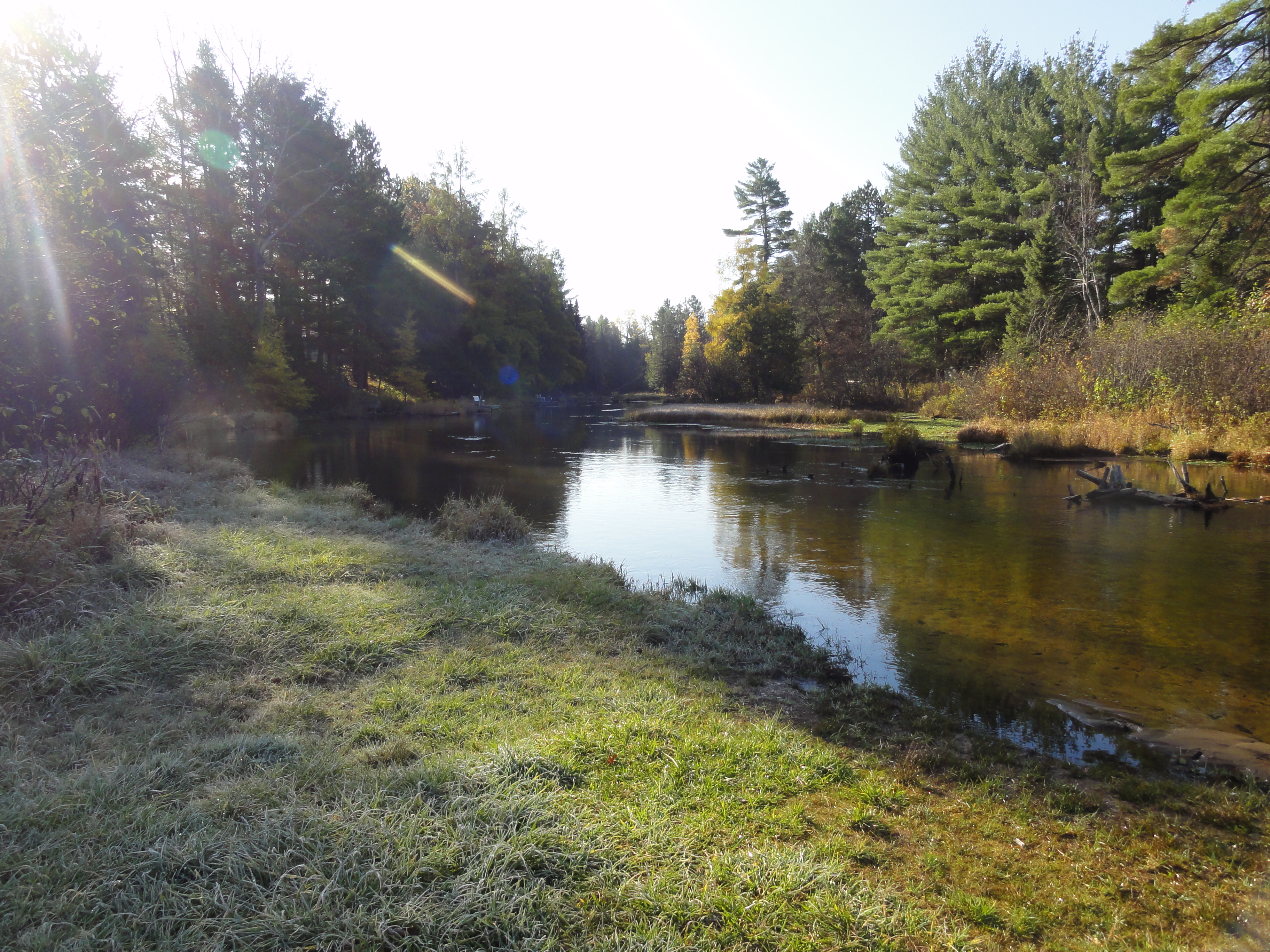
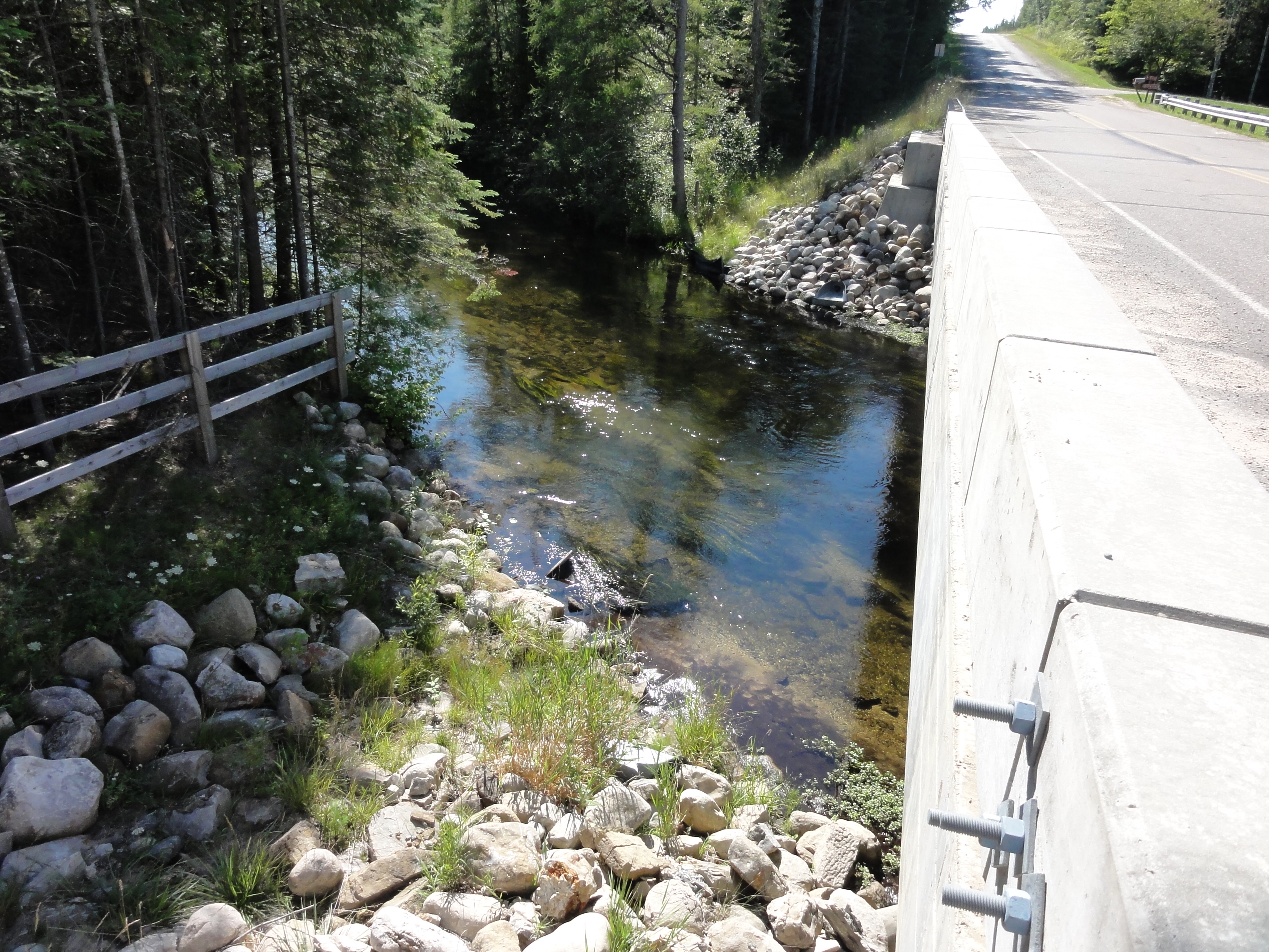
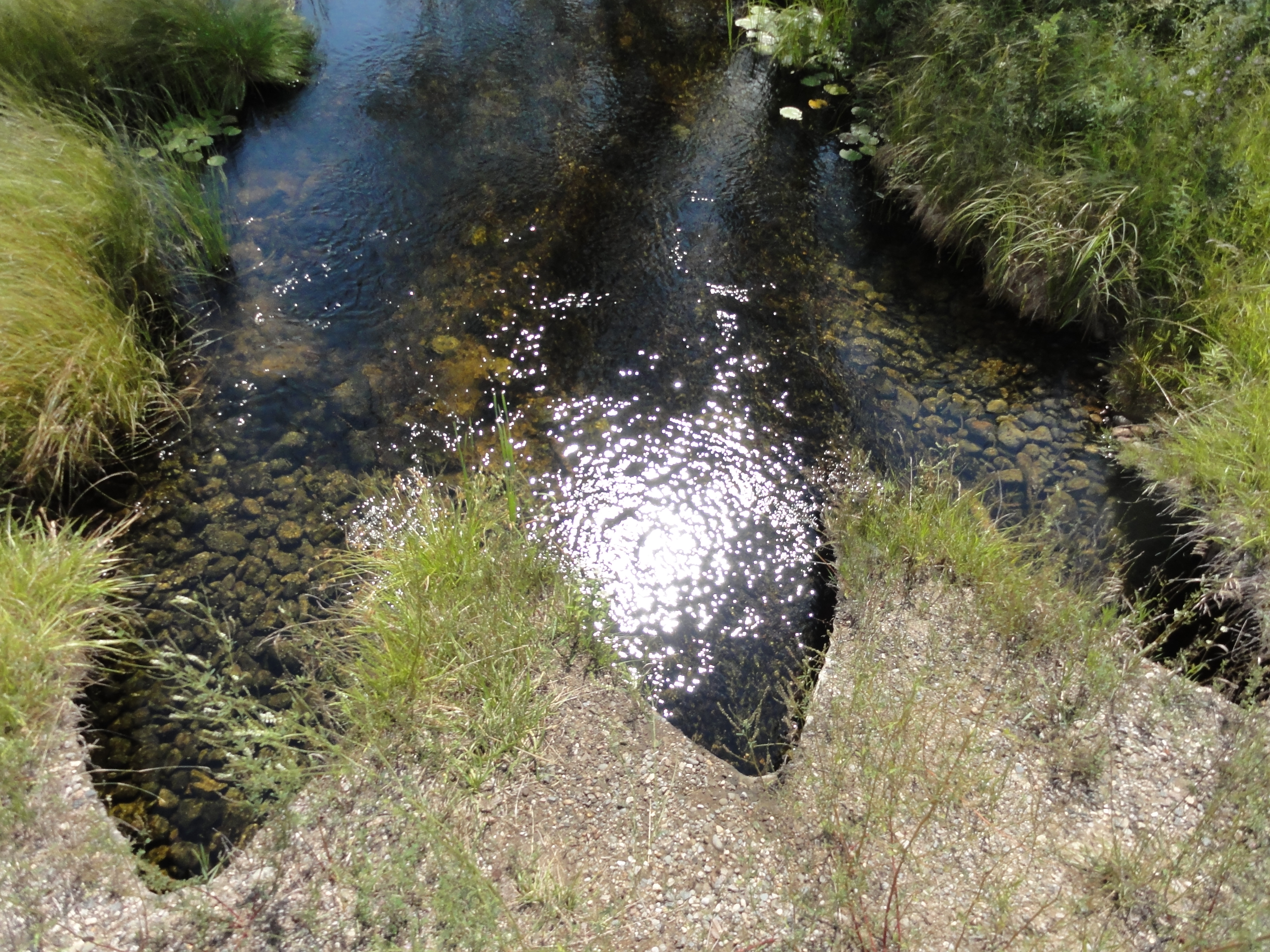
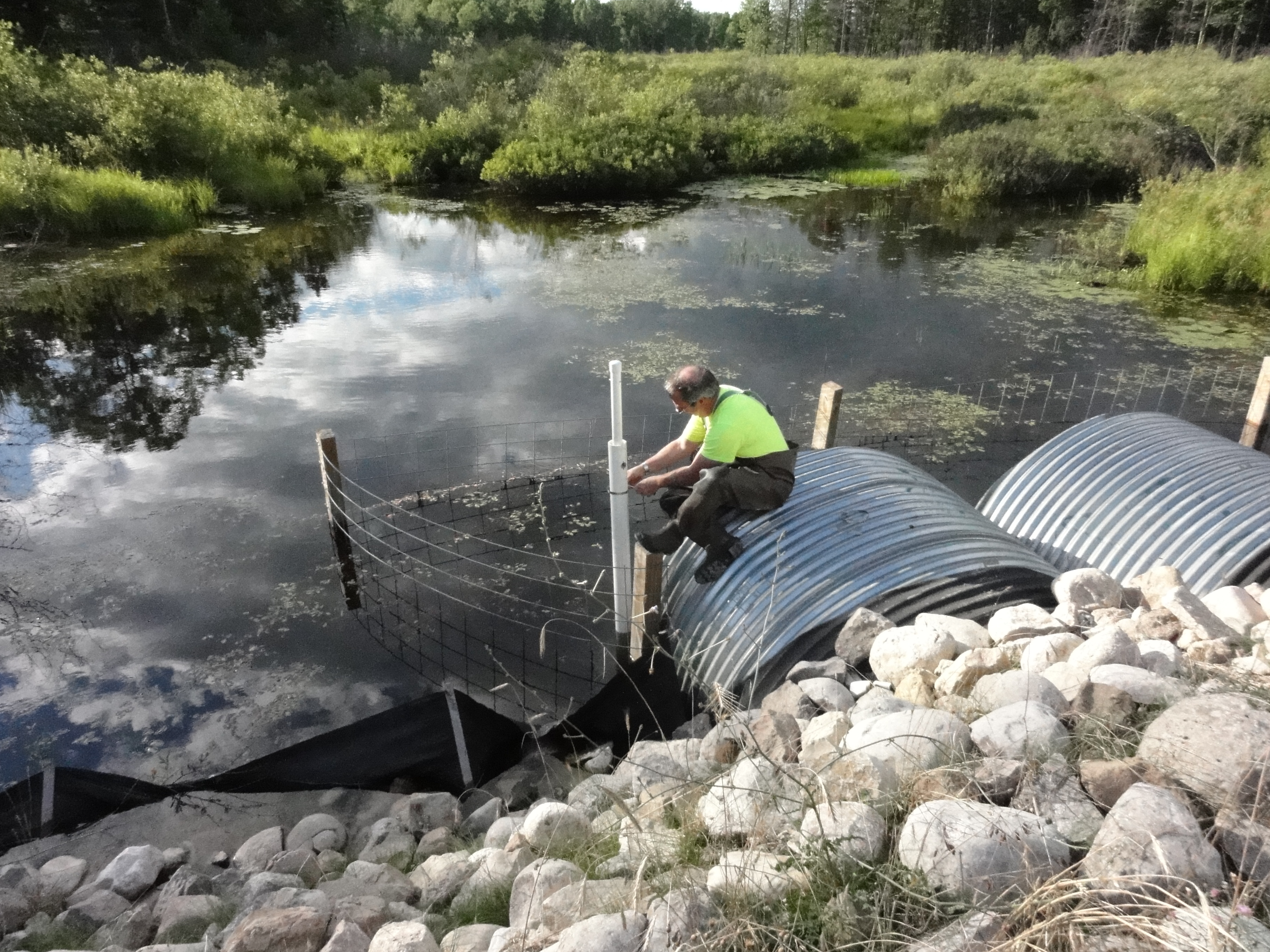
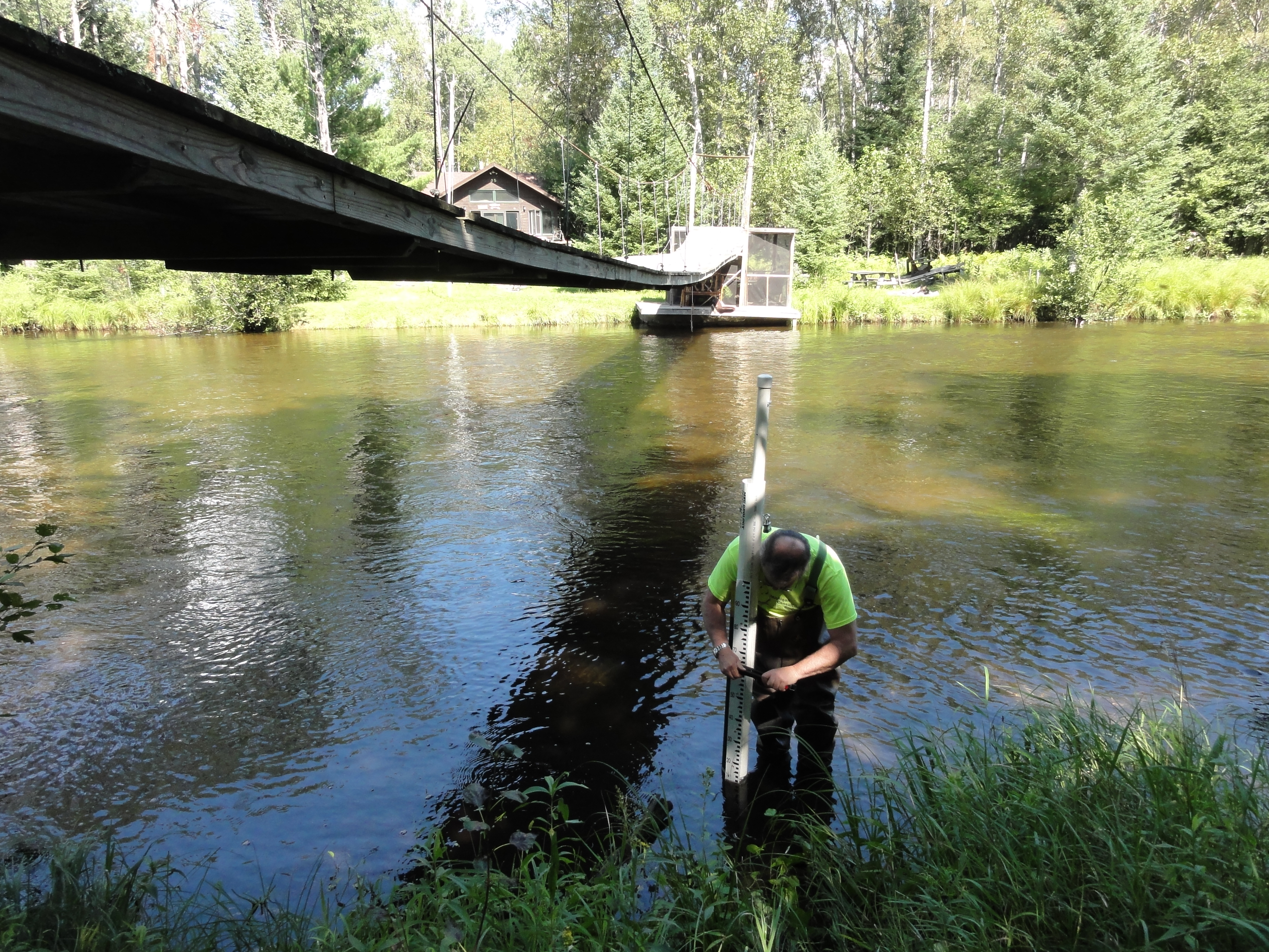
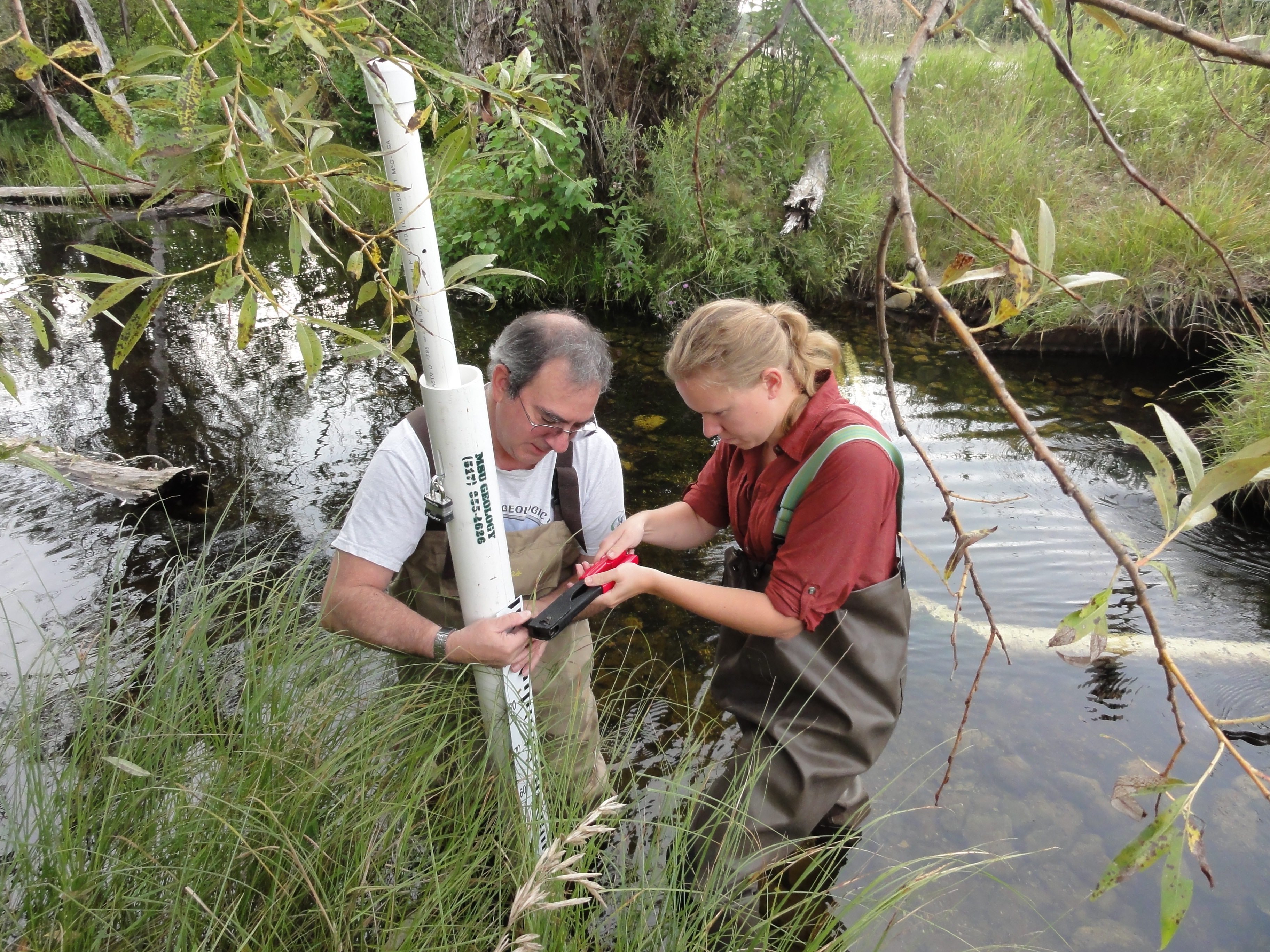
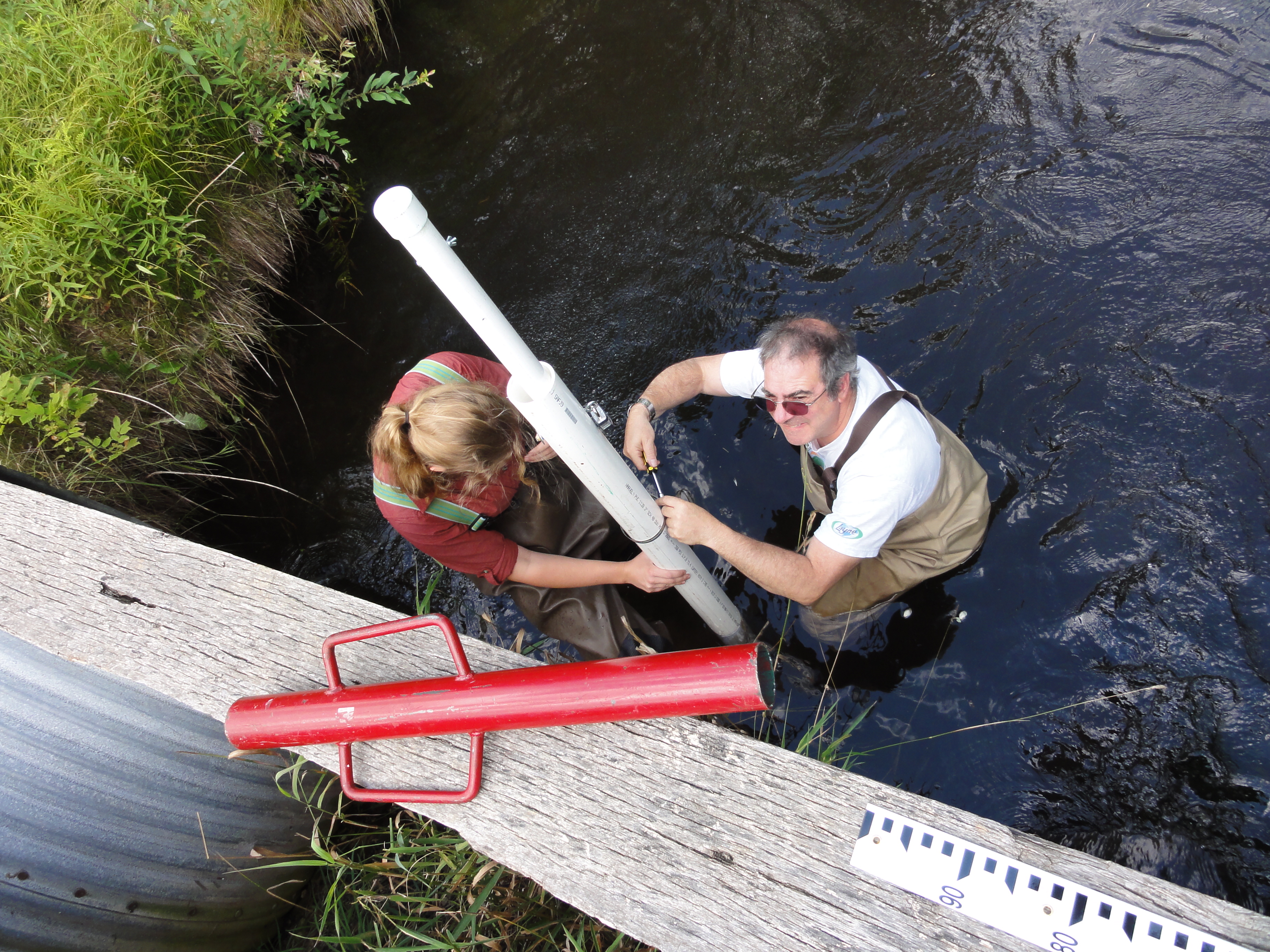
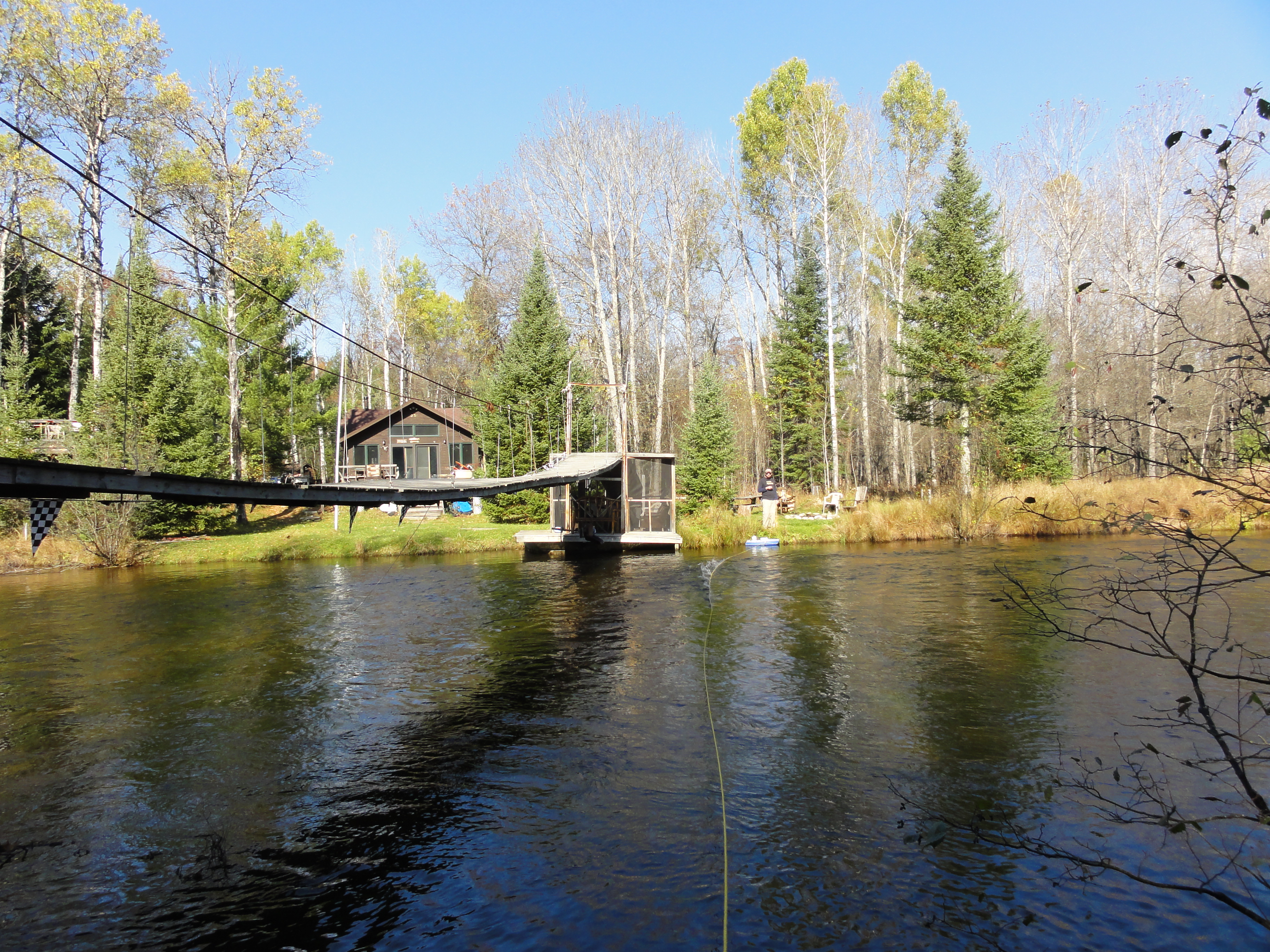
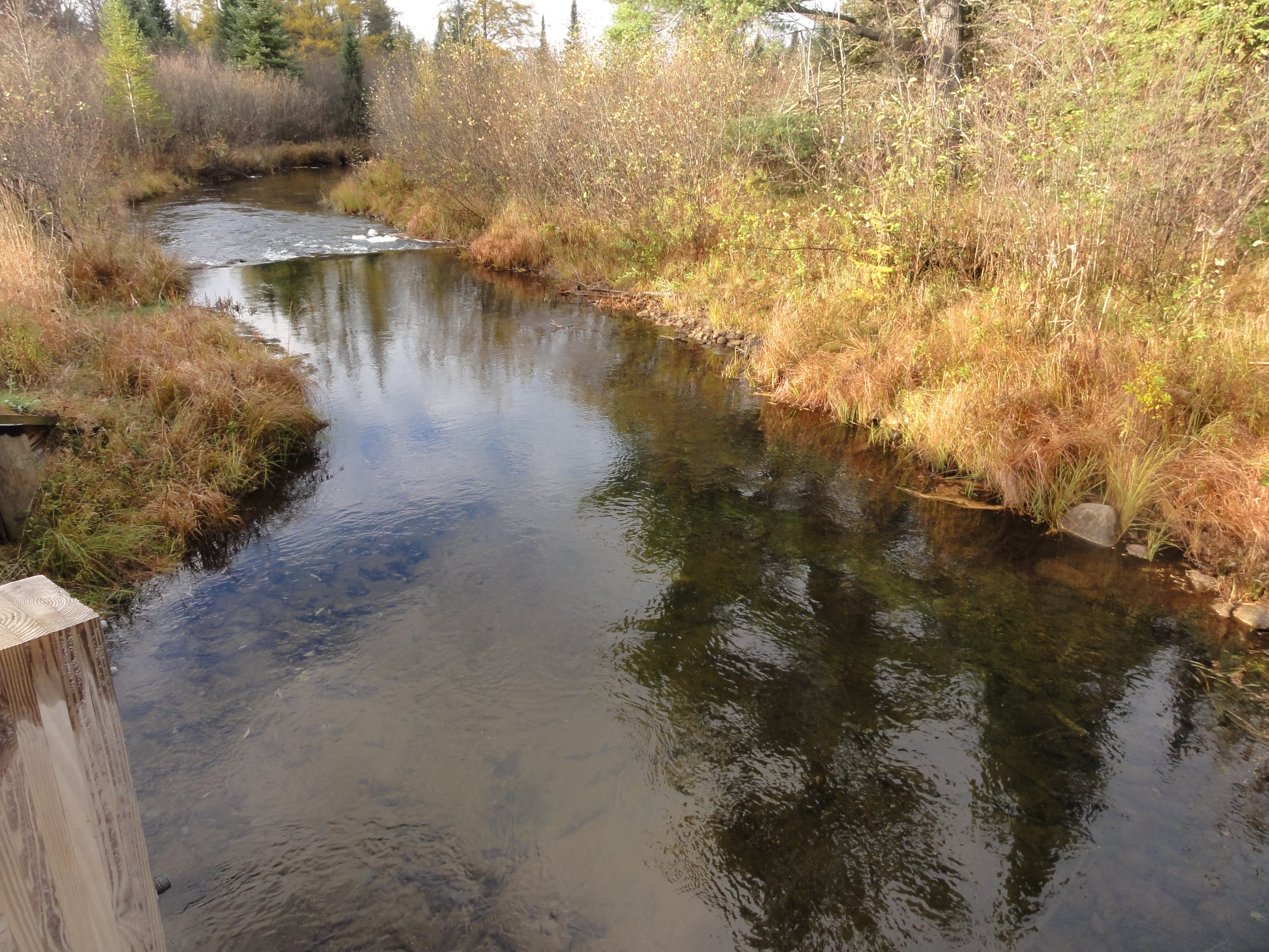
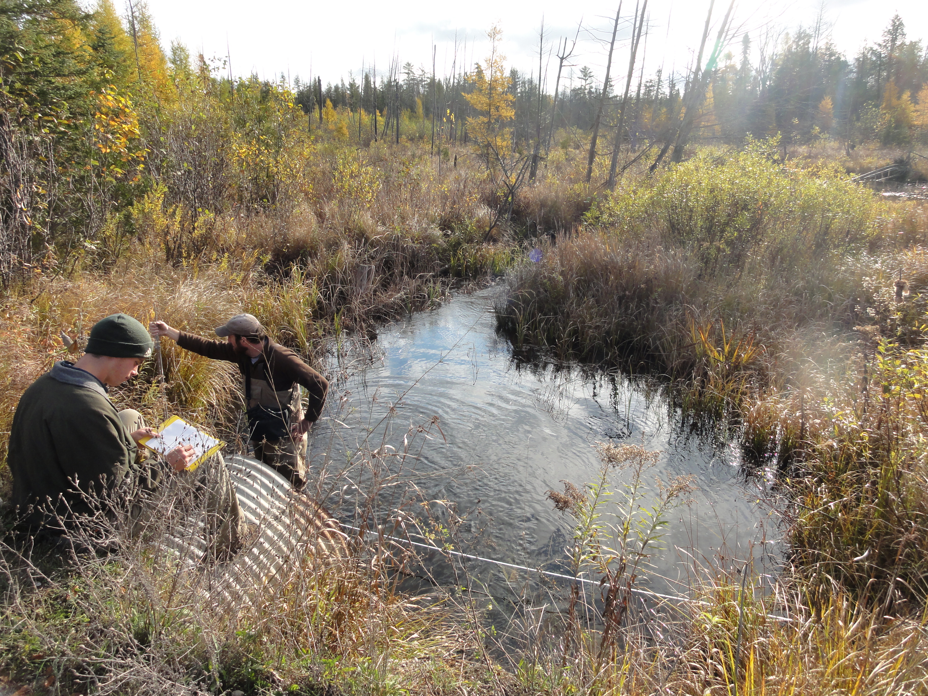
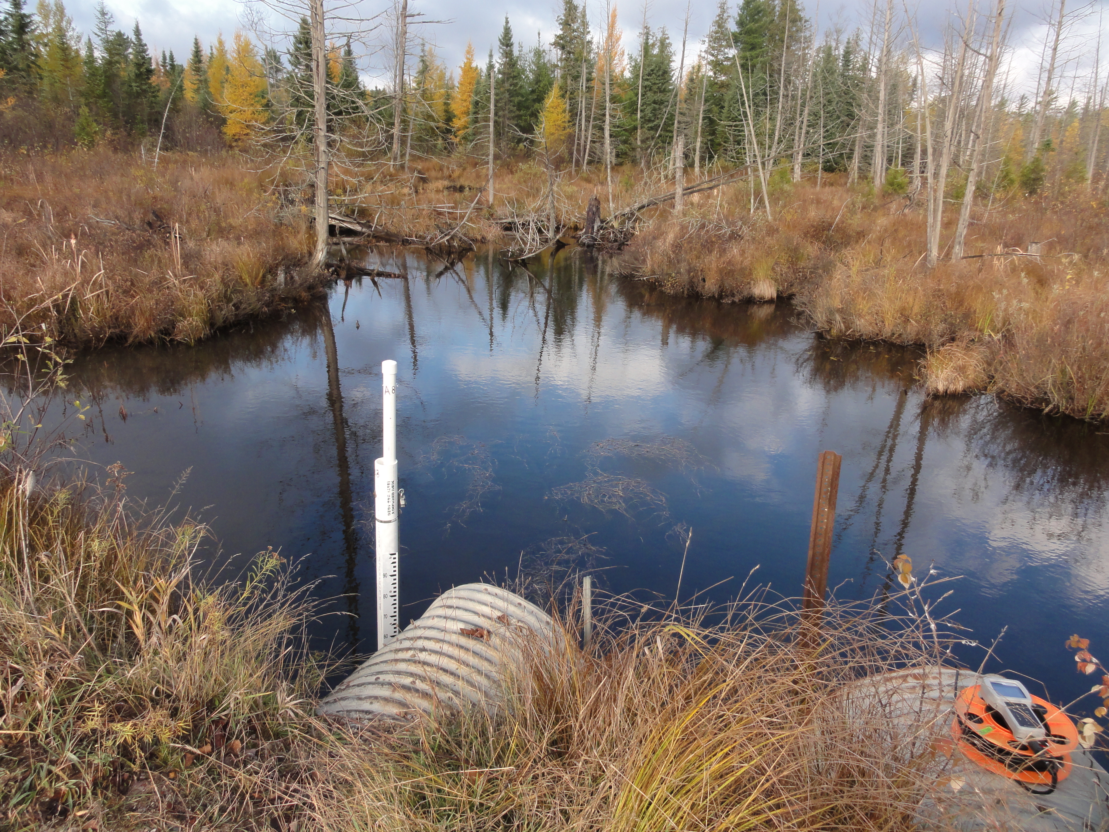
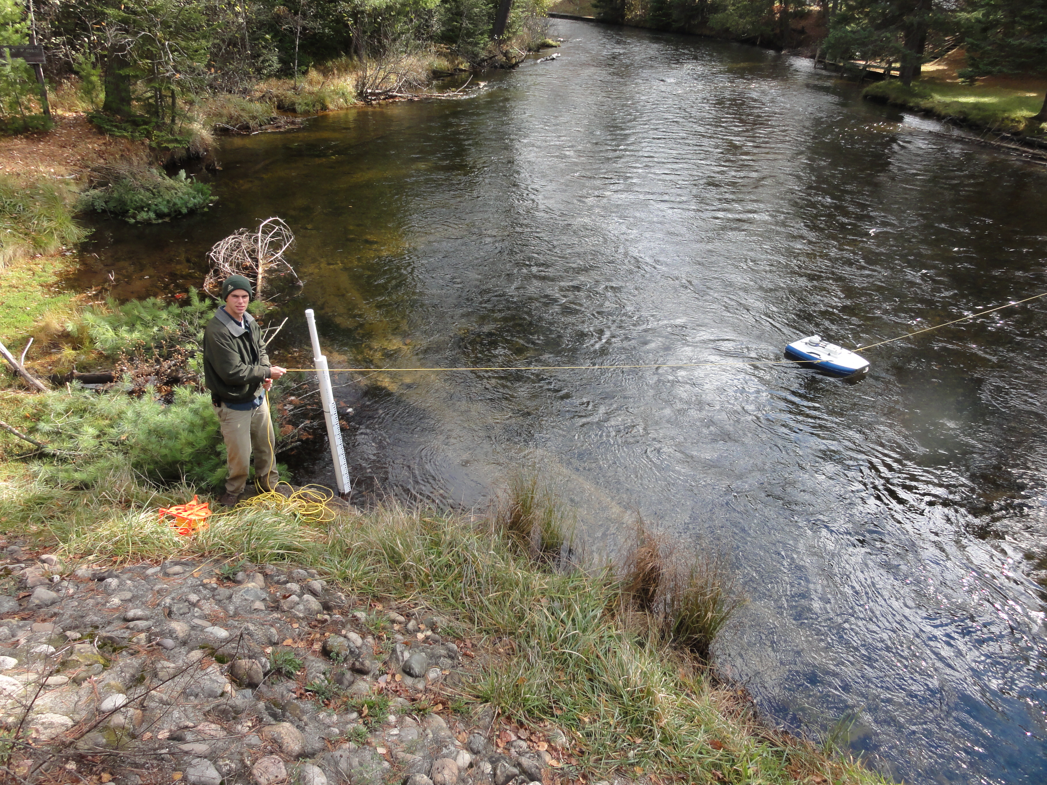
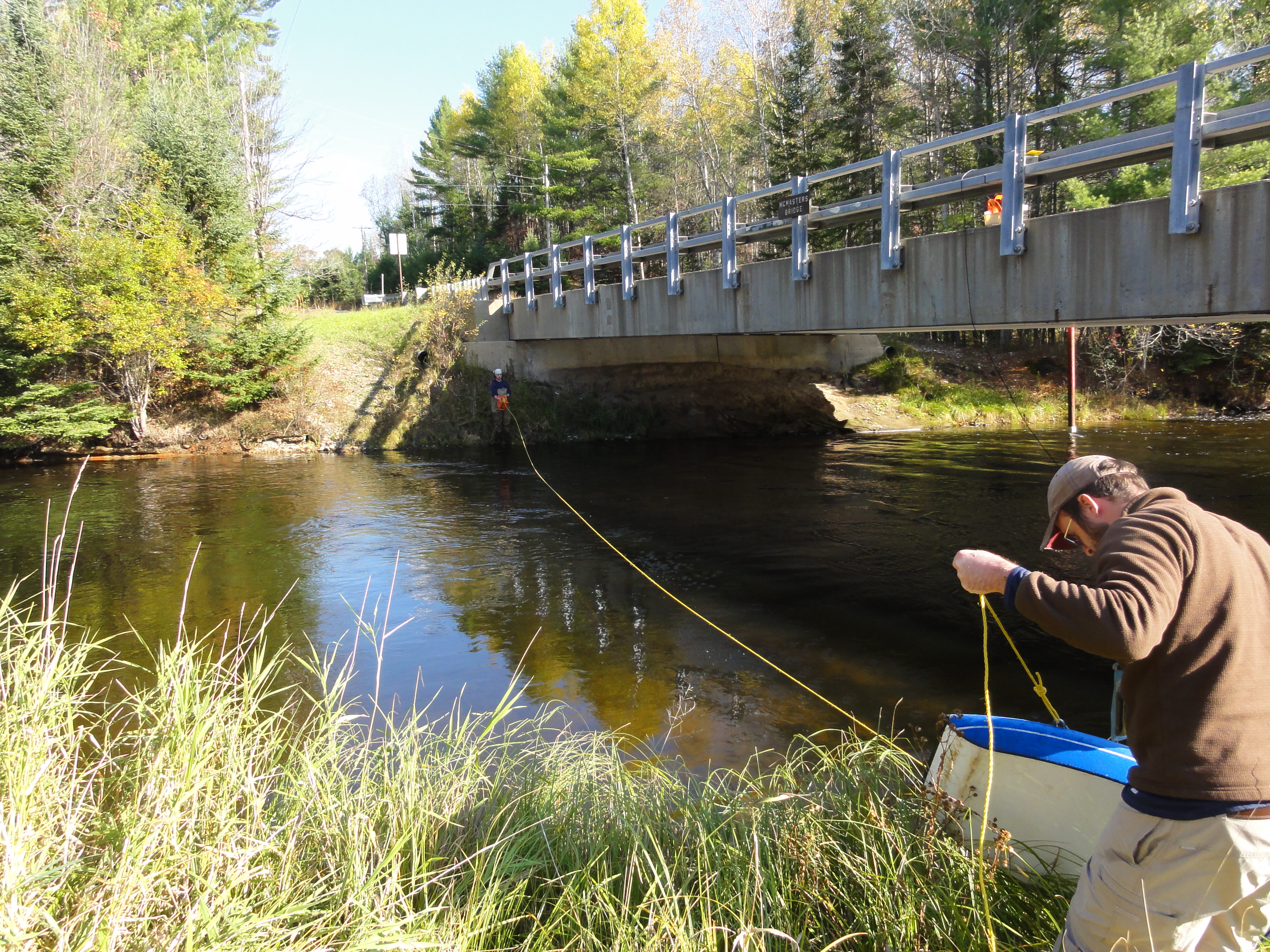
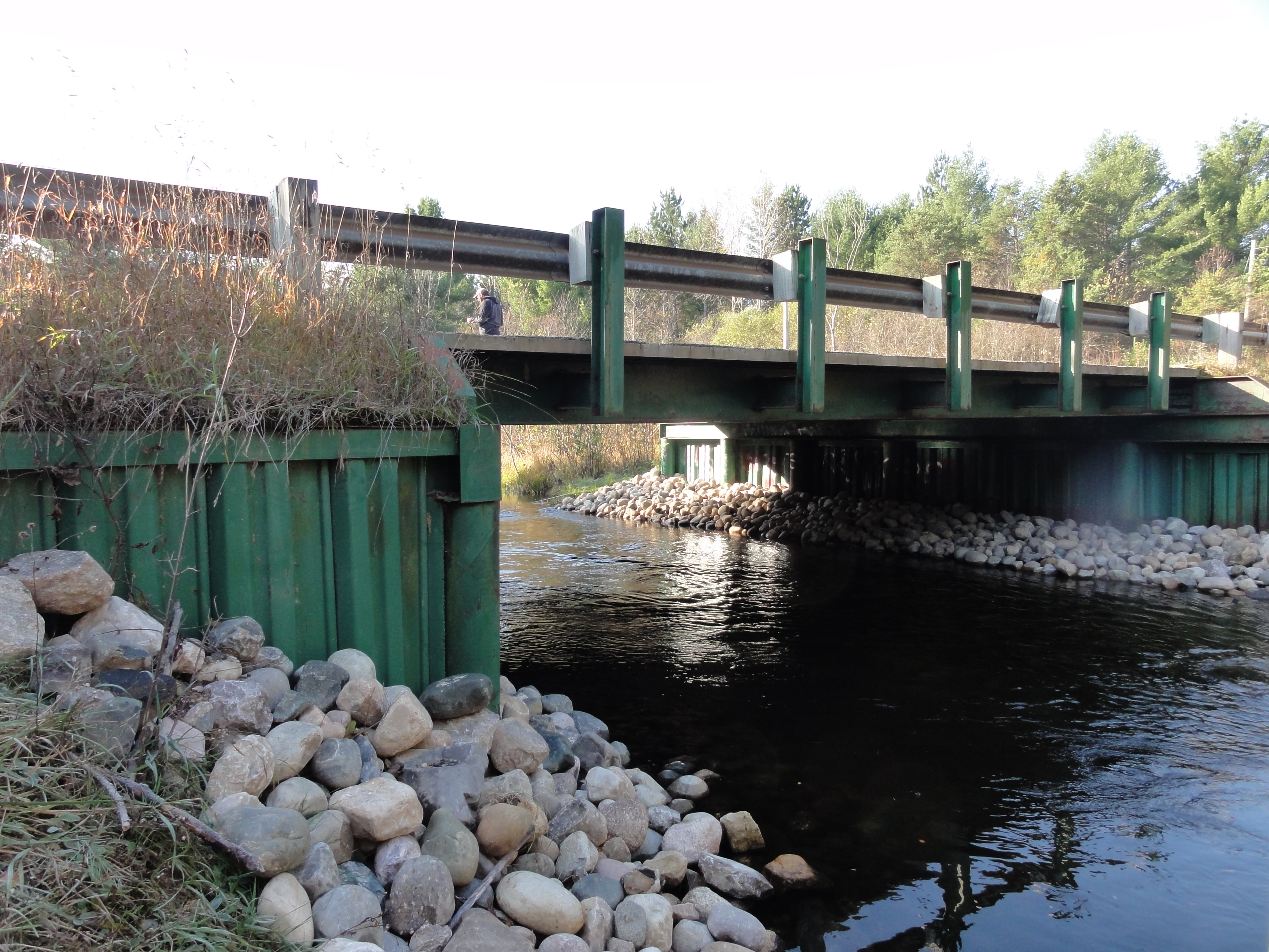
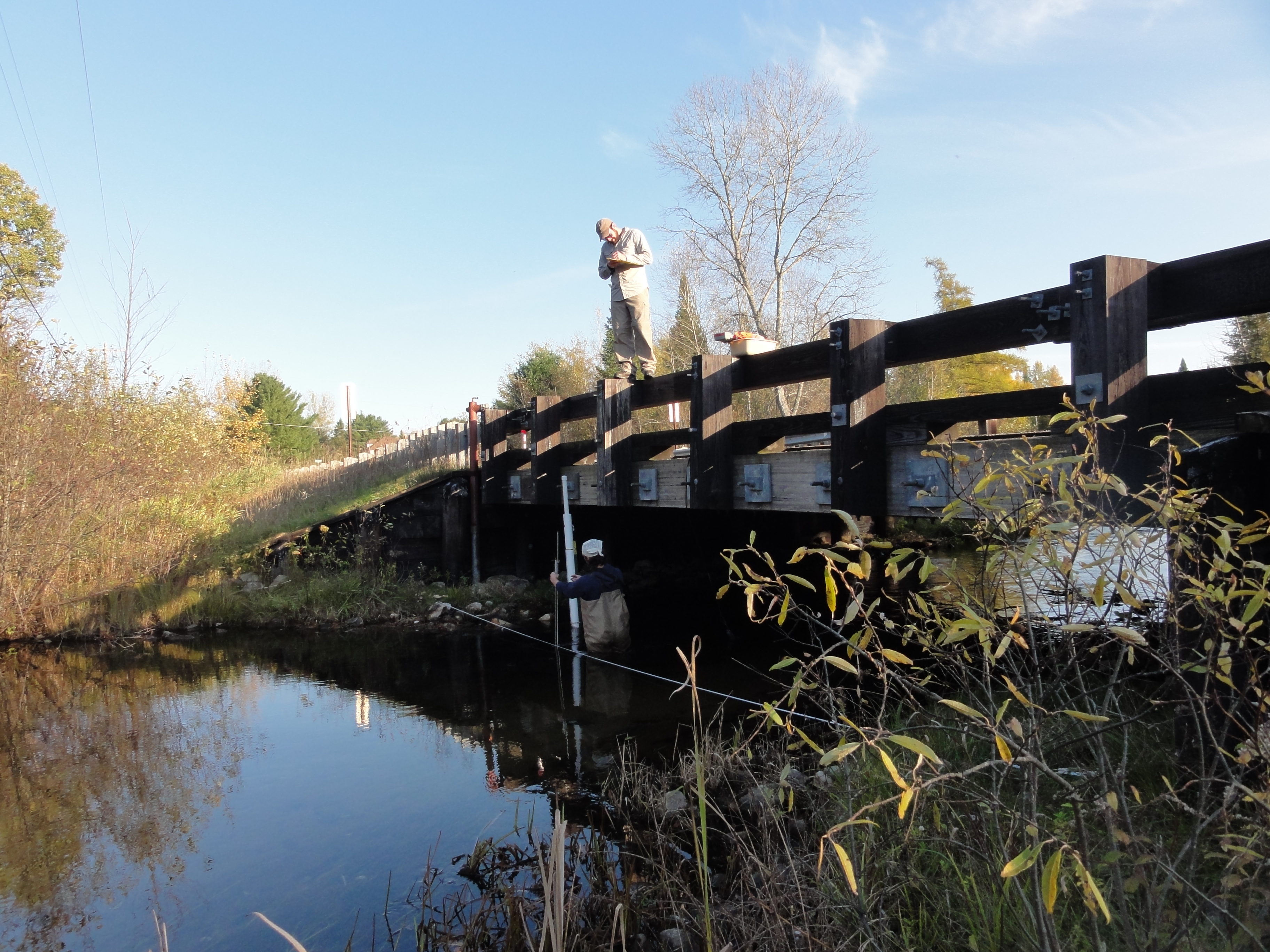
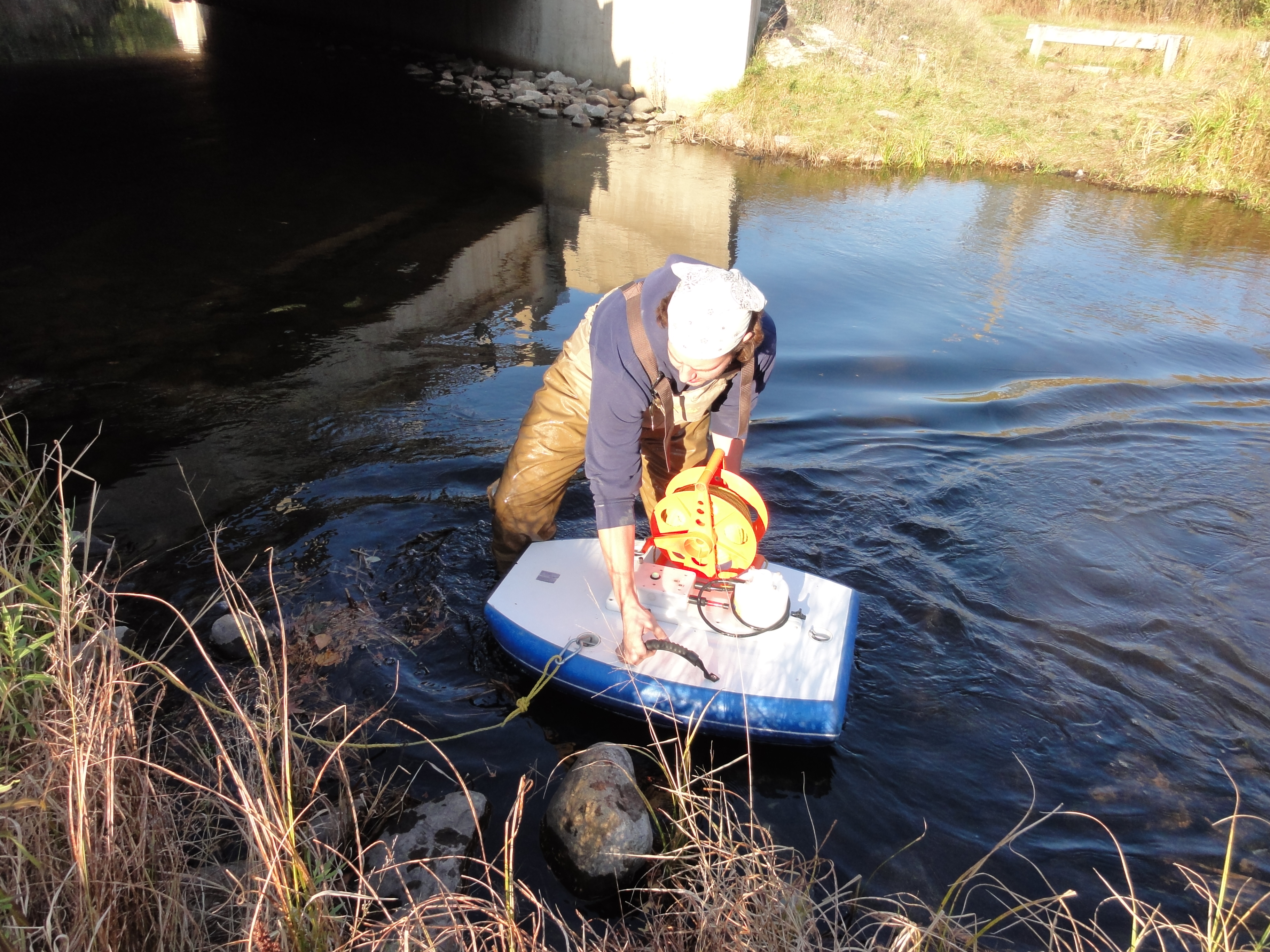
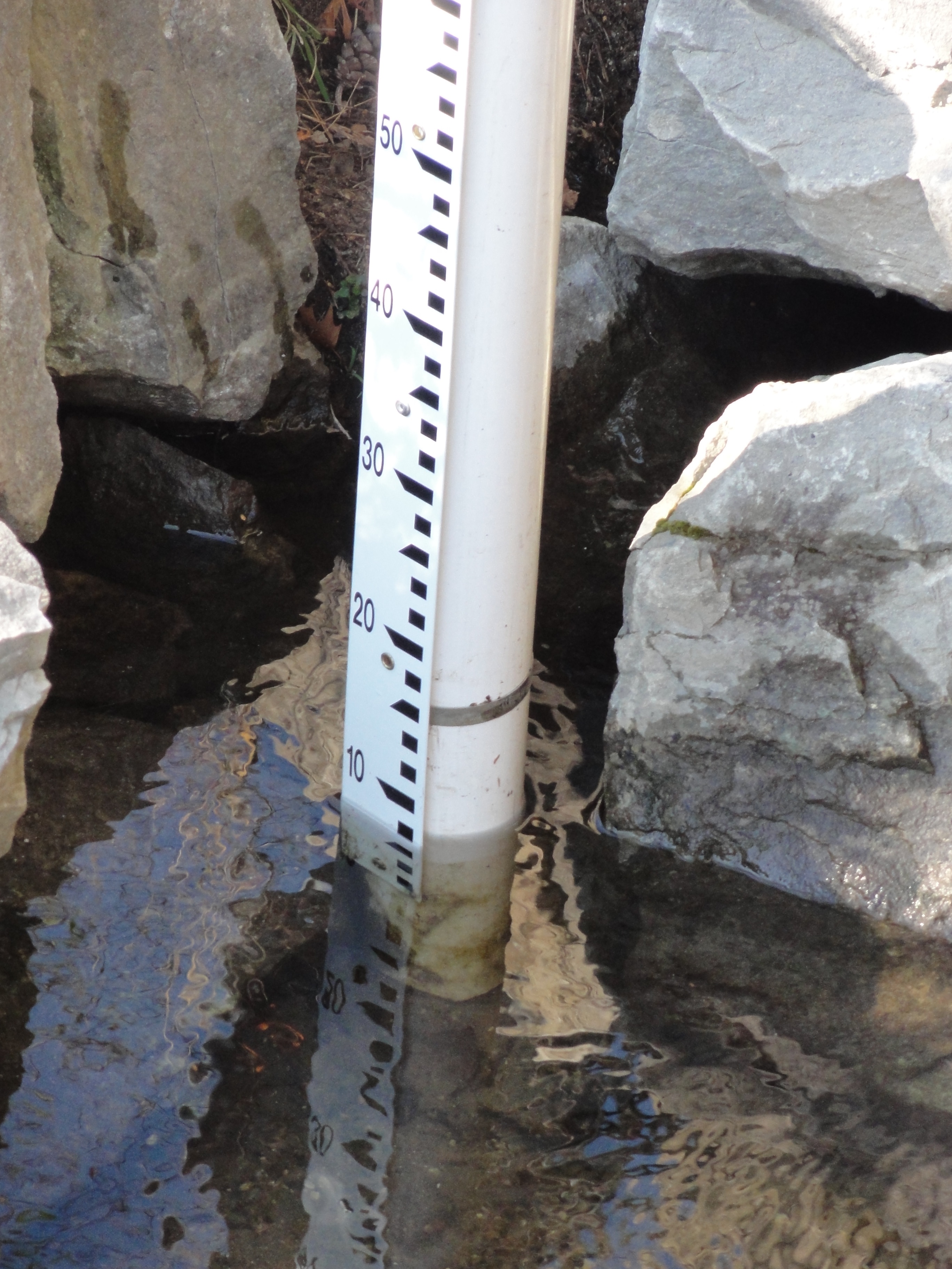
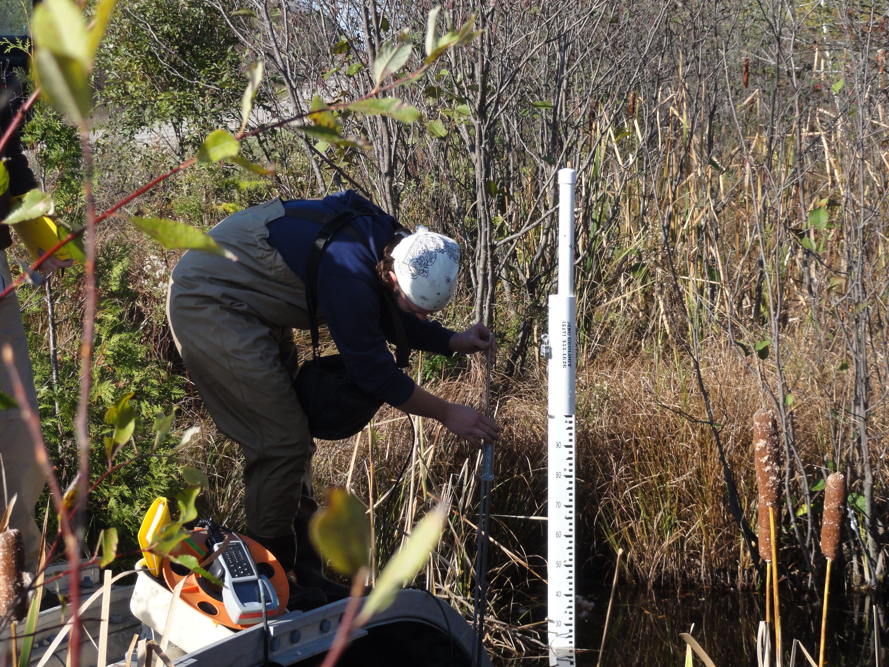
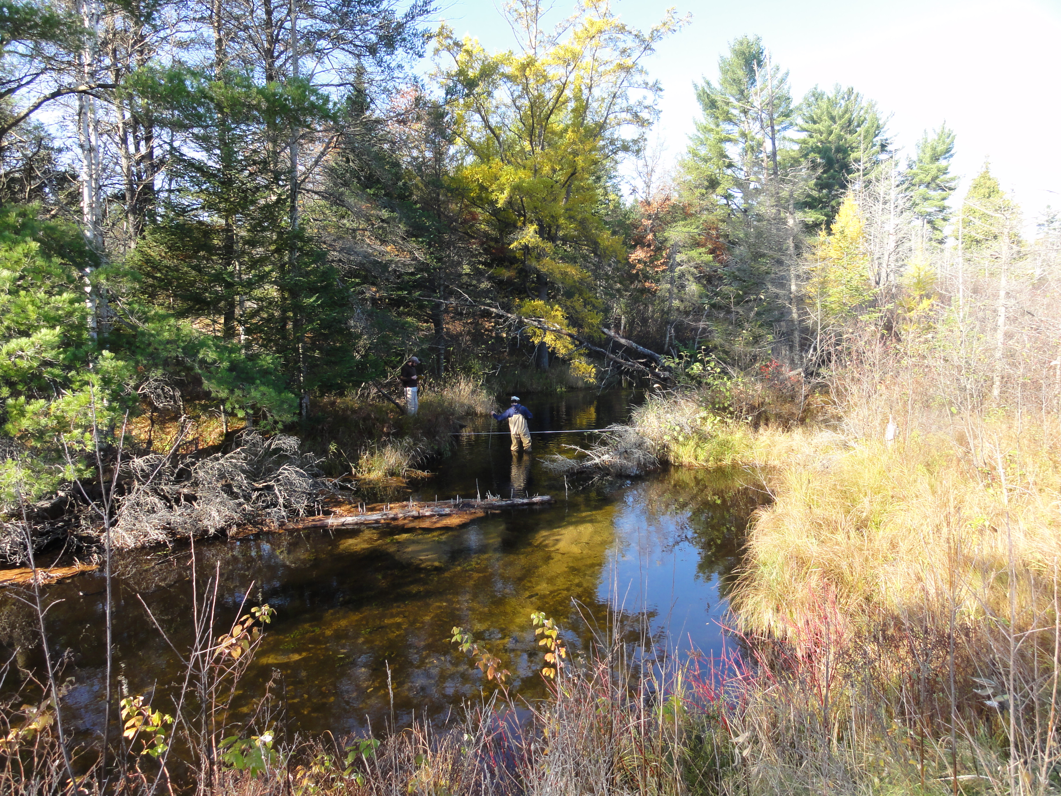
The interaction between groundwater and that on the surface is not understood well. Its aspects are both complex and in want of better ways to measure such things as stream flow. There is a need for newer methods to be found in order that we can more fully understand these systems and help maintain them.
![]() Through looking at both the Au Sable and Manistee River basins’ headwaters, our objective of this project is to develop methods to increase our knowledge of temperature, stream flow rates, groundwater recharge rates, etc. in these areas. In a two year span, forty gages are to be installed in both the headwaters of the Manistee and the Au Sable rivers. Though the state does have groundwater assessment tools out there, the system is not focused on the headwaters. We are creating a much denser network to narrow in on these specific places in the river system to add to the overall knowledge of rivers.
Through looking at both the Au Sable and Manistee River basins’ headwaters, our objective of this project is to develop methods to increase our knowledge of temperature, stream flow rates, groundwater recharge rates, etc. in these areas. In a two year span, forty gages are to be installed in both the headwaters of the Manistee and the Au Sable rivers. Though the state does have groundwater assessment tools out there, the system is not focused on the headwaters. We are creating a much denser network to narrow in on these specific places in the river system to add to the overall knowledge of rivers.
By creating a detailed network of stream gaging in these two areas, we hope this will in turn provide a basis for further research projects. Our findings will be able to help in dealing with the above such measurements in areas across the lower Peninsula of Michigan, more specifically in the areas of groundwater and recharge processes. Also, by assessing the use of such gages, we can analyze other impacts on the headwaters, such as climate changes, land use changes, and possible managing methods for various fisheries statewide.
The procedure for this project is as follows:
Task 1: Install Stream Gauging Stations
Task 2: Collect Stream Flow Measurements
Task 3: Monitor Basic in Stream Chemistry (conductivity, pH, temperature, ORP)
Task 4: Write Report
The PI for this project is Dr. David Hyndman. Funding is provided from both the State and the Anglers of the Au Sable for a two year study.
Project Photos:
]]>

Looking at Higgins Lake in Roscommon County, this project is analyzing the implications of a control structure dam on both the lake itself and the Cut River. Effects of erosion have been found and yet little study has been done on the structure’s role in the environment. This could play a large effect on not only the lake and river wildlife, but the economy and environment of the surrounding human population as well. The Higgins Lake Property Owners Association (HLPOA) made these possible implications and their concerns clear when they brought this issue to the Michigan Department of Natural Resources and Environment’s (MDNRE) Fisheries Division.
Higgins Lake has large economic benefits to the surrounding economy and is significant in both fishing and recreation. These were among the reasons HLPOA became concerned with the structure’s impacts in the first place. They fear that the control structure will diminish these benefits. This study aims to identify how water level management scenarios might impact fish habitat on Higgins Lake and the Cut River.
This study looks to accumulate data by analyzing the local vegetation, hydrology, weather, and wildlife. With this data, we will be better able to understand the implications of the control structure and how to prevent harm on the area’s bio-system. Furthermore, we will be looking at the possible effects of removing the control structure and returning both Higgins Lake and the Cut River to their natural conditions. All of this data will be combined, allowing us to be able to give those who are stakeholders in these areas the information they need when it comes to deciding what must be done: leave the dam alone or remove it.
Funded by the Michigan DNR and the Higgins Lake Foundation, on March 4, 2012, this project received a $100,000 grant for two years. The partners in the grant proposals are Mike Wiley at the University of Michigan and the Huron Pines Inc.
]]>

Six Word Summary:
Extreme Events Change Nutrient Delivery, Blooms
Furthering steps taken by a past EPA Grant, this project is looking at predicting harmful algal blooms using remote sensing, hydrologic models, and landscape features. With current extreme events, such as droughts and storms, caused by climate change, we want to assess how they will impact both water quality and algal blooms management. Looking into the relationship between extreme events and water quality, we hope to increase the variety of tools at our disposal. This will in turn help us to not only better understand this relationship, but also allow us to have a better knowledge of the impacts on water quality and algal blooms by different extreme events.
Algal blooms are caused by both microbial pathogens and excess nutrients that gather due to increased runoff during storms. Droughts also usually increase water temperatures, calmer weather, and high concentrations of nutrients, leading to algal blooms as well. The blooms can be harmful to both animals and humans, as in the area of quality of drinking water, and they have been estimated to cost the U.S. around 2.2 to 4.6 billion dollars per year in economic damages. Frequency of algal blooms has been increasing along with extreme events, and with such risks to animals, human health, and the economy, we want to look at how various regions and their water qualities will be impacted by extreme events in order to better manage algal blooms.
Three main tasks are associated with this project:
- Look at the history of algal blooms in different hydrological regions and how they have been tied to various extreme events in the past.
- Using models, possible causes of algal blooms by extreme events will be analyzed, as well as what influences climate change will have on algal biomass.
- Draw up statistical models that can be used on a nationwide basis in order to study various management strategies and their effects on possible extreme events’ vulnerabilities.
All this will be done is several ways. As stated above, the history of various lake water quality change and watershed land use will be analyzed through satellite imagery. Using Landsat, images as far back as 1972, and MODIS, along with USGS gaging stations, we can find the history of water quality and the amount of algal biomass in various lakes over a period of time. This project will hone in on four different hydrologic regions: the Lower Peninsula, the High Plains Aquifer, the Kentucky-Oklahoma corridor, and the California mountains and Central Valley. These areas were chosen due to our prediction that there will be large discrepancies among the algal biomasses’ responses to various extreme events. By this, we are trying to better understand how to predict algal blooms, how to better manage algal blooms, and how to better understand the impact of extreme events in various regions.
The PI for this project is Jane Stevenson. The co PIs are David Hyndman, Nathan Moore, and Jiaguo Qi. This project is funded by the EPA and received a grant on December 22, 2011 for $750,000.
]]>
This project is funded by NASA, in collaboration with the University of Michigan and Michigan Tech Research Institute.
]]>

We would like to acknowledge the USGS for funding this research.
]]>
We would like to thank the Michigan State Department of Natural Resources and the Higgins Lake Foundation for their support of our work in the Higgins Lake and Cut River system.
]]>
Environmental challenges are complex and require expertise from multiple disciplines. Consequently, there is growing interest in interdisciplinary environmental research that integrates natural and social science, an often arduous undertaking. We surveyed researchers interested and experienced in research at the human–environment interface to assess perspectives on interdisciplinary research. Integrative interdisciplinary research has eluded many of our respondents, whose efforts are better described as additive multidisciplinary research. The respondents identified many advantages and rewards of interdisciplinary research, including the creation of more-relevant knowledge. However, they also reported significant challenges and obstacles, including tension with departments (49%) or institutions (61%), communication difficulties, and differing disciplinary approaches, as well as institutional barriers (e.g., a lack of credit in promotion and tenure). Most (52%) believed that developing interdisciplinary breadth should begin as early as the undergraduate level. We apply our results to recommendations for successful interdisciplinary endeavors.
Article:
]]> Personal History
Some say I was born with a rock in my hand. My first memories are of rocks. In fact, all of my memories involve rocks. When I was very young I was playing in a stream looking for rocks, I noticed that rocks in the stream were much smoother than rocks on the banks of the stream. I thought “That’s pretty neat”. At that moment I knew that I wanted to learn about rocks and water, forever. My only wish was that there was some field of study that incorporated both of those concepts.
Education
No Formal Education.
Nomadic skills acquired from years spent living with wild bears in the heart of the Siberian Forests.
Served as a test dummy for many governmental experiments in the early 2000’s.
]]>
]]>

On October 26, 2012 Dave Hyndman gave a plenary session talk at the 5th annual Freshwater Summit in Traverse City, MI. ]]>
 Personal History
I grew up along the southern edge of the Adirondack Park in upstate New York, spending each summer outside – swimming in lakes, catching crayfish, climbing trees, etc. etc. Fortunately, those experiences gave me an intense appreciation for the quality of the environment and directed my career path towards the earth sciences. As an undergraduate at Brockport, I was lucky enough to study and research within the Water Resources Department while simultaneously gaining problem solving and programming skills as a Physics major. My desire to combine these interests led me to Hydrogeophysics here at MSU, where I’ve been able to apply my diverse abilities to develop models that help us understand how different factors influence the behavior of water in the environment.
Research Interests
I’m interested in using geophysical techniques and modeling to investigate how water moves in the shallow subsurface beyond point scales. Plant-water interactions play a huge role in controlling how water is distributed in the vadose-zone, but are traditionally difficult to quantify. Using non-invasive methods we can get a close look at the system without disturbing it. This kind of information is critical to anticipate how changes in land use and climate will influence future water balances. I’m currently focused on coupling hydrological and geophysical models to optimize root-uptake functions.
Education
- PhD Candidate 2012-Present, Environmental Geosciences, Michigan State University
- BS Physics 2012, The College at Brockport, State University of New York
- BS Water Resources 2012, The College at Brockport, State University of New York
Recent Abstracts
- Kuhl, A.S., Hyndman, D.W., 2015, Quantifying impacts of solute transport on time lapse ERT at a Michigan ecotone. American Geophysical Union Chapman Conference, Valencia, Spain. https://agu.confex.com/agu/15chapman4/webprogram/Paper59158.html
- Kuhl, A.S., Hyndman, D.W., Van Dam, R.L., 2013, A Coupled Hydrogeophysical Modeling Approach to Estimate Soil Moisture Redistribution in the Face of Land Use Changes. American Geophysical Union Fall Meeting, San Francisco, CA. http://abstractsearch.agu.org/meetings/2013/FM/H51F-1253.html
- Kuhl, A.S., Hyndman, D.W., Van Dam, R.L., 2013, Improving root distribution models through a novel coupled hydrogeophysical approach, ESPP Research Symposium: Water for a Sustainable World, East Lansing, MI. http://www.espp.msu.edu/events/past_symposium.php
- Kuhl, A.S., Van Dam, R.L., 2013, Coupled Inversion of Electrical Resistivity and Hydrological Models to Quantify Soil Moisture Dynamics Below a Michigan Ecotone. Geological Society of America North-Central Meeting, Kalamazoo, MI. https://gsa.confex.com/gsa/2013NC/webprogram/Paper218744.html
- Kuhl, A.S., Richards, P.L., 2012, Identifying Shallow Bedrock on the Onondaga Fm Using Ground Penetrating Radar. Geological Society of America Northeastern Section Meeting. Hartford, CT. https://gsa.confex.com/gsa/2012NE/finalprogram/abstract_200881.htm
- Kuhl, A.S., 2012, Physical Concepts of GPR. Rochester Symposium for Undergraduate Physics Students. Albany, NY.
Complete CV
Download my complete CV (updated 08/01/2017).
]]>
Personal History
During my undergraduate studies at Illinois State University, I worked as a research assistant for the Geology department’s paleontologist and also as a tutor for an introductory level geology course. After earning my degree, I worked for a petroleum company in southern Illinois managing and monitoring multi-formation water injection wells used in secondary recovery of hydrocarbons.
Research Interests
My research focuses on the possible impacts of biofuel crop production and climate change on future water quality and quantity. More specifically, I am attempting to determine how various cellulosic biofuel feedstocks will affect the water balance when compared to one another as well as more traditional grain-based feedstocks. To do this, I work with data collected from biofuel crop test plots and integrate it with state-of-the-art hydrogeologic models to simulated crop, soil, and water interactions.
Education
- B.S. Geology, Illinois State University, 2011
Complete CV
Download my complete CV.
]]>His project was titled: “Predicting the Impacts of Climate Change on Agricultural Yields in the Maumee River Watershed.” ]]>
Forests cover approximately one third of the global land surface area. Changes induced by human activities can exert significant impacts on the environmental services provided by forests. Nevertheless, the long term footprints of certain types of forest cover conversions on the water and biogeochemical cycles are poorly understood. My research work has focused on observing and predicting hydrological processes in managed forested ecosystems. This is, how the disturbance and recovery of forests can affect the components of the water balance.
Currently, I am investigating the potential effects on the water quantity and quality of the Great Lakes Basin from on-going environmental changes as the intensive development of biofuel crops in the Midwestern United States. I am also involved in the large-scale assessment of the Ogallala-High Plains aquifer, one of the largest aquifers in the world, from a sustainability approach that combines climate, economic, social, crop, and hydrological models. A third topic of my research concerns the observation and modeling of subsurface processes using geophysical methods.
Moreover, I am also interested on additional topics as ecohydrology, desertification, nonlinear patterns in geophysics, climate change and infrastructure and, water management systems.
Education
- Ph.D. Forestry and Environmental Sciences, University of Freiburg, Germany. 2012. Dissertation Title: The hydrology of forest disturbance and succession during dry periods.
- M.A.S. Water resources engineering and management, Swiss Federal Institute of Technology Lausanne/Zurich, Switzerland. 2007. Thesis Title: On the sensitivity analysis of the PMF to the space-time distribution of a PMP: Analysis of the hydrological response of a catchment.
- B.Eng. Hydrological engineering, Metropolitan Autonomous University, Mexico. 2005.
Recent Publications
- Brena A, Stahl K and Weiler M (2011) Evapotranspiration and land cover transitions: long term watershed response in recovering forested ecosystems. Ecohydrology DOI: 10.1002/eco.256
- Brena A, Weiler M and Stahl K (2011) The sensitivity of a data-driven soil water balance model: insights from
a successional chronosequence. Hydrology and Earth System Sciences Accepted.
Recent Abstracts
- Brena A, Stahl K and Weiler M. 2011. How does forest disturbance and succession affect summer streamflow recession?, AGU Fall Meeting, San Francisco, USA.
- Brena A, Weiler M and Stahl K. 2011. Predicting evapotranspiration in a successional forest without eddy covariance measurements, EGU General Assembly, Vienna, Austria.
- Brena A, Weiler M, Stahl K and Smith R. 2010. Comparative ecohydrology across disturbed forested watersheds: soil moisture regimes and storage-discharge relationships, LATSIS Symposium. Lausanne, Switzerland.
- Brena A, Weiler M and Stahl K. 2010. Inferring long-term water balance dynamics in forested watersheds: tracing vegetation cover transitions, EGU General Assembly, Vienna, Austria.
- Gaume E, Bain V, Marchi L, Preciso E, Bass S, Brena A, Borga M, Bonnifait L, Horvat O, Rogga M, Stegmeier A, Schütz T and Viglione A. 2009. An intensive Post Event Campaign (IPEC) on the extreme flash flood which affected the Starzel river (Germany) on the 2nd of June 2008, EGU General Assembly, Vienna, Austria.
- Brena A, Schneider J, Stahl K. and Weiler M. 2009. Estimation of low flows sensitivity to climate and land use changes using a parsimonious water balance model, EGU General Assembly, Vienna, Austria.
- Brena A,. 2006. Strategies for flood prediction in large urban zones, 2nd International Symposium “Preventing and Fighting Hydrological Disasters”, Timisoara, Romania.
- Brena A, and Briseno F. 2005. Strategies for flood prediction in large urban zones, 4th Worldwide Workshop for Young Environmental Scientists CEREVE-UNESCO-IWA, Paris, France.
- Brena A,. 2003. Managing Urban Development and Industrial Growth in the Basin of Mexico, 13th Stockholm Water Symposium, Stockholm, Sweden.
Complete CV
]]>Blaze has been working at the Lab since Summer of 2011, and after a competitive external search was selected to fill this newly-created position.
]]> Research:
My research focuses on developing source models for nutrient loading to watersheds in the lower peninsula of Michigan. Watershed nutrient loading models are important tools used to address issues including eutrophication, harmful algal blooms, and decreases in aquatic species diversity. A source specific model will help show the value of detailed source inputs, revealing regional trends while still providing insight to the existence of variability at smaller scales.
I have additional interest and background in groundwater management, characterization, and prediction for mining projects and contaminated sites.
Education:
Dartmouth College, 2008 BA
Recent Abstracts:
Luscz E.C., Kendall, A.D., Martin, S.L., Hyndman, D.W. (2011): Modeling Nutrient Loading to Watersheds in the Great Lakes Basin: A Detailed Source Model at the Regional Scale, AGU Fall Meeting, San Francisco
Breckenridge, James Larry; Luscz, Emily (2011): Predicting Underground Mine Dewatering Requirements: A Case Study of a Precious Metal Mine in a Subtropical Environment. – In: Rüde, R. T., Freund, A. & Wolkersdorfer, Ch.: Mine Water – Managing the Challenges. – p. 101 – 105; Aachen, Germany.
]]>This project is EPA funded. The PI is Jane Stevenson. The co-PIs are David Hyndman, Nathan Moore, and Jiaguo Qi.
 Large portions of the Ogallala-High Plains aquifer (henceforth, HPA) complex, underlying approximately 450,000 km2 from Texas to South Dakota, are experiencing fundamentally unsustainable groundwater withdrawals due to large scale irrigation [McMahon 2000]. Since pumping began in earnest in the 1930’s [Weeks et al. 1988], storage in the HPA, the largest aquifer in North America [Jackson et al. 2001], has declined by 333 km3 [McGuire 2009]. Despite rapid water table drawdown and near depletion of some portions of the aquifer [McGuire 2009], irrigated acreage continues to expand [NASS 2007, 2002, 1997]. Underlying natural and socioeconomic drivers of this expansion are heterogeneous in time and space, driven by changes in climate, product demand (due to biofuels development, global population expansion, etc.), energy costs, and other factors [i.e. Peterson and Bernardo 2003]. Although a range of management and policy actions could help move this region toward sustainability, such efforts are complicated by a diverse range of state laws and regulations, economic drivers and agricultural production systems, variable soil productivity and aquifer storage, and forecast changes in temperature and precipitation [e.g., Ashley and Smith 1999; McGuire et al. 2003; Sophocleous 2010].
We propose to address the sustainability of HPA irrigated agriculture by simulating the linked physical, agroengineering, and socioeconomic systems of the region using a suite of climate, hydrology, and biophysical models coupled to socioeconomic models that simulate crop rotation and irrigation decisions in response to markets, policies, and physical drivers. This linked set of models will allow us to characterize and quantify interactions and feedbacks between social and natural systems, provide a thorough understanding of drivers of historical changes, and offer predictive forecasts of the sustainability of various land management alternatives under a range of climate conditions. In particular, we will investigate the social, economic, agricultural, climatological, and hydrologic impacts of land management scenarios ranging from business-as-usual, to managed aquifer depletion, to full sustainability under both static and changing climate conditions. This work will build on related efforts including the coupling of land use, hydrology, and ecosystem models to predict the changes in hydrology and ecosystems in lower Michigan [e.g., Wiley et al, 2010, Kendall and Hyndman, in review], and the CLIP project that coupled socioeconomic models with a regional climate model (RCM) to predict the feedbacks between land use, agriculture, and climate change in East Africa [e.g., Olson et al. 2008; Moore et al. 2009; Moore et al. in review].

Developing management strategies to minimize algal blooms requires detailed knowledge about the landscape factors that drive them. We will use over 35 years of Landsat imagery to map nearshore algal bloom intensity and extent at unprecedented spatial and temporal resolution. These will be related to watershed nutrient and sediment exports predicted using advanced watershed models at both sub-basin and Great Lakes Basin scales. We will then establish nutrient thresholds for specific HAB risks, identify sources of nutrients on the landscape, and prioritize restoration strategies.
]]>
We propose to apply a newly-developed coupled crop-growth and hydrologic model SALUS-ILHM, to simulate scenarios of climate change impacts on crop yields and water resources across the Maumee River Watershed (MRW) in Southeast Michigan, Northeast Indiana, and Northwest Ohio.
Scenarios will include a range of statistically-downscaled GCM forecasts, cultivar adaptation and yield curves, single- and double-cropping strategies, planting and harvest times, and irrigation technology adoption. The coupled SALUS-ILHM model will be able to explicitly simulate both biophysical and hydrological processes in each sub-square kilometer cell. This will allow us to evaluate the role that landscape factors, such as slope and soil texture, will likely play in the response of crop yields and water resources to model scenarios.
We will assess the impacts of forecast warmer temperatures, altered precipitation, and increasing CO2 concentrations on crop yields under different management strategies. We will also evaluate how climate change and associated management scenarios would alter groundwater levels and stream flows in the MRW.
]]>In contrast to the Western U.S., many climate change models predict increased precipitation in the Great Lakes region. This increased precipitation (and runoff), coupled with warmer temperatures, has the potential to significantly affect sediment production and transport in Great Lakes rivers, increasing the loadings to federal harbors that already have a large dredging backlog. Additionally, a number of future climate scenarios predict lower water levels in the Great Lakes, which would further exacerbate the impacts on harbors. This project will look at two federal harbors in the Great Lakes and their watersheds in order to examine potential impacts. The information gained from this work is expected to allow the Corps to make qualitative comparisons with current dredging requirements at most of the federal harbors in the Great Lakes.
This study will specifically look at the St. Joseph River (located in Michigan and Indiana), which enters Lake Michigan through Detroit District’s St. Joseph Harbor, and the Maumee River (located in Ohio), which enters Lake Erie through Buffalo District’s Toledo Harbor. These harbors were selected both because of their sizable dredging requirements and the existence of sediment production and transport models that can be fed new climate scenarios.
Sediment models for these two watersheds have been produced under previous Corps of Engineers tributary modeling studies. This project will also utilize information on climate change specific to the Great Lakes that has been produced for the International Upper Great Lakes Study by scientists from NOAA’s Great Lakes Environmental Research Laboratory and Environment Canada. Additional hydrology models for the two watersheds are also available from Michigan State University.
]]>The associated land cover/management changes will have unknown, but potentially significant, impacts on the quantity and quality of groundwater recharge. This recharge is the primary source of water to streams, lakes, and wetlands across the region. Additionally, Midwestern climate is predicted to change significantly in the coming decades with warmer temperatures, as well as higher precipitation and evapotranspiration, potentially leading to a net soil moisture deficit along with more frequent flooding (USGCRP, 2009). Working in conjunction with the Great Lakes Bioenergy Research Center (GLBRC), researchers from the University of Wisconsin (UW)-Madison, Michigan State University (MSU), Ball State University (BSU) and the United States Geological Survey (USGS) will conduct a collaborative multi-scale effort to:
- 1) expand ongoing field monitoring effort to collect a detailed data set of collocated, surface and subsurface water and nutrient fluxes and above- and below-ground biomass for a variety of model biofuel feedstock cropping systems,
- 2) use our data set along with regional water quality and quantity data, provided in part by USGS, to further develop, parameterize and validate a new biogeophysical hydrology model,
- 3) use our model to explore the implications of coupled climate change and biofuel-based land-use changes for Great Lakes Basin water quantity and quality, and
- 4) perform a side-by-side comparison between a new landscape hydrology code and a USGS hydrology model.
Forecasting the effects of large-scale changes in agricultural management practices on groundwater is a significant shift from the past when such impacts were given little consideration. There is urgent need for studies of coupled land use and climate change because both changes are happening simultaneously. Our analyses will provide important information for water resource managers charged with protection of water for ten percent of the United States population and also land managers and farmers concerned with optimizing sustainable biofuel production in a time of impending climate change.
]]> Vadose‐zone soil moisture is an important driver of processes in agricultural, hydrological, ecological, and climate systems, yet the detailed nature of plant water use across ranges of scales is often poorly characterized. With projected changes in climate and land use (including afforestation, urbanization, agricultural intensification, and biofuels production) there is a critical need to understand the likely impacts on the hydrologic cycle and ecosystem health. Important hydrological and biophysical processes are not adequately characterized with point estimates, and models of rootwater uptake are generally unable to accurately predict such changes. Our objectives are to: 1) quantify multi‐scale dynamics of vegetation‐water interactions across different land cover types to improve predictive capabilities of hydrologic models, and 2) explore the impacts of land use and climate changes on watershed‐ to Great Lakes Basin‐scale hydrologic fluxes.

To explore the likely effects of projected changes in climate and land cover, we propose to use time‐lapse electrical resistivity imaging and a novel coupling of a fully integrated terrestrial hydrology model with a dynamic vegetation growth model to study managed and natural sites along a climate gradient across a range of soils. The intellectual merit of this research includes 1) improved knowledge and predictive capability of short‐ and long‐term processes that drive the terrestrial water cycle, 2) root‐zone moisture and root‐development data that will improve parameterization of roots in coupled land surface and climate models, and 3) quantitative information about implications of land use and climate changes across a range of scales.
Our work also has several significant broader impacts. First, the analysis will provide a critical foundation for further exploration of the impacts of biofuel crop development and reforestation for energy independence and carbon sequestration initiatives. Second, we are developing novel tools to image transient moisture under a range of land uses and climate conditions, and predict the impacts of climate and land use changes on the terrestrial hydrologic cycle. Third, the developed tools would increase the efficiency of resource allocation for monitoring natural and managed systems by practitioners in agriculture, ecology, and hydrology. Fourth, this project will advance discovery and understanding while promoting teaching, training and learning through an ongoing study of the impact of undergraduate research experiences. Finally, findings of the proposed work will be highlighted by existing outreach programs, and ultimately may play a pivotal role in policy decisions regarding the environmental sustainability of the various land management options.
]]>
Great Lakes coastal communities are already feeling the impacts of climate variability and change. Communities across the Grand Traverse Bay (GTB) watershed have witnessed changes in lake ice cover, seasonal precipitation, air and lake temperatures, and storm severity.
These changes have occurred against a backdrop of increasing population and urbanization across the watershed. Parallel climate and land use change drivers have altered water sediment, nutrient, toxin, and pathogen fluxes across the GTB watershed. Forecasts suggest that warming temperatures and altered precipitation patterns are likely to accelerate during the 21st century, which threatens economically and ecologically vital uses of the GTB and its contributing waters.
We propose to conduct an Integrated Assessment (IA) of vulnerabilities and risks of climate variability and change to the GTB. The IA will consist of parallel and intersecting tracks of stakeholder engagement through interactive workshops and technical assessments conducted by an interdisciplinary team from Michigan State University. The team seeks to better inform stakeholders and the scientific community about the vulnerability of the GTB to climate variability and change, and will begin a process of adaptive management that should ultimately improve the capabilities of regional stakeholders to respond to and mitigate the impacts of change.
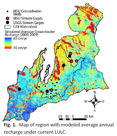
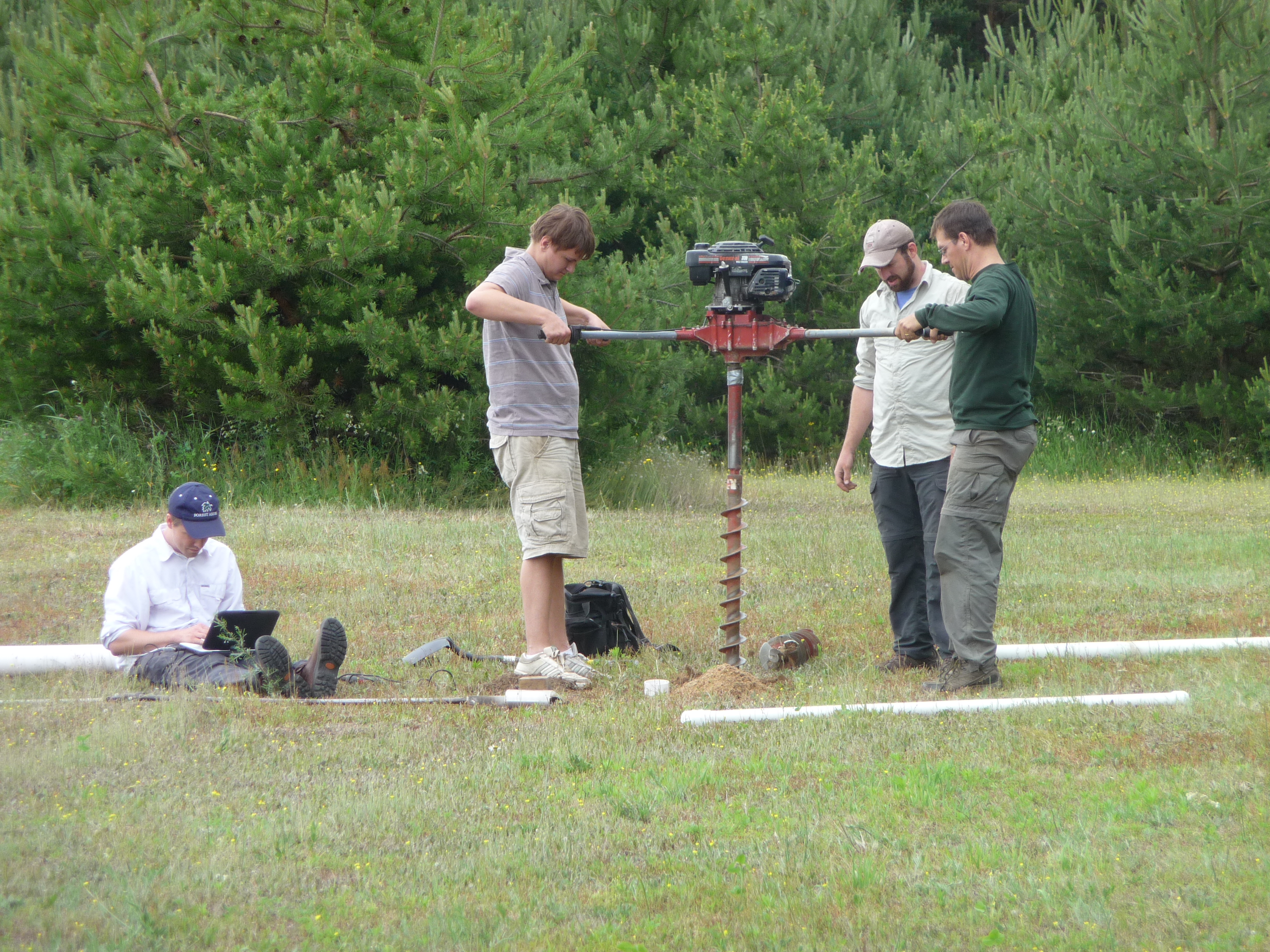

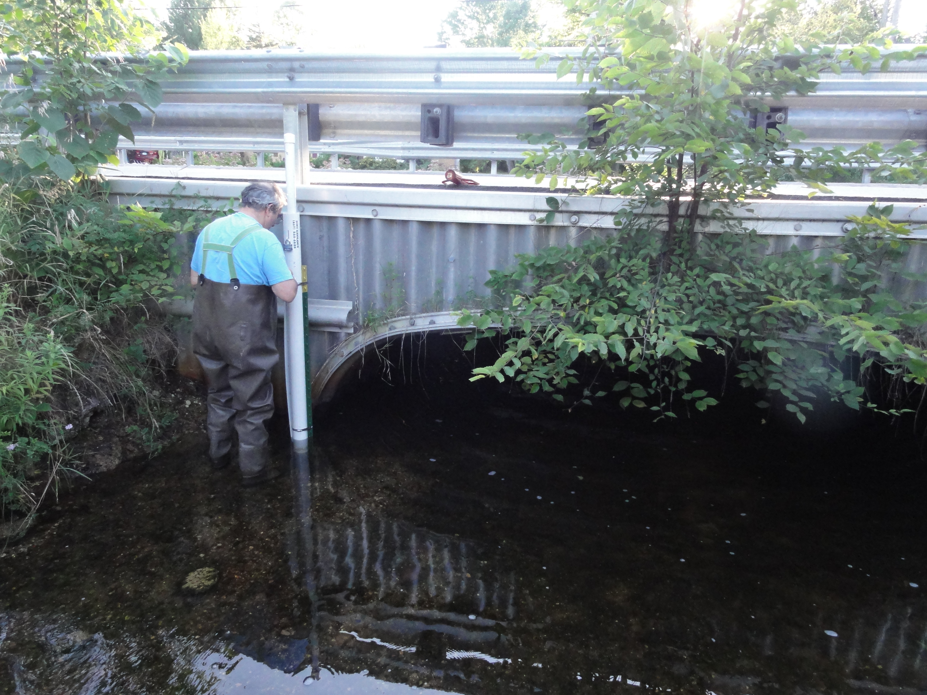

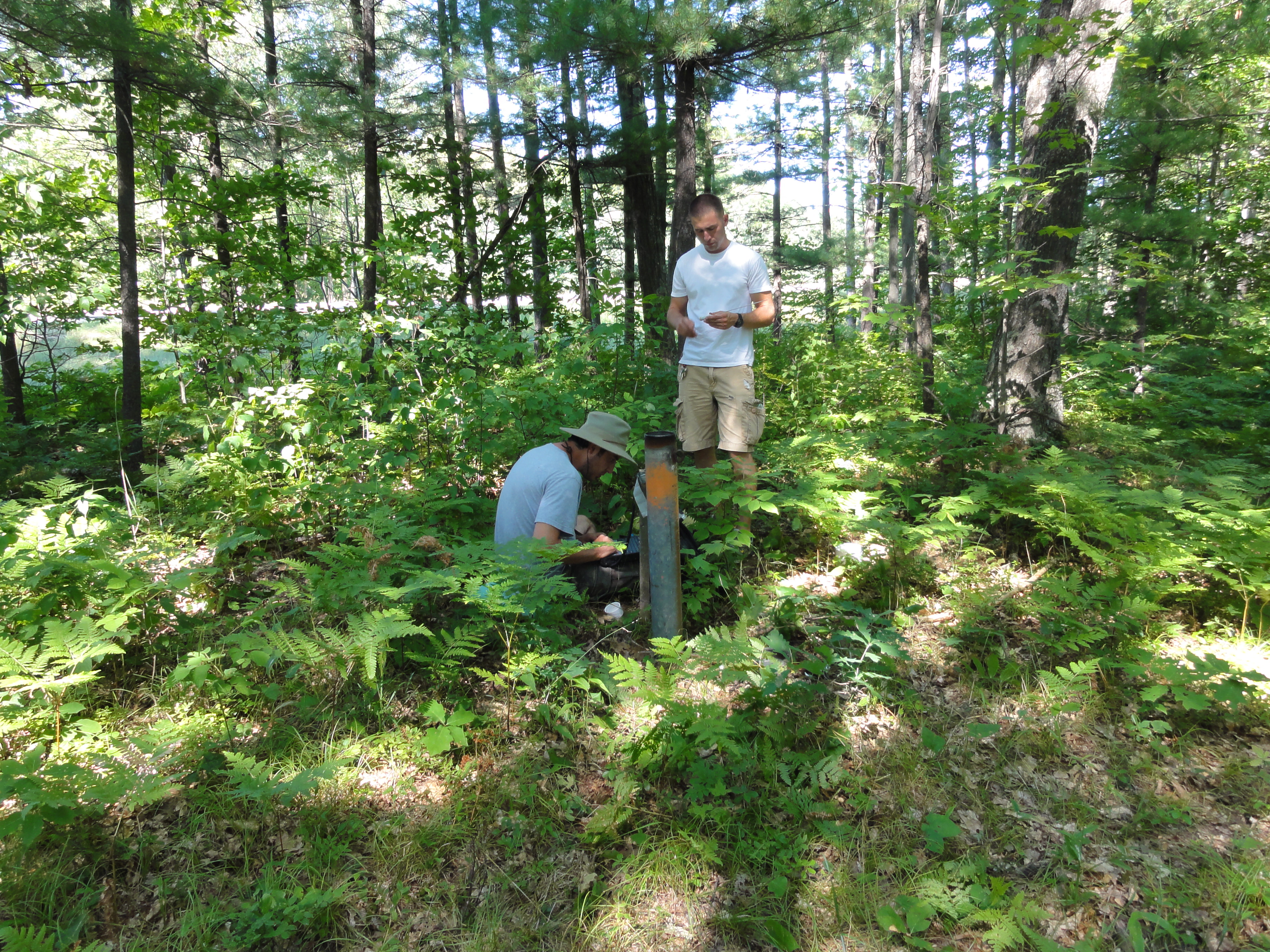
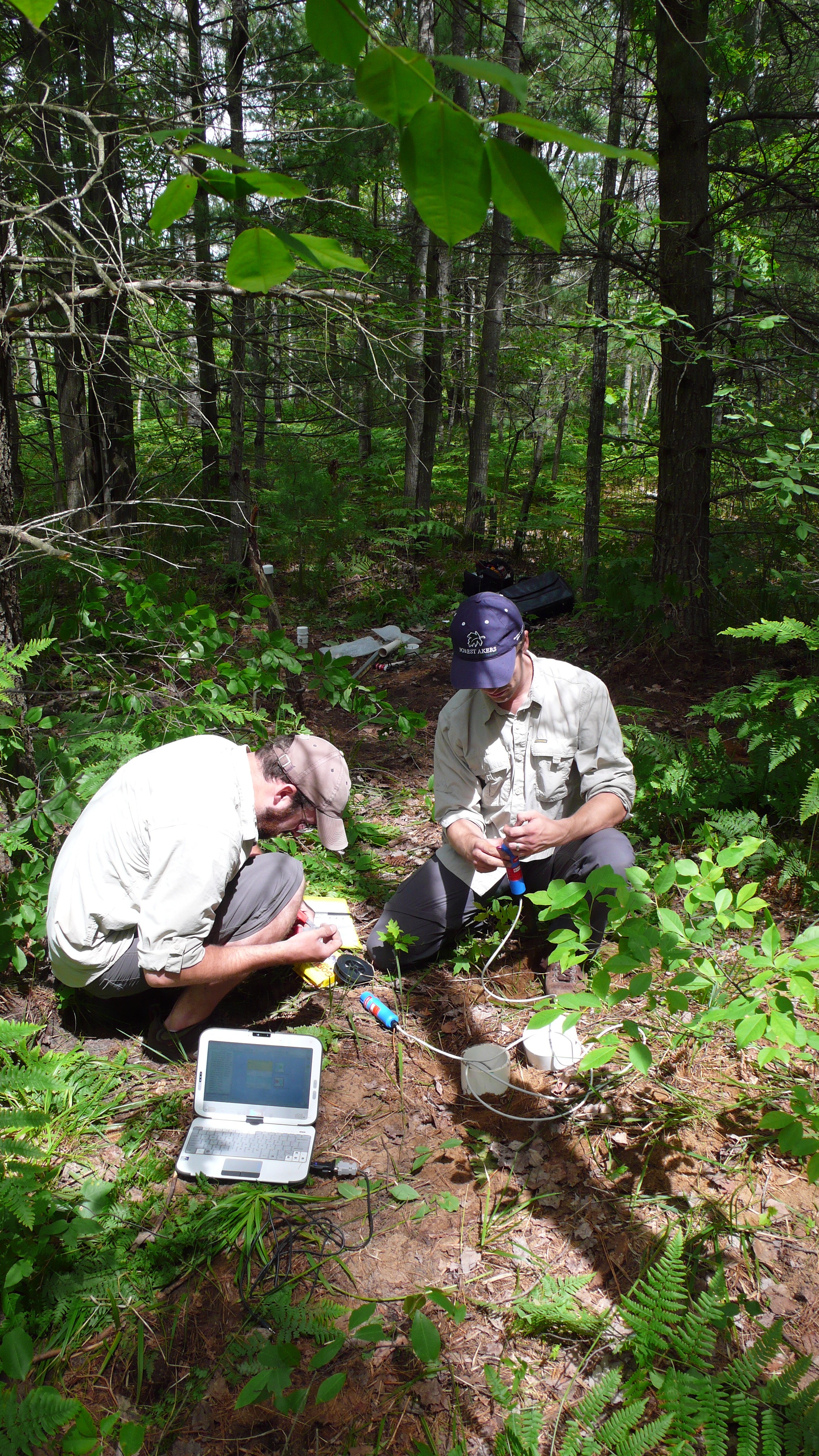
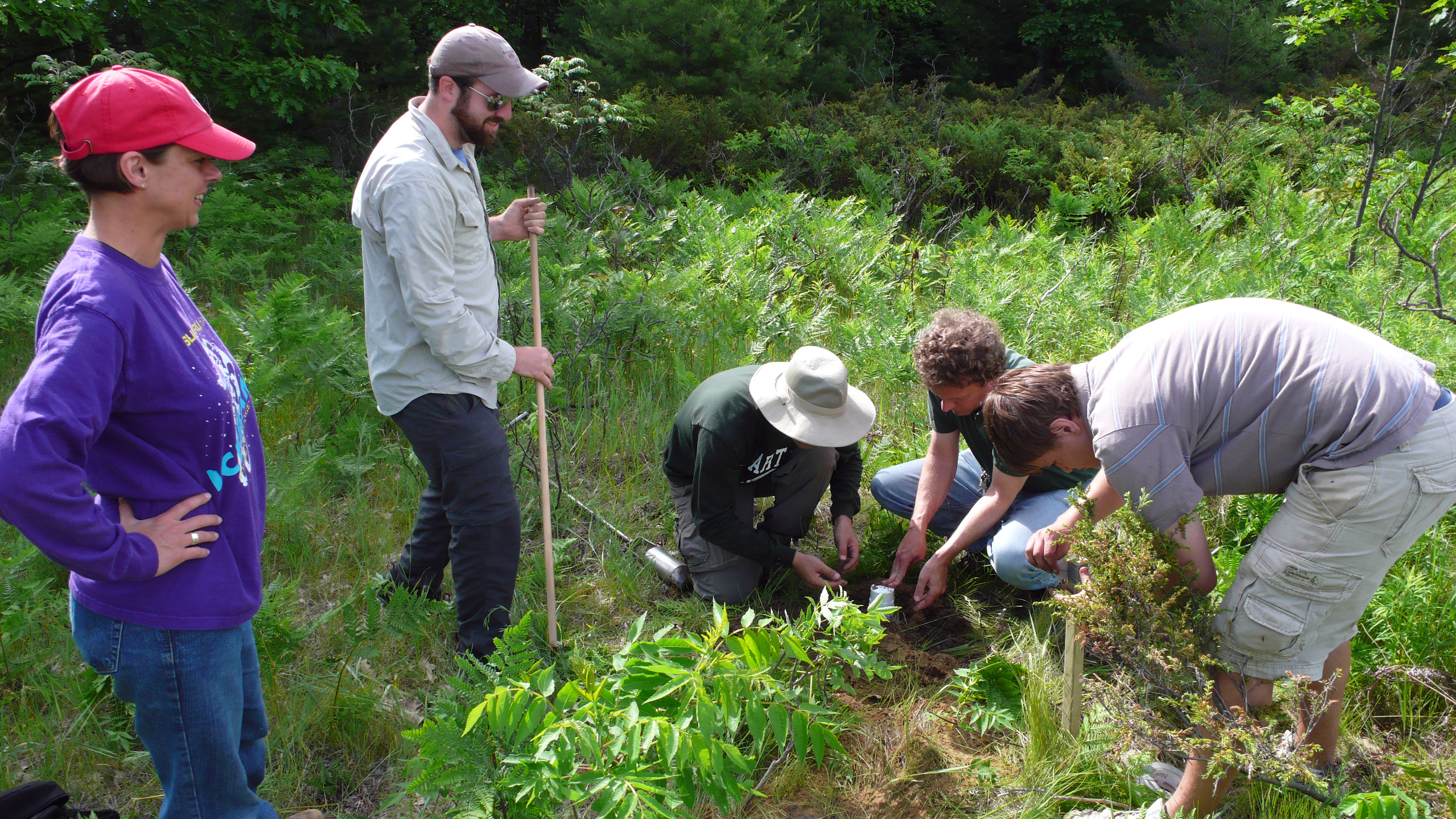
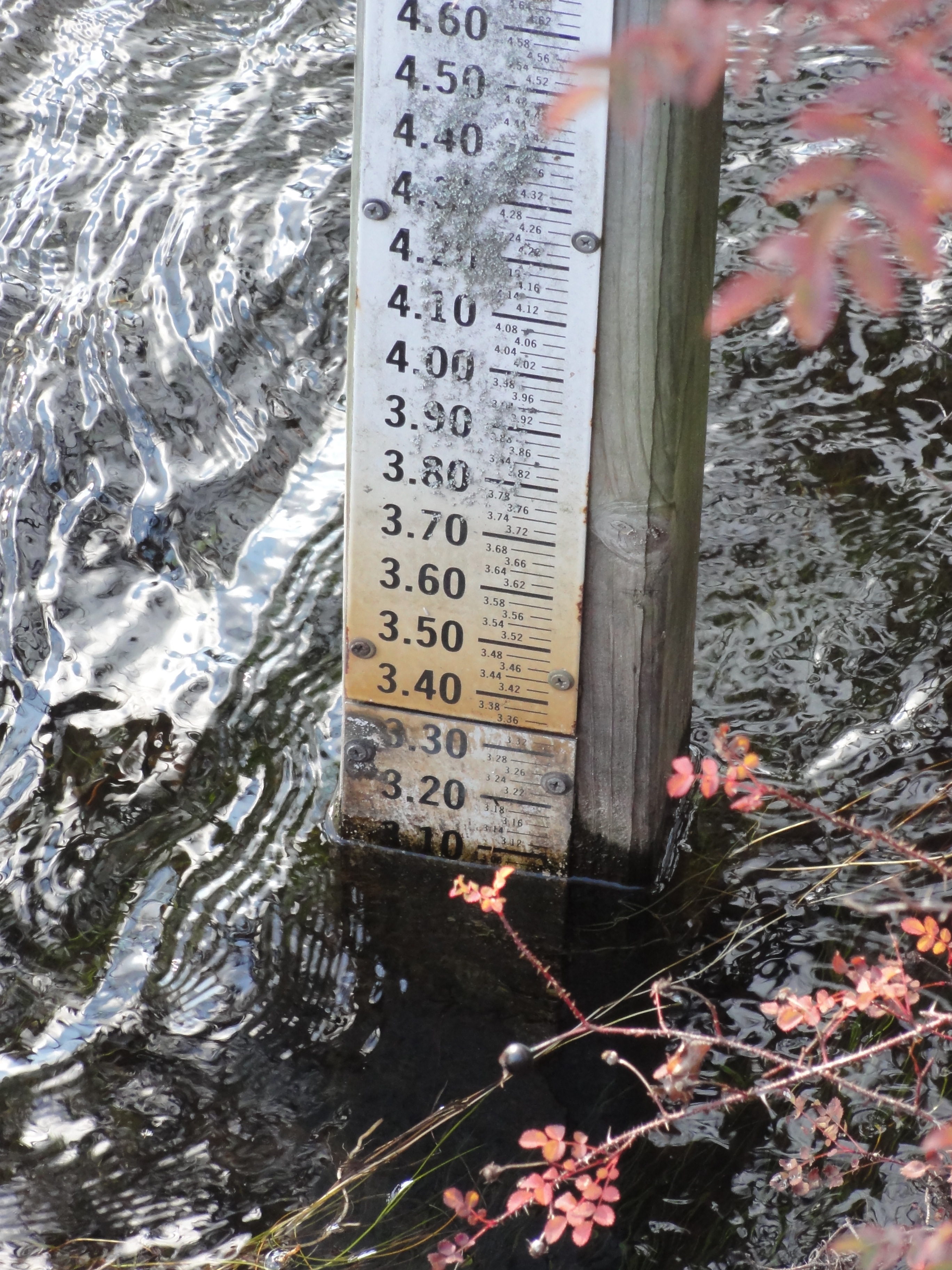
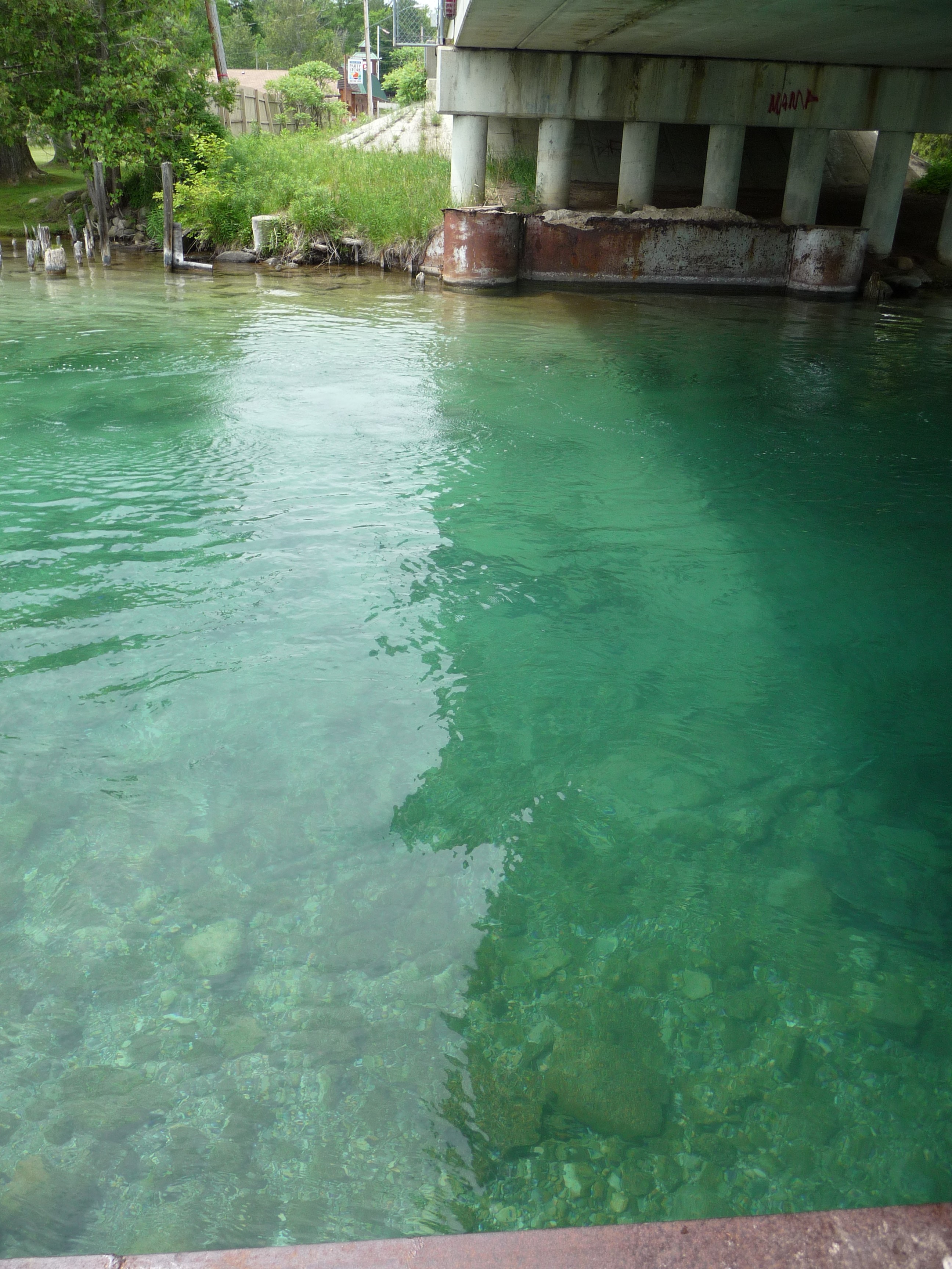
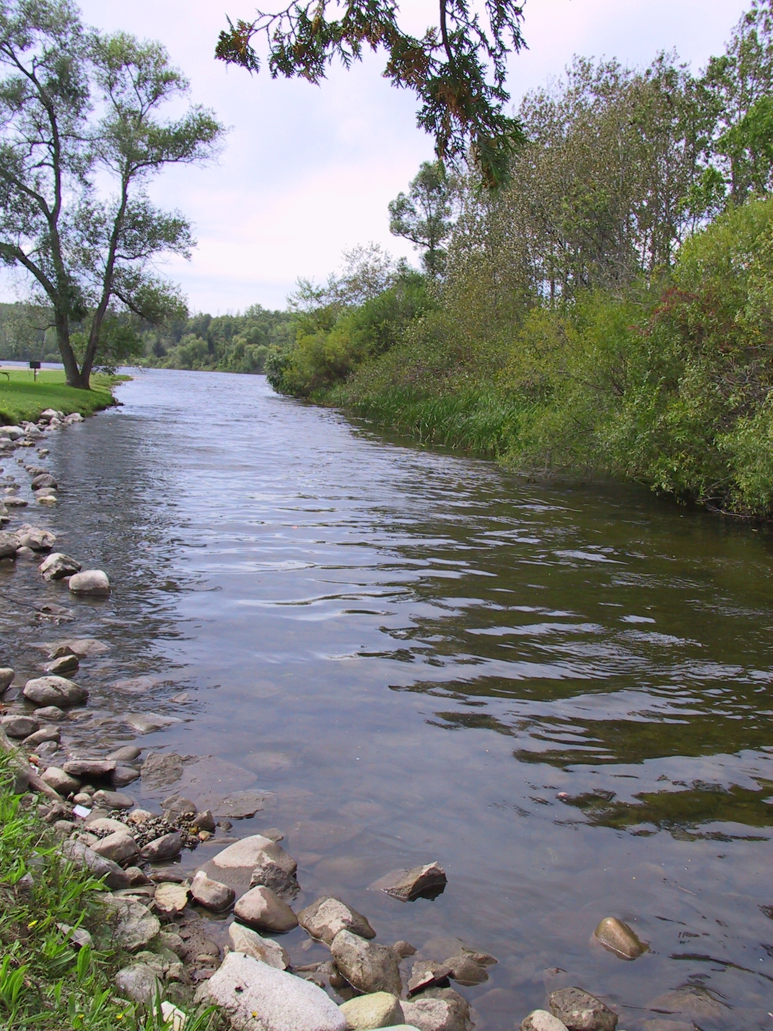
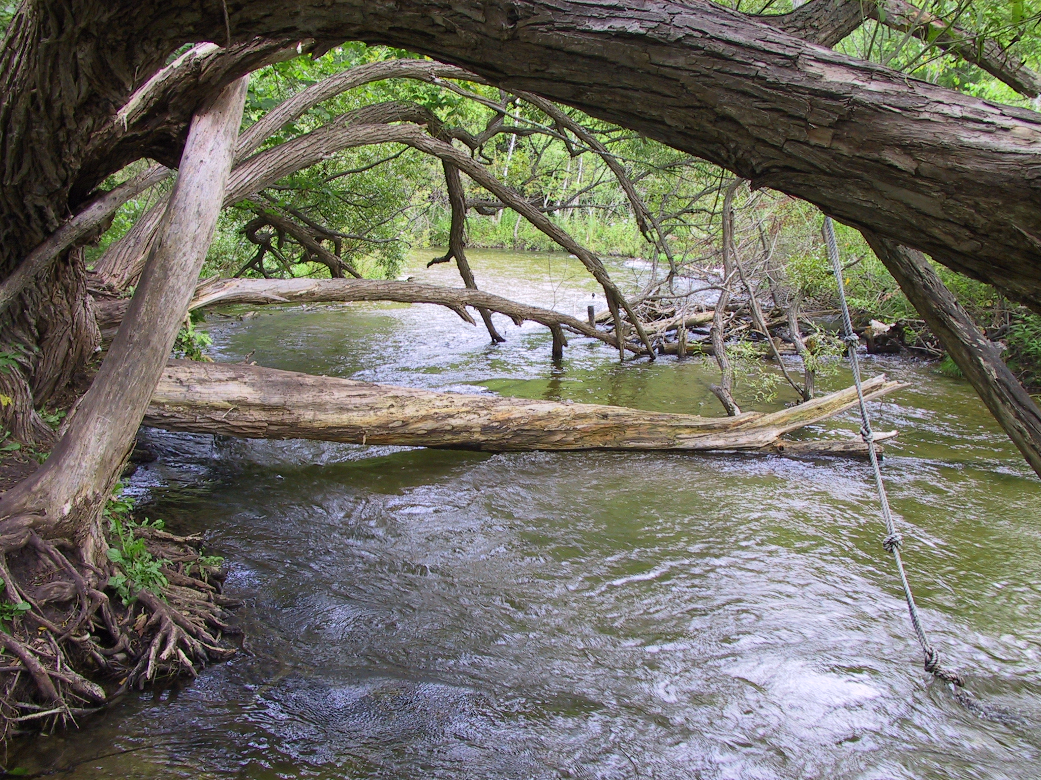
 Research Interests
My primary research interest is the impacts of global change on hydrology and sediment. This encompasses investigating causes of changing streamflow across Michigan, land use impacts due to a ski area in Minnesota, legacy forestry impacts in Northern Michigan, and potential impacts of climate change on hydrology and sediment yield from agricultural watersheds in the southern portion of the Great Lakes Basin.
Education
Certificate, Complex Systems, University of Michigan, Ann Arbor, MI, 2004.
M.S.E., Environmental Engineering, University of Michigan, Ann Arbor, MI, 2003.
B.S., Industrial & Management Engineering, Rensselaer Polytechnic Institute, Troy, NY, 1998.
Publications
Calappi TJ, CJ Miller, DD Carpenter, TA Dahl (2011). Developing a Family of Curves for the HEC-18 Scour Equation. Journal of Hydraulic Engineering (In Review)
Stone AG, MS Riedel, TA Dahl, JP Selegean (2010). Application and Validation of a GIS-Based Stream Bank Stability Tool for the Great Lakes Region. J. Soil and Water Conservation, 65 (4): 92A-98A.
Dahl TA and TR Willemain (2001). The effect of long-memory arrivals on queue performance. Oper. Res. Lett. 29(3): 123-127.
Abstracts
Dahl TA, CT Creech, JP Selegean (2011). Reducing Sediment Loads to USACE Harbors: Case Studies from the Great Lakes. U.S. Army Corps of Engineers Infrastructure Systems Conference, June 13-17, Atlanta, GA.
Calappi TJ, TA Dahl, KW Kompoltowicz (2011). Water Level Forecasting and Regulation in the Upper Great Lakes. U.S. Army Corps of Engineers Infrastructure Systems Conference, June 13-17, Atlanta, GA.
Dahl TA, JW Lewis (2011). The Use of Residual Net Basin Supplies in the Great Lakes. IAGLR 54th Conference on Great Lakes Research, May 30-June 3, Duluth, MN.
Creech CT, JP Selegean, TA Dahl (2011). Reducing Sediment Yields to Lake Superior: Case Studies from the Great Lakes Tributary Modeling Program. IAGLR 54th Conference on Great Lakes Research, May 30-June 3, Duluth, MN.
Dahl TA, JL Ryder, JP Selegean (2010). Non-Stationary Annual Peak Flows in the Lower Peninsula of Michigan; Potential Evidence for Climate Change Observed in the Mid-20th Century. American Geophysical Union Fall Meeting, December 15-19, San Francisco, CA.
AG Stone, MS Riedel, TA Dahl, JP Selegean (2010). Boardman River Existing-Conditions SIAM Model for Dam Removal Study. 2nd Joint Federal Interagency Conference, June 27-July 1, Las Vegas, NV.
Riedel MS, TA Dahl, JP Selegean (2010). Sediment Budget Development for the Great Lakes Region. 2nd Joint Federal Interagency Conference, June 27-July 1, Las Vegas, NV.
Creech CT, JP Selegean, TA Dahl (2010). Historic and Modern Sediment Yield from a Forested Watershed and its Impact on Navigation. 2nd Joint Federal Interagency Conference, June 27-July 1, Las Vegas, NV.
JP Selegean, RB Nairn, TA Dahl, CT Creech (2010). Building a better understanding of sediment issues through the application of a long-term fluvial and littoral sediment budget. 2nd Joint Federal Interagency Conference, June 27-July 1, Las Vegas, NV.
Creech CT, JP Selegean, RE McKeever, TA Dahl (2010). The Ontonagon River: A History of Sediment Yields in a Geologically Young Watershed. IAGLR 53rd Conference on Great Lakes Research, May 17-21, Toronto, ON.
Dahl TA, MA Kropfreiter, SJ Tule (2009). 150 Year Old Infrastructure vs. HEC-RAS: Modeling the Lower Fox River, WI. U.S. Army Corps of Engineers Infrastructure SystemsConference, July 20-24, Cleveland, OH.
Dahl TA, JP Selegean, MS Riedel (2009). A GIS-Based Channel Stability Tool for the Great Lakes Region. U.S. Army Corps of Engineers Infrastructure Systems Conference, July 20-24, Cleveland, OH.
Dahl TA, MH Mahoney, JP Selegean (2008). An Observed Regime Shift in SE Michigan Bankfull (Q1.5) Streamflow Records. American Geophysical Union Fall Meeting, December 15-19, San Francisco, CA.
Dahl TA and JP Selegean (2008). The Right Tool for the Job: Creating a Full Suite of Models to Help the Clinton River Decrease Sediment Loading. IAGLR 51st Conference on Great Lakes Research, May 19-23, Peterborough, ON.
McPherson MM and TA Dahl (2008). Modeling the Routing of Water Through the Upper Lakes Using HEC-RAS. IAGLR 51st Conference on Great Lakes Research, May 19-23, Peterborough, ON.
Dahl TA and JP Selegean (2007). Tools to Study Sediment Transport in the St. Joseph River Watershed. State of Lake Michigan Conference, 27-28 September, Traverse City, MI.
Dahl TA and JP Selegean (2007). Modeling Sediment Yield and Flow in a Rapidly Urbanizing Watershed. U.S. Army Corps of Engineers Infrastructure Systems Conference, June 25-29, Detroit, MI.
Selegean JP, TA Dahl, RB Nairn (2007). The Quantification of Sediment Production, Transport and Deposition with Numerical Models. IAGLR 50th Conference on Great Lakes Research, May 28-June 1, State College, PA.
Riedel MS, D Vujisic, JP Selegean, AG Stone, TA Dahl (2007). A GIS Based Streambank Stability Tool for the Great Lakes Region. IAGLR 50th Conference on Great Lakes Research, May 28-June 1, State College, PA.
Stone AG, MS Riedel, TA Dahl, JP Selegean, D Vujisic (2007). Application and Validation of a GIS Based Streambank Stability Tool for the Great Lakes Region. IAGLR 50th Conference on Great Lakes Research, May 28-June 1, State College, PA.
Dahl TA, M Jonas, P O’Brien, JP Selegean (2006). Two-Stage Agricultural Ditch – Hydraulic and Sediment Impacts (Sebewaing River Basin, Michigan). American Geophysical Union Fall Meeting, December 11-15, San Francisco, CA.
Selegean JP and TA Dahl (2006). Modeling Great Lakes Sediments from Source to Sink. NSF MARGINS Conference on Teleconnections Between Source and Sink in Sediment Dispersal Systems. September 17-21, Eureka, CA.
]]>
 Research Interests
Interactions between land use change and groundwater availability; sustainability of water resources in the face of change
My work focuses on the ways in which changes on the land surface – particularly changes in management practices – affect aquifers. Myriad feedbacks exist between groundwater availability and the human decisionmaking process. Through my work on the High Plains Aquifer, I am learning to approach complex “coupled human and natural systems” from an interdisciplinary modeling perspective.
Education
- 2011-Present: Ph.D. student in Environmental Geosciences and Environmental Science and Policy at Michigan State University.
- 2005-2010: BS in International Field Geosciences jointly awarded from the University of Montana and University College Cork.
- 2005-2010: BA in Zoology at the University of Montana.
Presentations
2012 American Geophysical Union Conference: “A New Assessment of Groundwater Levels of the High Plains Aquifer: From Predevelopment to Current” (poster)
Complete CV
]]>

The Landscape Hydrology Model (LHM) is a new landscape hydrology simulation suite capable of very large domain, fine resolution modeling. It simulates nearly the entire terrestrial hydrologic cycle with full energy- and water-balance physically-based component modules. LHM incorporates a host of novel components, but integrates fully with the USGS MODFLOW software, and allows existing MODFLOW simulations to run with little modification.
Structure
LHM is written primarily in MATLAB, with a number of ArcGIS interface modules written in Python. It is coupled with MODFLOW using a pass-to-disk coupling, which requires a slight modification of the MODFLOW source code. Currently, the plan is to migrate fully to Python within the next year, as Python provides a much more robust development environment, and greater possibilities for GUI front end development.
Release
LHM is currently nearing public release. If you are interested in previewing the software, or collaborating on its development, contact Anthony Kendall. The software and all associated model development tools will be released under an open source license. It is the intention of the developers that LHM be adopted by the broader community as a tool for landscape hydrologic simulations at a variety of spatial scales.
Developers
LHM was developed at Michigan State University primarily by Anthony Kendall and Dr. David Hyndman. The work of students including Dushmantha Jayawickreme, Nicklaus Welty, and Cheryl Kendall was critical to the development of earlier versions of the software.
Related Publications:
- Wiley, MJ, DW Hyndman, BC Pijanowski, AD Kendall, C Riseng, ES Rutherford, ST Cheng, ML Carlson, JA Tyler, RJ Stevenson, PJ Steen, PW Seelbach, JM Koches, and RR Rediske, (2010), A multi-modeling approach to evaluating climate and land use change impacts in a Great Lakes River Basin, Hydrobiologia, doi: 10.1007/s10750-010-0239-2
- Hyndman, DW, AD Kendall, and NRH Welty, (2007), Evaluating Temporal and Spatial Variations in Recharge and Streamflow Using the Landscape Hydrology Model (LHM), Subsurface Hydrology: Data Integration for Properties and Processes, AGU Geophysical Monograph Series 171: 121-141
Related Conference Abstracts:
- Kendall, A, JA Bernstein, and DW Hyndman, (2007), Improving Regional Groundwater Recharge Models With A Network Of High-Resolution Temperature Recording Buttons, Geological Society of America, Abstracts with Programs
- Kendall, AD, and DW Hyndman, (2007), Simulating Fluxes Through Large Watersheds Using Remotely Sensed and Ground Based Datasets With the Landscape Hydrology Model LHM, Geological Society of America, Abstracts with Programs

The MSU Hydrogeology Lab has been conducting research in the Jordan River Watershed since 2006. The objective has been to understand the causes and possible solutions to sand accumulation on what had been considered previously to be a primarily gravel-bed stream. The sand is believed to be negatively impacting the fishery of the Jordan River, possibly reducing populations of brown and brook trout in one of Lower Michigan’s premier cold water streams. The work has been funded by the Friends of the Jordan River.
During the course of our research, the Lab has installed a network of stream gauging stations to continuously monitor stream flow and temperature, conducted extensive channel surveys for sediment and flow modeling, surveyed the stream channel with a variety of sophisticated instruments including an Acoustic Doppler Current Profiler (ADCP), survey-grade Global Positioning System (GPS), and both floating and land-based Ground Penetrating Radar (GPR).
Research Products
Presentations to FoJ and Regional Stakeholders
Martin et al. 2010
Jasinski et al. 2012
Photo Albums
Below are a selection from several thousand photographs of the Jordan River and its watershed taken by MSU researchers and students during the course of this project. Stream bank and sediment photos were taken during three float trips down the Jordan River during October 2009, November 2010, and July 2011. Photos of beaver activity are from 2010 and 2011. Others are indicated in their albums below.
The maps below show photos at their proper locations using GPS coordinates. For best viewing, click the magnifying glass and view full-screen. Also, there are in some cases many photos at the same location, to view all of them, click the “Earth” button. This may require that you install the Google Earth plug-in (a link will be provided).
Stream Bank Photos
[xmlgm ngg_gallery=4]
Stream Sediment Photos
[xmlgm ngg_gallery=2]
]]>
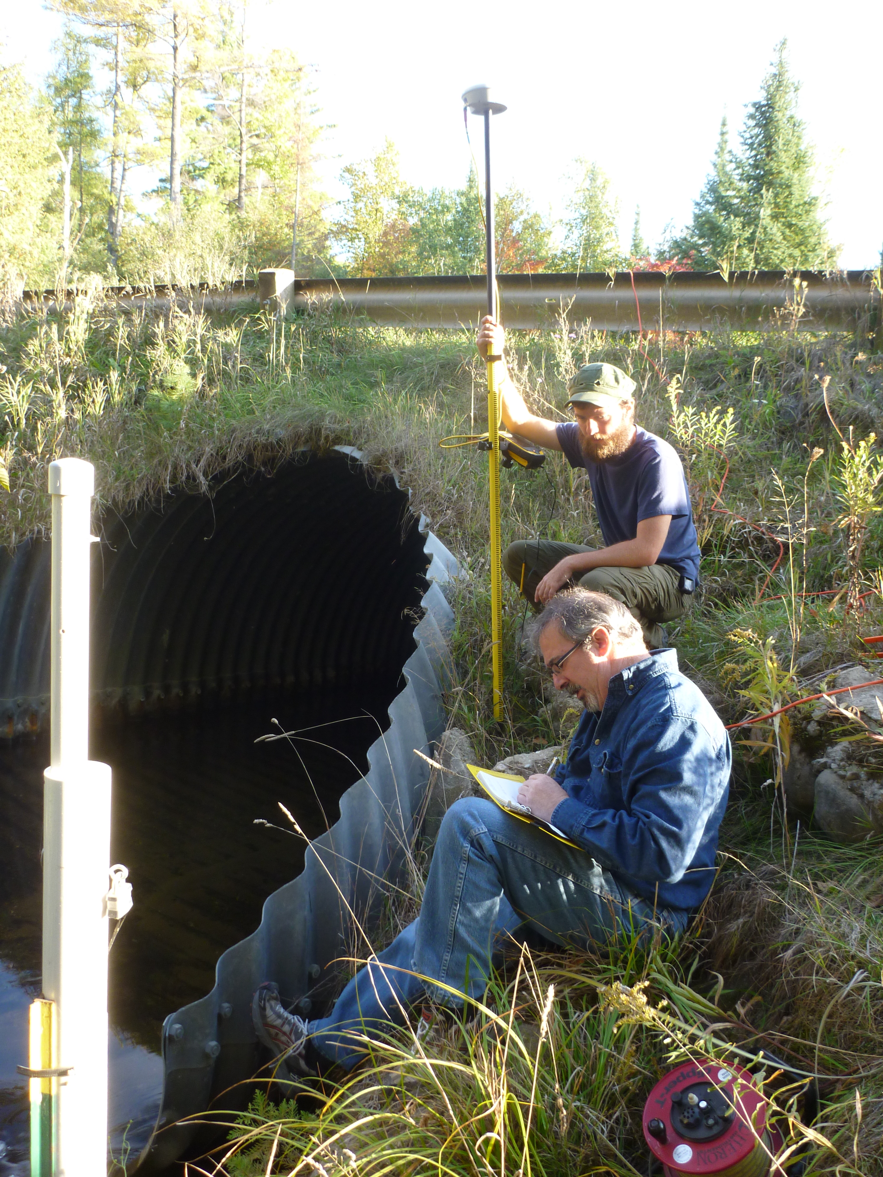
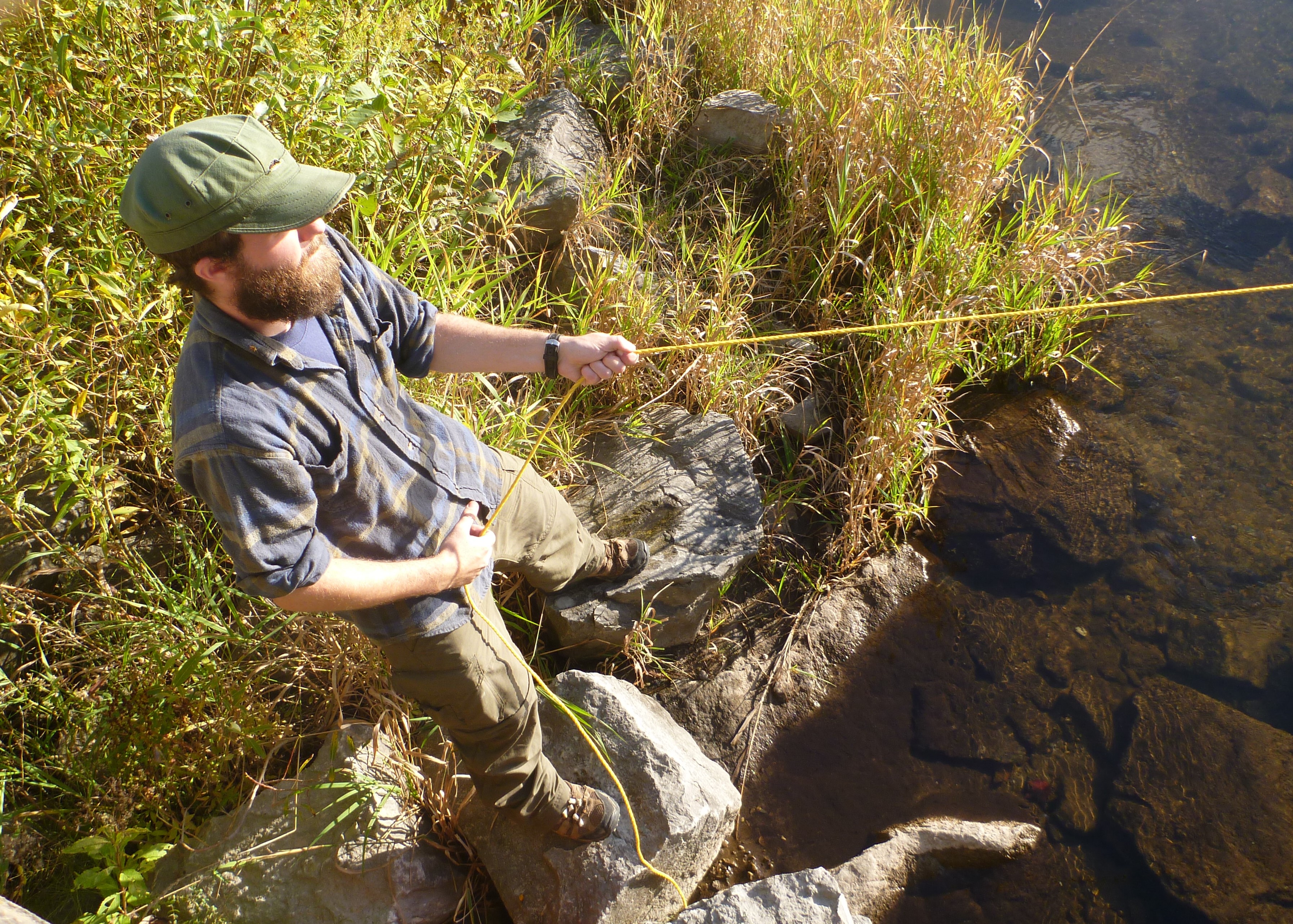
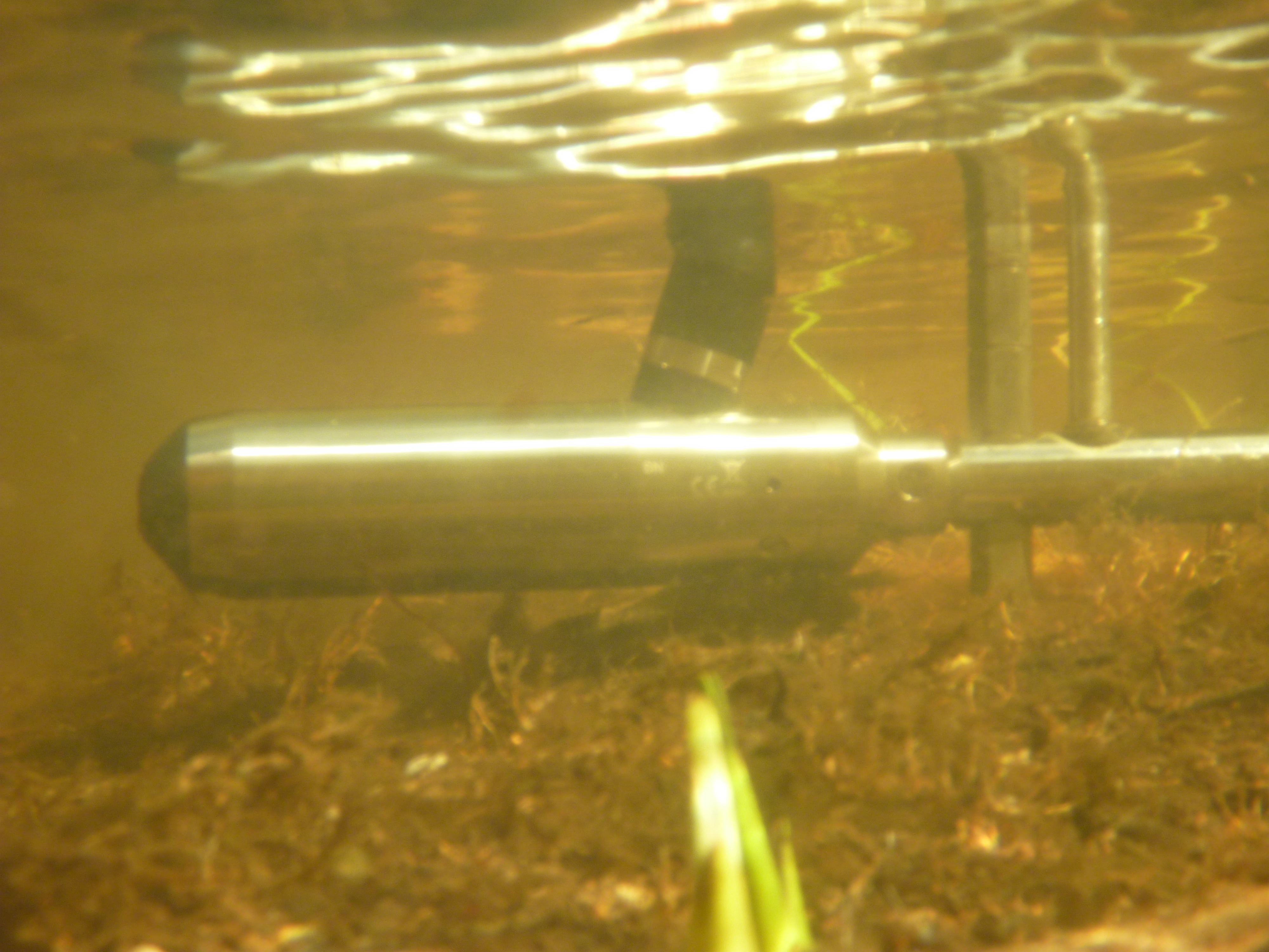
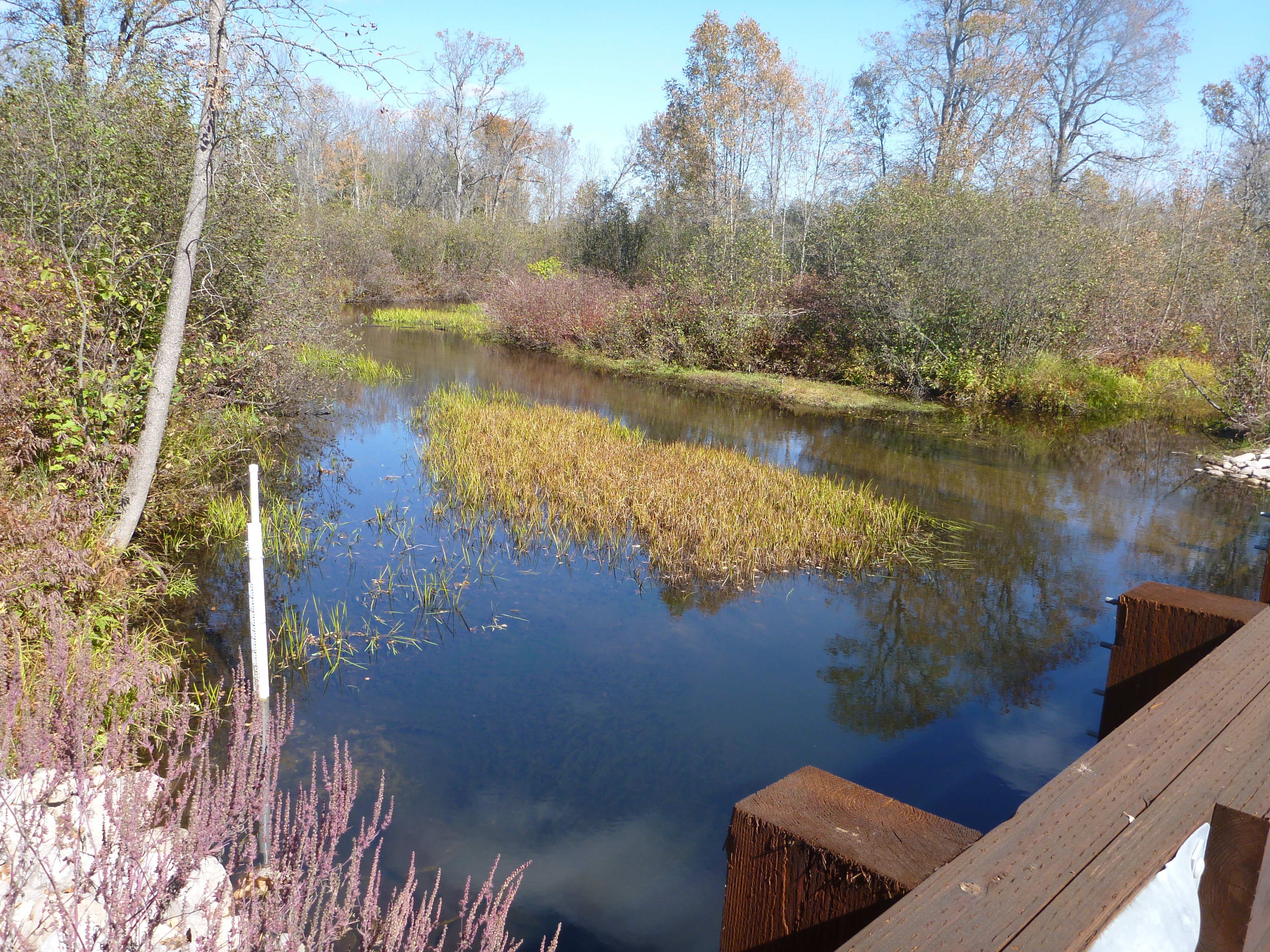
 ]]>
]]>
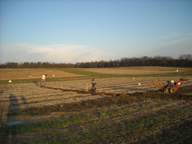
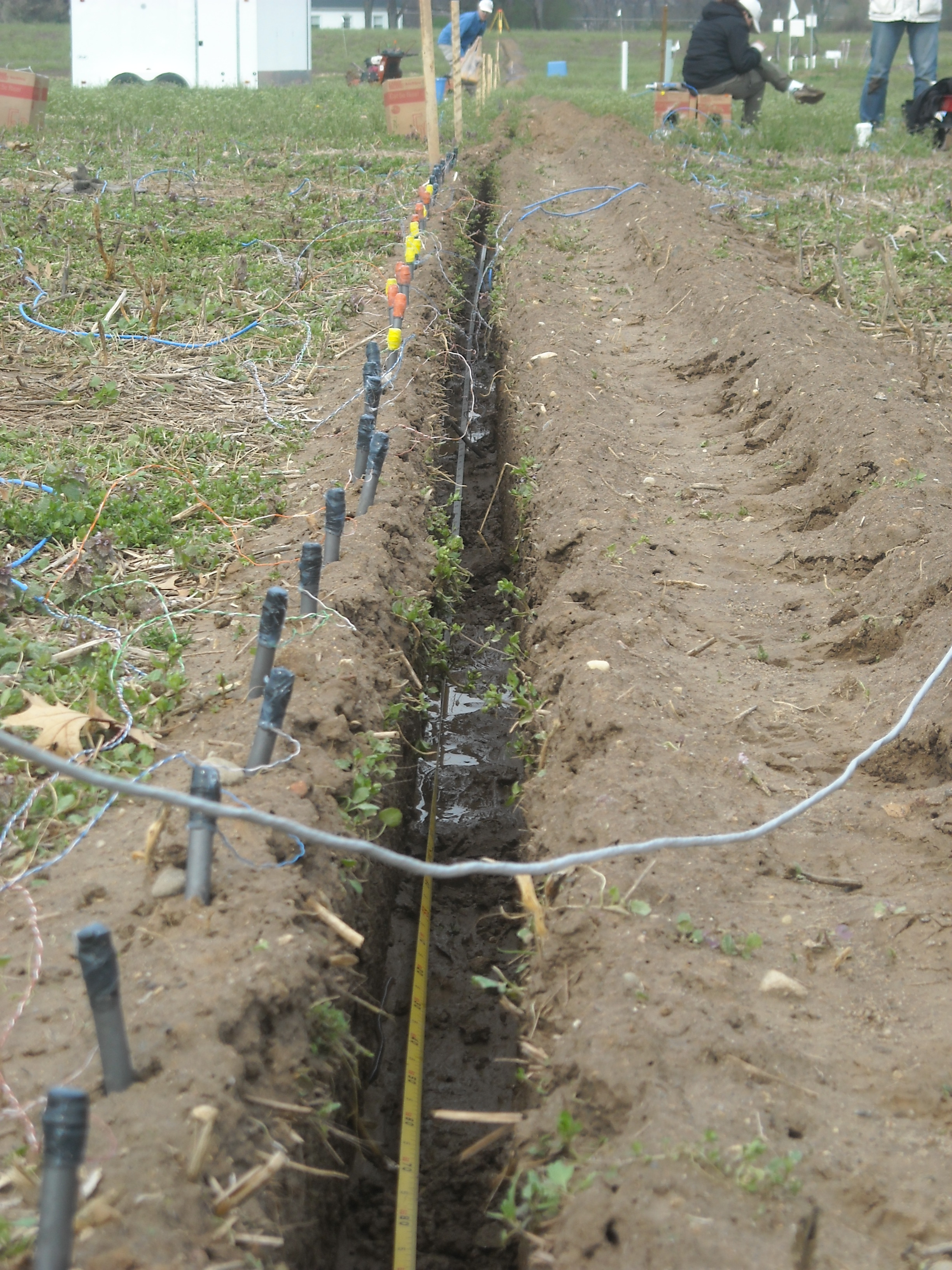
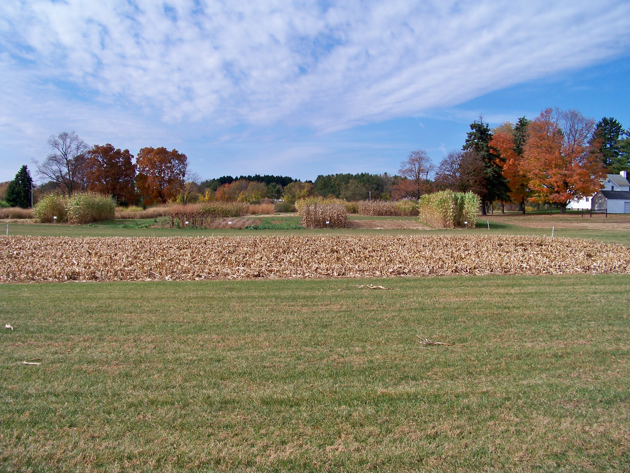
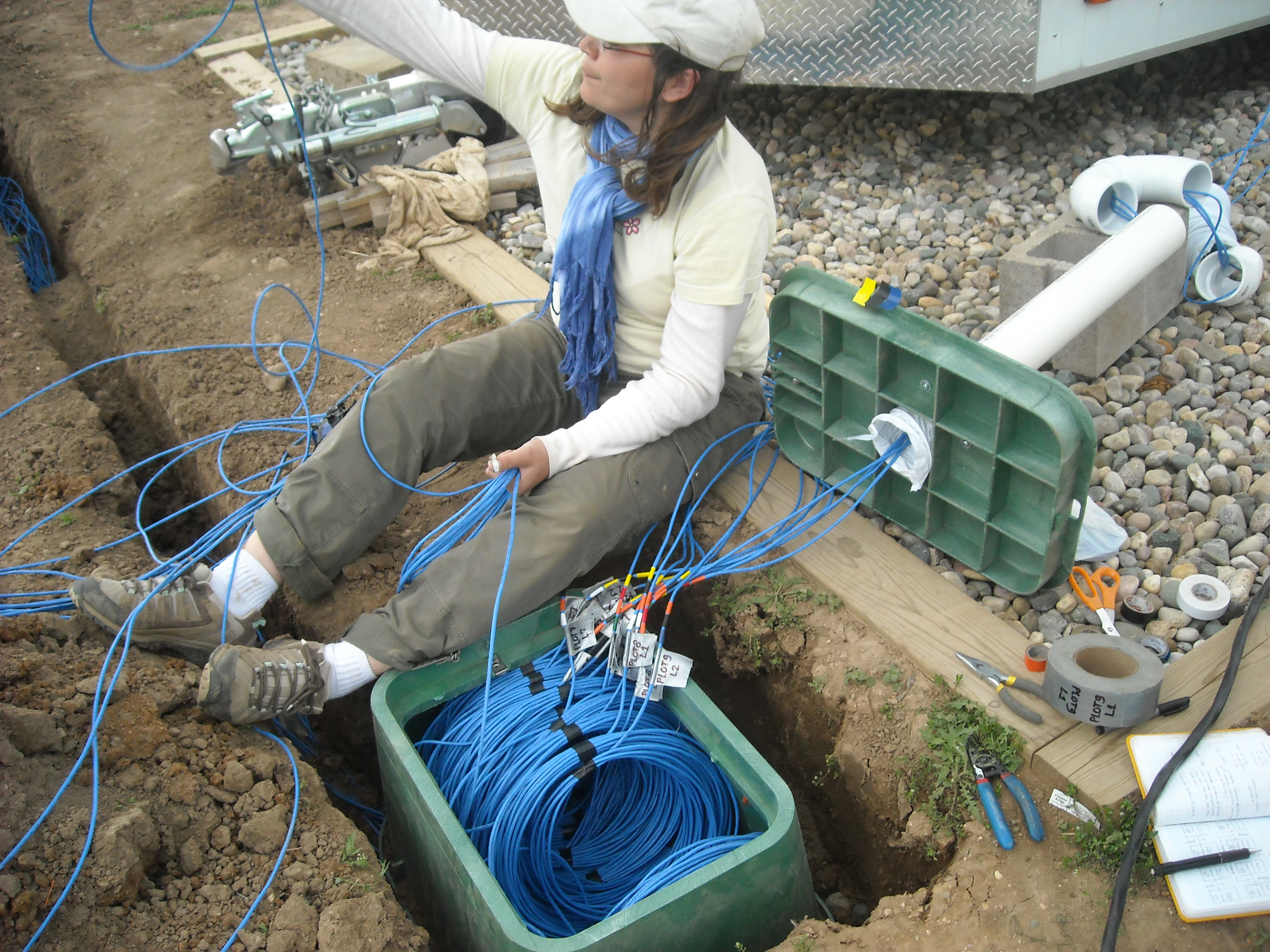
Projects:
]]>
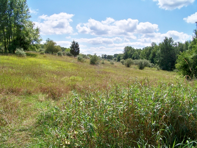
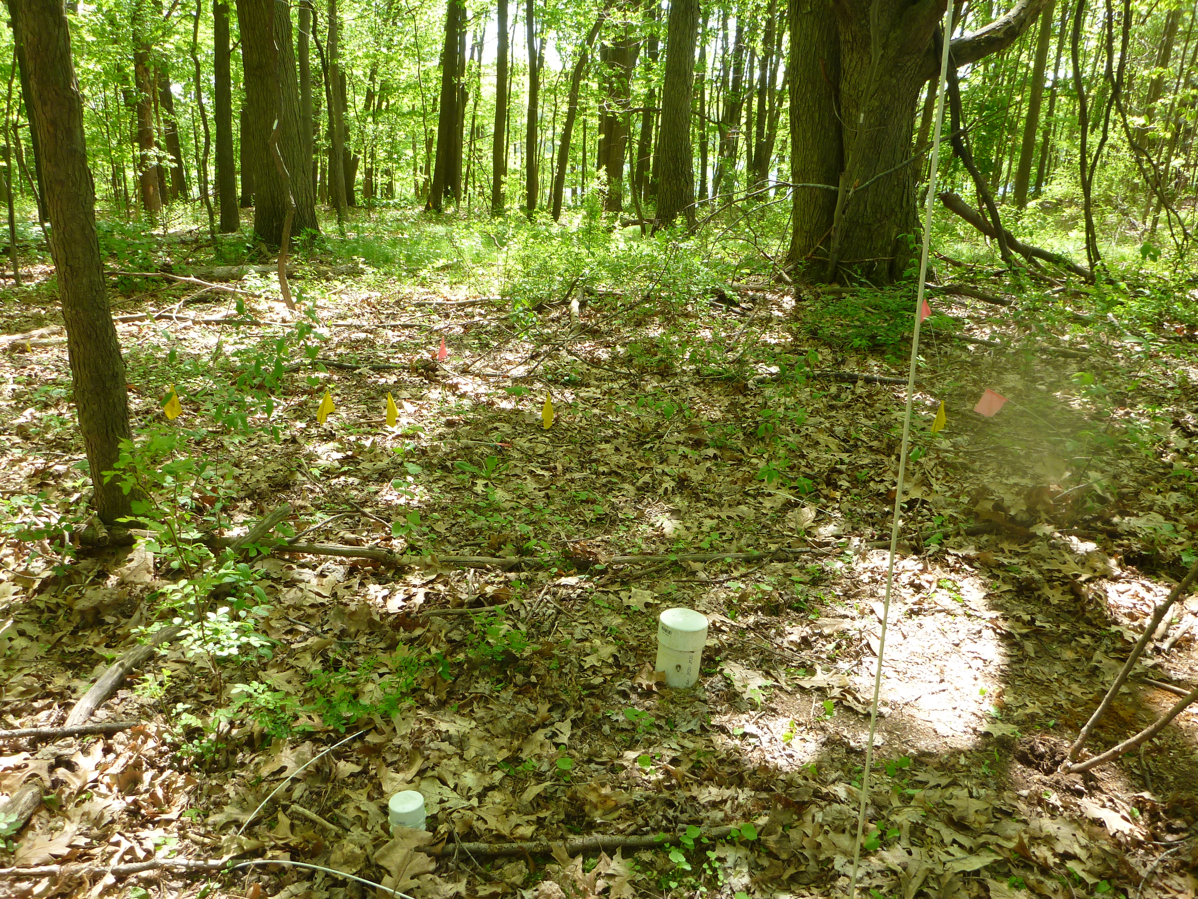
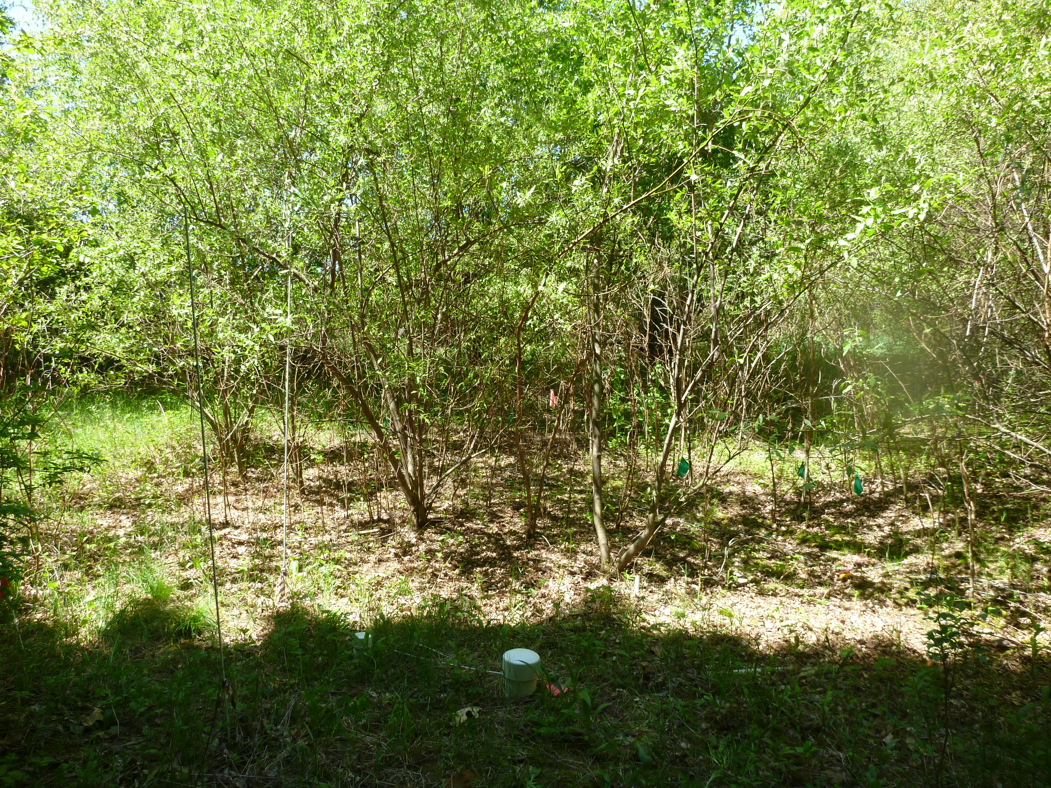
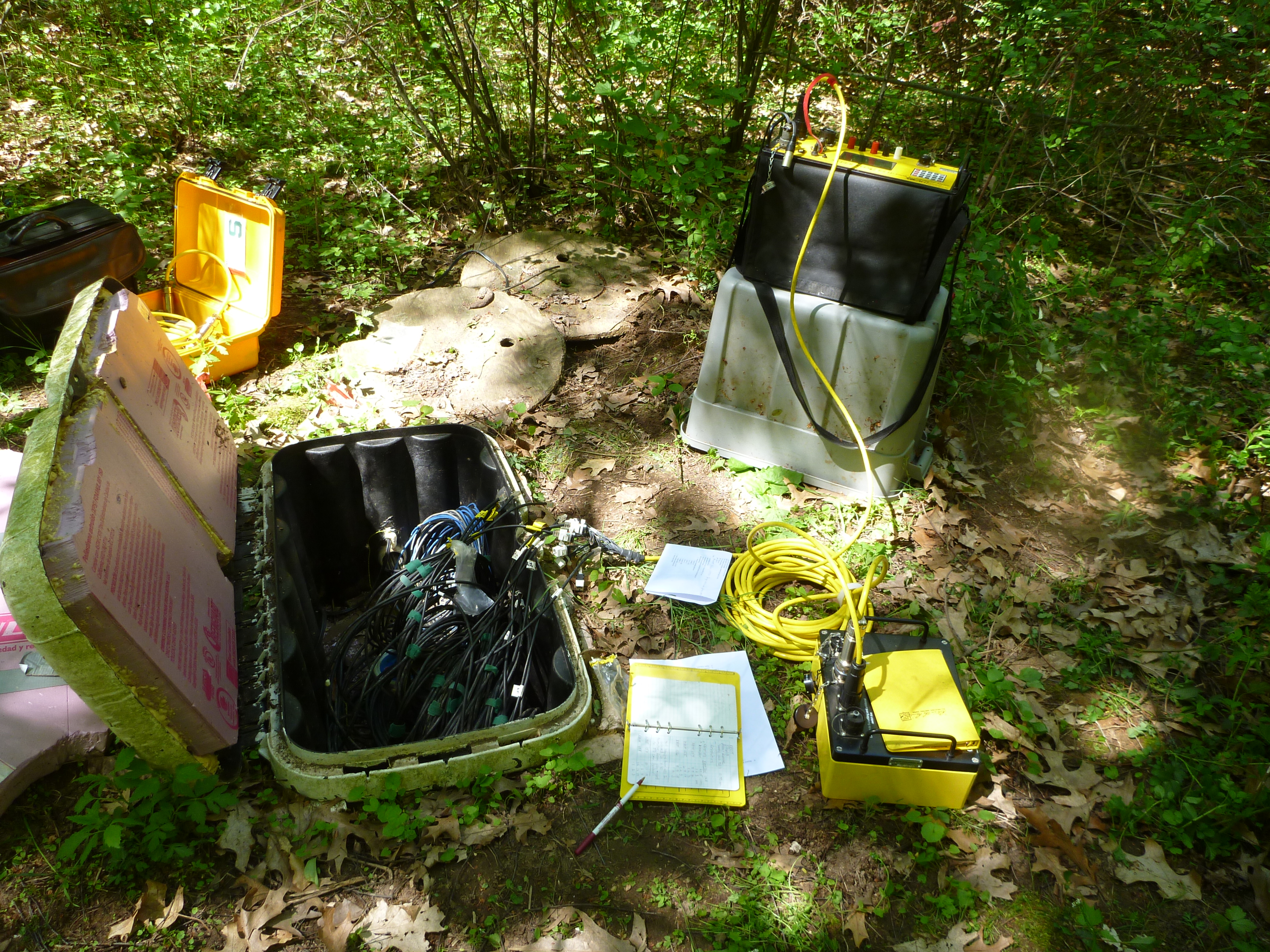
We would like to to thank the National Science Foundation for funding this research.
Projects:
]]>
Research Interests
My research areas are electrical and electromagnetic methods of geophysics and their applications on hydrogeophysics, archaeogeophysics, environmental geophysics. My Ph.D. thesis research focuses on characterization of a highly heterogeneous aquifer using novel characterization methods such as full-resolution 3D GPR and DPP hydraulic conductivity tool. My other research interests are data processing, numerical solutions, modeling, and simulation since I personally like advanced math and coding in Matlab. For more information see my personal website.
Education
- Ph.D. candidate, 2007-2008, Istanbul Technical University, Geophysical Engineering
- M.S., 2007, Istanbul Technical University, Geophysical Engineering
- B.S., 2003, Istanbul Technical University, Geophysical Engineering
Recent Abstracts
- Dogan, M., Mark M. Meerschaert, David W. Hyndman, Remke L. Van Dam, Geoffrey C. Bohling, Gaisheng Liu, James J. Butler Jr., 2011, Fractal Stochastic K Field Generation Based on Direct-Push and GPR Data, NovCare, Cape Cod, MA, U.S.A.
- Hyndman, D. W., Dogan, M., Bohling, G. C., van Dam, R. L., Liu, G., Butler, J. J. Jr., 2010, Integration of high-resolution GPR and direct-push methods: Subsurface imaging of the highly heterogeneous MADE site (invited), AGU Fall Meeting, Abstract H24E-01, San Francisco, U.S.A.
- Dogan, M., van Dam, R. L., Hyndman, D. W., Butler, J. J. Jr., and Bohling, G. C., 2010, Full-resolution 3D GPR and direct-push K data reveal distinct hydrostratigraphic zones at the MADE site, AGU Fall Meeting, San Francisco, U.S.A.
- Dogan, M., Hyndman, D.W., van Dam, R. L., and Butler, J. J. Jr., 2009, Hydrostratigraphic analysis of the MADE site using full-resolution 3D GPR and direct-push K data, AGU Fall Meeting, San Francisco, U.S.A.
- Dogan, M., Hyndman, D. W., and van Dam, R. L., 2009, Geophysical methods to characterize a highly heterogeneous aquifer, NovCare, Leipzig, Germany.
Publications
- Doğan, M., R. L. Van Dam, G. C. Bohling, J. J. Butler Jr., and D. W. Hyndman, 2011, Hydrostratigraphic analysis of the MADE site with full-resolution GPR and direct-push hydraulic profiling, Geophys. Res. Lett., 38, L06405, doi:10.1029/2010GL046439.
- Doğan, M., 2007, Very Low Frequency Electromagnetic Method (VLF-EM) Interactive Data Processing and Interpretation Package: VLFINTERP, M.Sc. Thesis, Istanbul Technical University, Institute of Science and Technology, 87 p.
- Doğan, M., Özürlan, G., 2006. Availability of VLF-Electromagnetic Method for the Exploration of Geothermal Fields; Demirci Case, The 1st International Geothermal Congress (UCEAT) and Exhibition of Turkey, Oral presentation, Abstract book: pp 53-54, 21-24 November 2007, MTA Cultural Center, Ankara, Turkey.
- Doğan, M., Özürlan, G., 2006. Very Low Frequency Electromagnetic Method (VLF-EM) Interactive Data Processing and Interpretation Package: VLFINTERP, The 17th International Geophysical Congress and Exhibition of Turkey, Poster presentation, Abstract book: pp 49, 14-17 November 2006, MTA Kültür Sitesi, Ankara, Turkey.
- Doğan, M., 2006. Geophysical Methods for the Exploration of Mines, Poster presentation, Mining Turkey 2006 Fair, Istanbul, Turkey.
 Research Interests
My interests include geophysics and hydrogeology with an application to engineering and environmental issues. Current work includes the development of a field data database and an analysis of soil moisture and temperature variability in the shallow subsurface. I will pursue an advanced degree in either hydrogeology or hydrogeophysics in Fall 2011.
Education
B.S. Geological Sciences, Concentration in Geophysics, Michigan State University, May 2011.
SAGE – Summer of Applied Geophysical Experience 2010, Los Alamos, NM.
Study Abroad – Ecology of the Mountains 2010, Lesser Himalayas, India.
Contact Info
bbchrisman@gmail.com
chrisma8@msu.edu
 Research Interests
I take an interdisciplinary approach in researching issues related to water quality and quantity. More specifically, I use the principles of landscape ecology together with biogeochemistry and systems modeling to investigate ecosystem services in a changing landscape. My current research evaluates temporal shifts in coupled human and natural systems. To this end, I am using both multivariate statistical techniques and mechanistic models to investigate the role of historical land use/cover in driving physical, chemical, and biological characteristic currently observed in lake, stream, and wetland ecosystems.
Overall, my goal is to conduct research for the purpose of guiding ecosystem management, with ecosystem type unconstrained by salinity or water residence time. One line of research which I plan on pursuing is the concept of land use/cover legacies.
Education
- Ph.D. Fisheries and Wildlife and Ecology, Evolutionary Biology, and Behavior, Michigan State University, East Lansing, MI. 2010. Dissertation Title: Understanding variation in lake water chemistry over space and time. Advisor: Daniel Hayes
- M.S. Fisheries and Wildlife, Michigan State University, East Lansing, MI. 2004. Thesis Title: Defining lake landscape position: relationships to hydrologic connectivity and landscape features. Advisor: Patricia Soranno
- B.A. Biology, with Political Science minor, Wittenberg University, Springfield, OH. 1995.
Recent Publications
- Nshimyimana JP, S.L. Martin, M. Flood, M.P. Verhougstraete, D.W. Hyndman, and J.B. Rose. 2018. Regional Variations of Bovine and Porcine Fecal Pollution as a Function of Landscape, Nutrient, and Hydrological Factors. Journal of Environmental Quality 47(5): 1024-1032.
- Martin, S.L., D.B. Hayes, A.D. Kendall, and D.W. Hyndman. 2017. The land-use legacy effect: Towards a mechanistic understanding of time-lagged ecosystem responses to land use/cover. Science of the Total Environment 579: 1794–1803.
- Verhougstraete, M., S. Martin, A. Kendall, D. Hyndman, and J.B. Rose. 2015. Linking Fecal Bacteria in Rivers to Landscape, Geochemical, Hydrologic Factors, and Sources at the Basin Scale. Proceedings of the National Academy of Sciences 112(33): 10419-10424.
- Martin, S.L., B.L. !Jasinski, A.D. Kendall, and D.W. Hyndman. 2015. Predicting beaver population dynamics and dam sediment retention using aerial imagery, habitat characteristics, and economic. Landscape Ecology 30(6): 1129-1144.
- Roy, E.D., A.T. Morzillo, F. Seijo, S.M. Walsh, J.M. Rhemtulla, J.C. Milder, T. Kuemmerle, and S.L. Martin. 2013. The Elusive Pursuit of Interdisciplinarity at the Human-Environment Interface. BioScience 63(9):745-753
Complete CV
]]> Research Interests
My research interests are in the application and improvement of near-surface geophysical methods for hydrological and engineering problems, sedimentology and stratigraphy, issues of environmental change, and characterization of soils.
Personal Page
Education
- Ph.D. VU University Amsterdam, Earth Science. 2001.
- M.Sc. Utrecht University, Physical Geography. 1996.
- B.Sc. Utrecht University, Physical Geography. 1992.
Recent Publications
- Van Dam, R.L., Accepted. Landform characterization using geophysics – Recent advances, applications, and emerging tools. Geomorphology. http://www.sciencedirect.com/science…
- Jayawickreme, D.H., Van Dam, R.L., and Hyndman, D.W. 2010 – In Press. Hydrological consequences of land-cover change: Quantifying the influence of plants on soil moisture with time-lapse electrical resistivity, Geophysics.
- Van Dam, R.L., Simmons, C.T., Hyndman, D.W., and Wood, W.W. 2009. Natural free convection in porous media: First field documentation in groundwater, Geophys. Res. Lett., 36, L11403, doi:10.1029/2008GL036906. https://www.msu.edu/~rvd/pub/grl_2009.pdf
- Lusch, D.P., Stanley, K.E., Schaetzl, R.J., Kendall, A.D., Van Dam, R.L., Nielson, A., Blumer, B.E., Hobbs, T.C., Archer, J.K., Holmstadt, J.L.F., and May. C.L., 2009. Characterization and mapping of patterned ground in the Saginaw Lowlands, Michigan: possible evidence for Late-Wisconsin permafrost. Annals of the Association of American Geographers, 99(3).
- Van Dam, R.L., Harrison, J.B.J., Hirschfeld, D.A., Meglich, T.M., Li, Y., and North, R.E. 2008. Mineralogy and magnetic properties of basaltic substrate soils: Kaho’olawe and Big Island, Hawaii. Soil Science Society of America Journal, 10.2136/sssaj2006.0281, 72(1), 244–257. http://www.msu.edu/~rvd/pub/sssaj_2008.pdf
- Jayawickreme, D.H., Van Dam, R.L., and Hyndman, D.W. 2008. Subsurface imaging of vegetation, climate, and root-zone moisture interactions, Geophys. Res. Lett., 35, L18404, doi:10.1029/2008GL034690. https://www.msu.edu/~rvd/pub/grl_2008.pdf
- Törnqvist, T.E., Wallace, D.J., Storms, J.E.A., Wallinga, J., Van Dam, R.L., Blaauw, M., Derksen, M.S., Klerks, C.J.W., Meijneken, C., and Snijders, E.M.A., 2008, Mississippi Delta subsidence primarily caused by compaction of Holocene strata. Nature Geoscience. Published online: 17 February 2008 | doi:10.1038/ngeo129. http://www.tulane.edu/~tor/documents/NG2008.pdf
- Young, R.A., Staggs, J.G., Slatt, R.M. and Van Dam, R.L. 2007. Application of 1-D Convolutional Modeling to Interpretation of GPR Profiles – Turbidite Sandstone Channel 1, Lewis Shale, Wyoming. Journal of Environmental and Engineering Geophysics, 12(3), 241-254. DOI: 10.2113/JEEG12.3.241
- BS 2008, Istanbul Technical University, Geophysical Engineer
Recent Abstracts
- van Dam R.L., Diker K., Bhardwaj A.K., Hamilton S.K., (2009),
Spatial variability of near-surface soil moisture for bioenergy crops, at the Great Lakes Bioenergy Research Center, AGU Fall Meeting, San Francisco - Diker K., van Dam R.L., Bhardwaj A.K., Hamilton S.K., (2010), Electrical resistivity measurements at GLBRC: instrumentation, data collection, and processing, GLBRC Thrust 4 (Sustainability) Retreat, Hickory Corners
- Bhardwaj A.K., Hamilton S.K., van Dam R.L., Diker K., Basso B., (2010)
Root zone soil water dynamics and its effects on above ground biomass in cellulosic and grain based bioenergy crops of Midwest USA, AGU Fall Meeting, San Francisco
 Research Interests
My current interests are in applied geophysics and hydrogeophysics and their environmental applications. My master’s thesis research focuses on using electrical resistivity tomography to study the transient nature of natural free convection in a sabkha in the United Arab Emirates.
Education
BS 2009, Western Michigan University, Geology
Recent Abstracts
Eustice, BP, DW Hyndman, RL Van Dam, WW Wood, (2010), Modeling and Electrical Imaging of Natural Free Convection Induced by Saline Recharge in a Coastal Sabkha, AGU Fall Meeting, San Francisco
Dr. Kendall has begun an appointment as a postdoctoral researcher in the Hydrogeology Lab.
]]> ]]>
]]>
![]()
We would like to thank the National Science Foundation for funding this research.
]]> We are using electrical resistivity tomography to image the dynamic nature of soil moisture, and coupling this with high resolution models to better understand transpiration dynamics and unsaturated flow. We are using time-lapse hydrogeophysical tools to characterize soil moisture variability beneath a range of vegetation types. Those tools include 2D and 3D electrical resistivity tomography (ERT), and ground-penetrating radar (GPR).
We will then combine our measurements with detailed site characterization, point measurements of soil temperature and moisture, and numerical models of hydrological and plant processes to quantify root-zone moisture dynamics with an unprecedented level of detail.
Related Publications:
Related Conference Abstracts:
- Jayawickreme, DH, MA Malkowski, RL Van Dam, and DW Hyndman, (2007), Characterizing Long-Term Near-Surface Soil Moisture Variability in Natural Environments using Electrical Resistivity Imaging and Hydrological Modeling, Eos Trans AGU, 88 (52), Fall Meet Suppl, Abstract H11G-02
- Van Dam RL, DH Jayawickreme, and DW Hyndman, (2007), Vadose Zone Resistivity Variations Across a Michigan Ecotone, Geological Society of America, Abstracts with Programs
- Jayawickreme, DH, RL Van Dam, DW Hyndman, (2006), Transient Soil Moisture Characteristics Below Different Land Cover Types: Implications for Quantifying Groundwater Recharge, H13B-1387, Eos Trans AGU
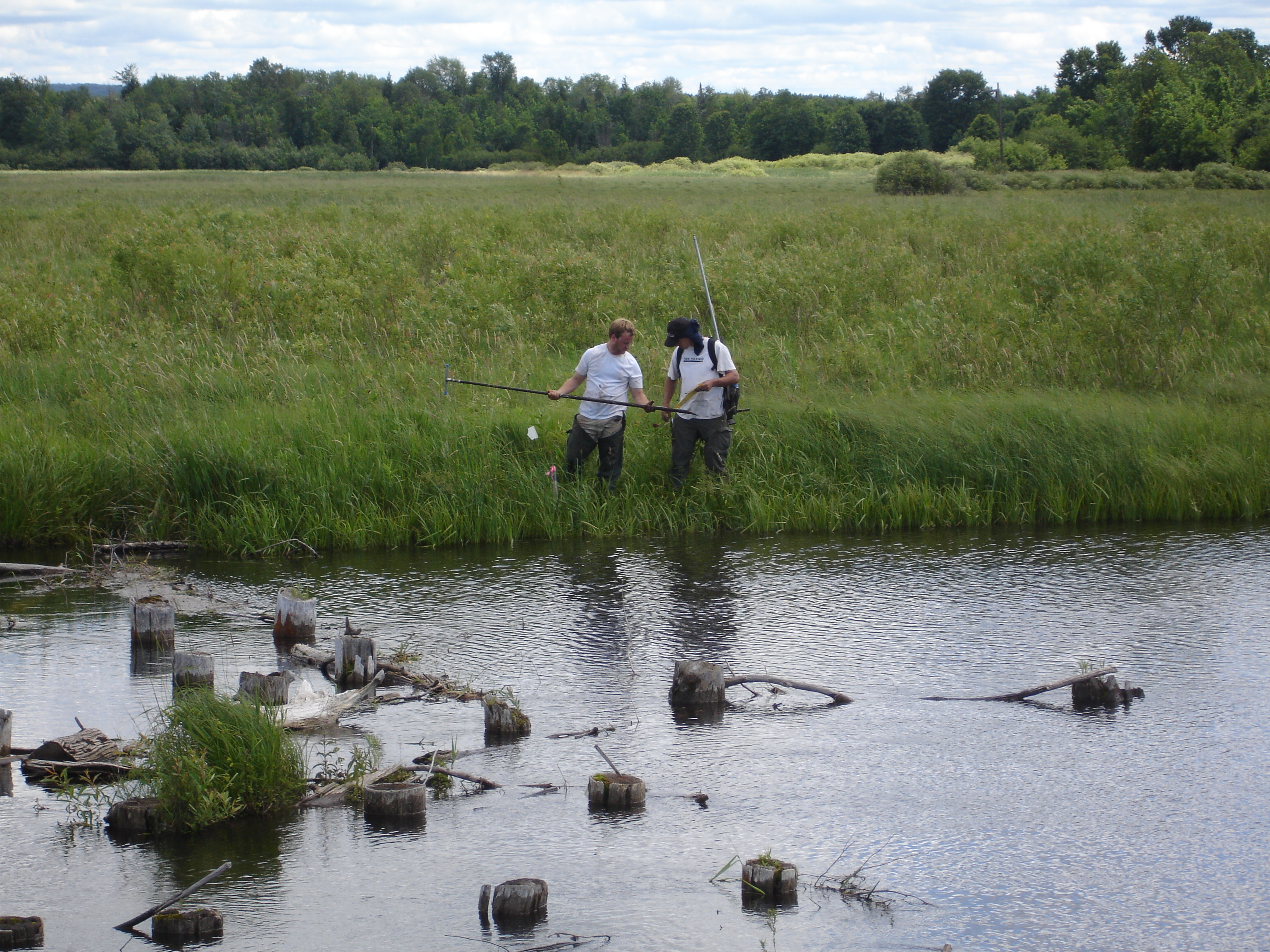
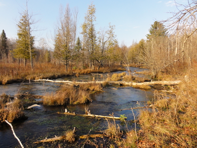
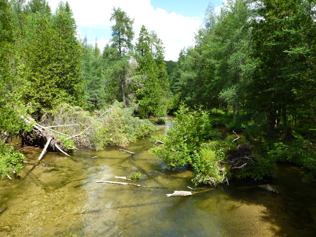
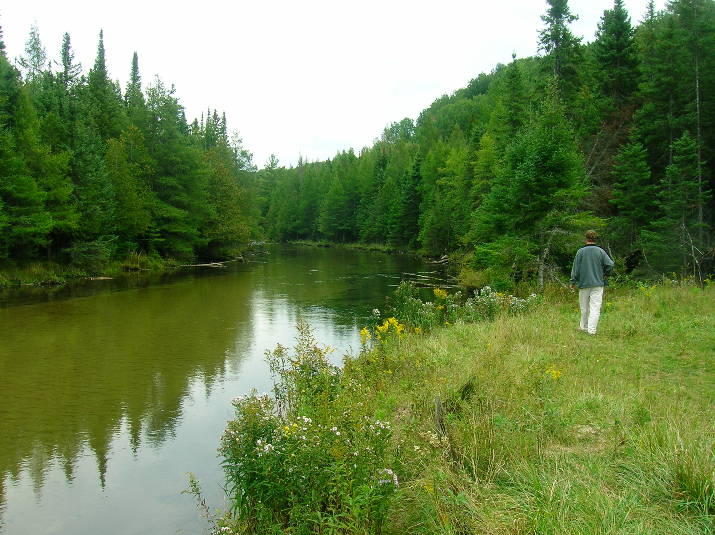
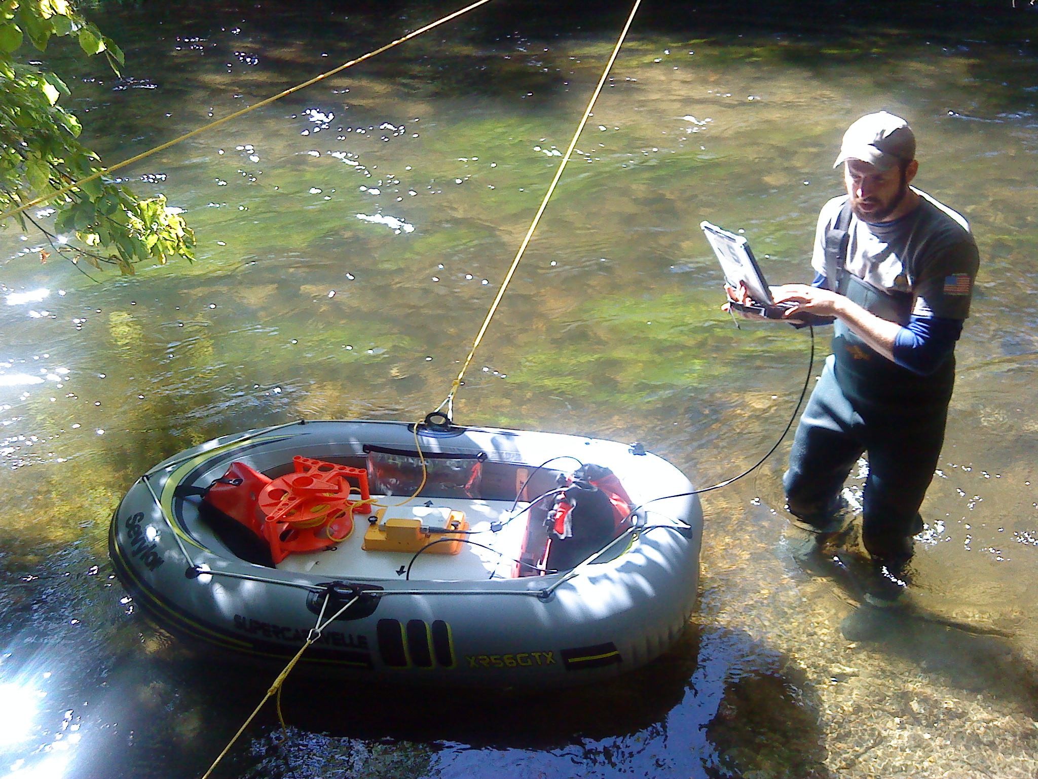
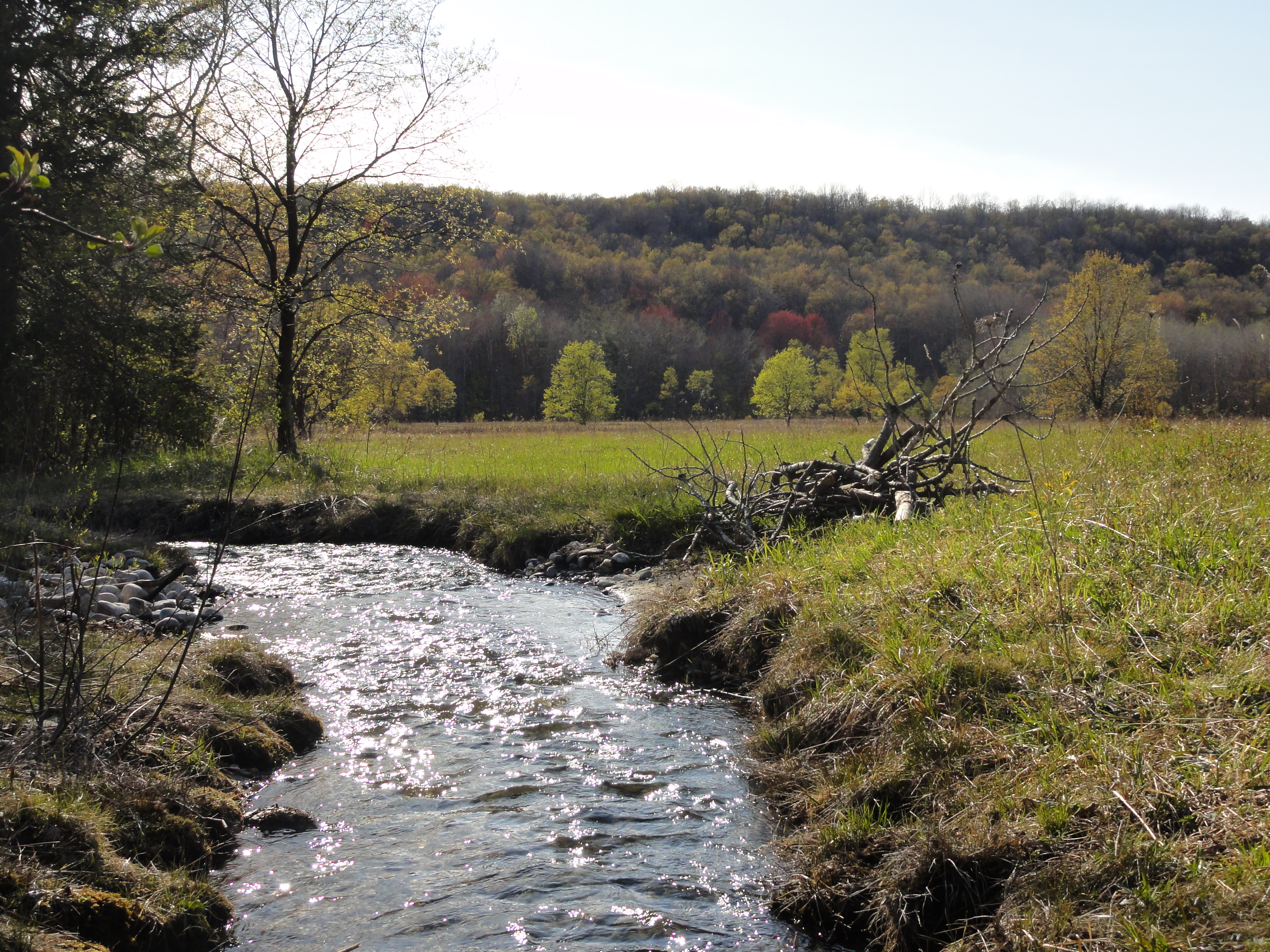
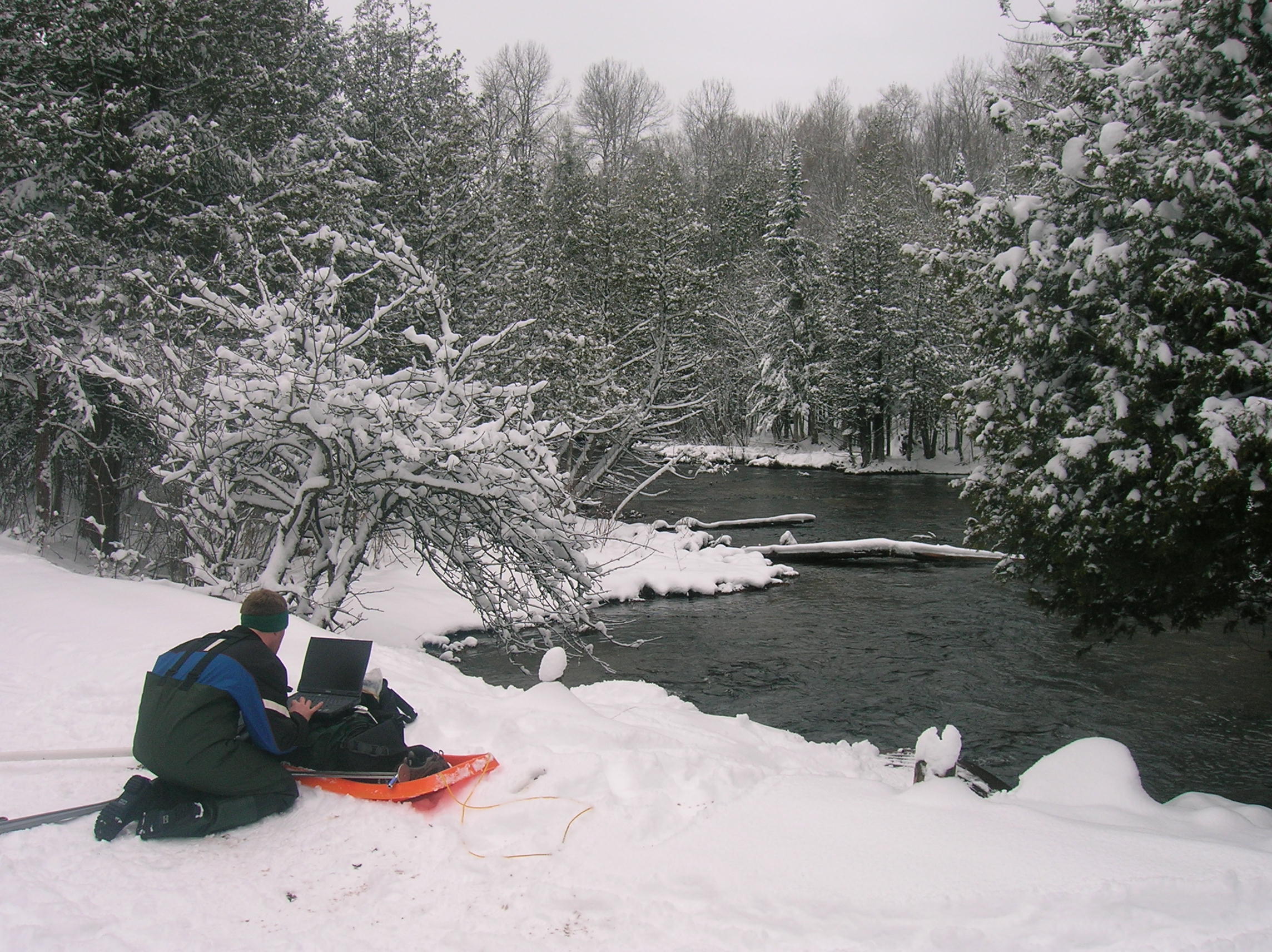
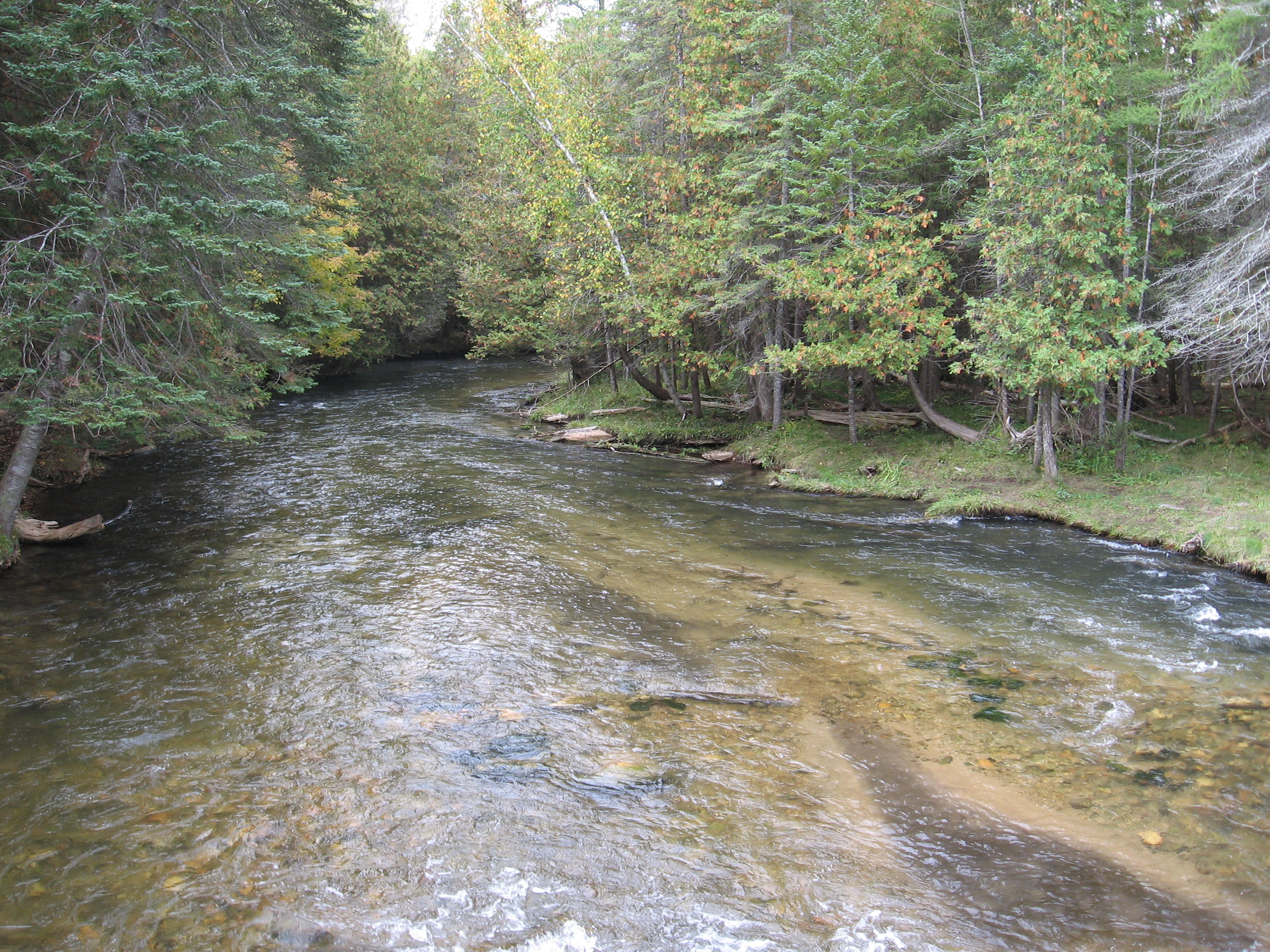
We would like to thank the Friends of the Jordan River Watershed for their continued support for our efforts in the Jordan River Watershed.
]]>
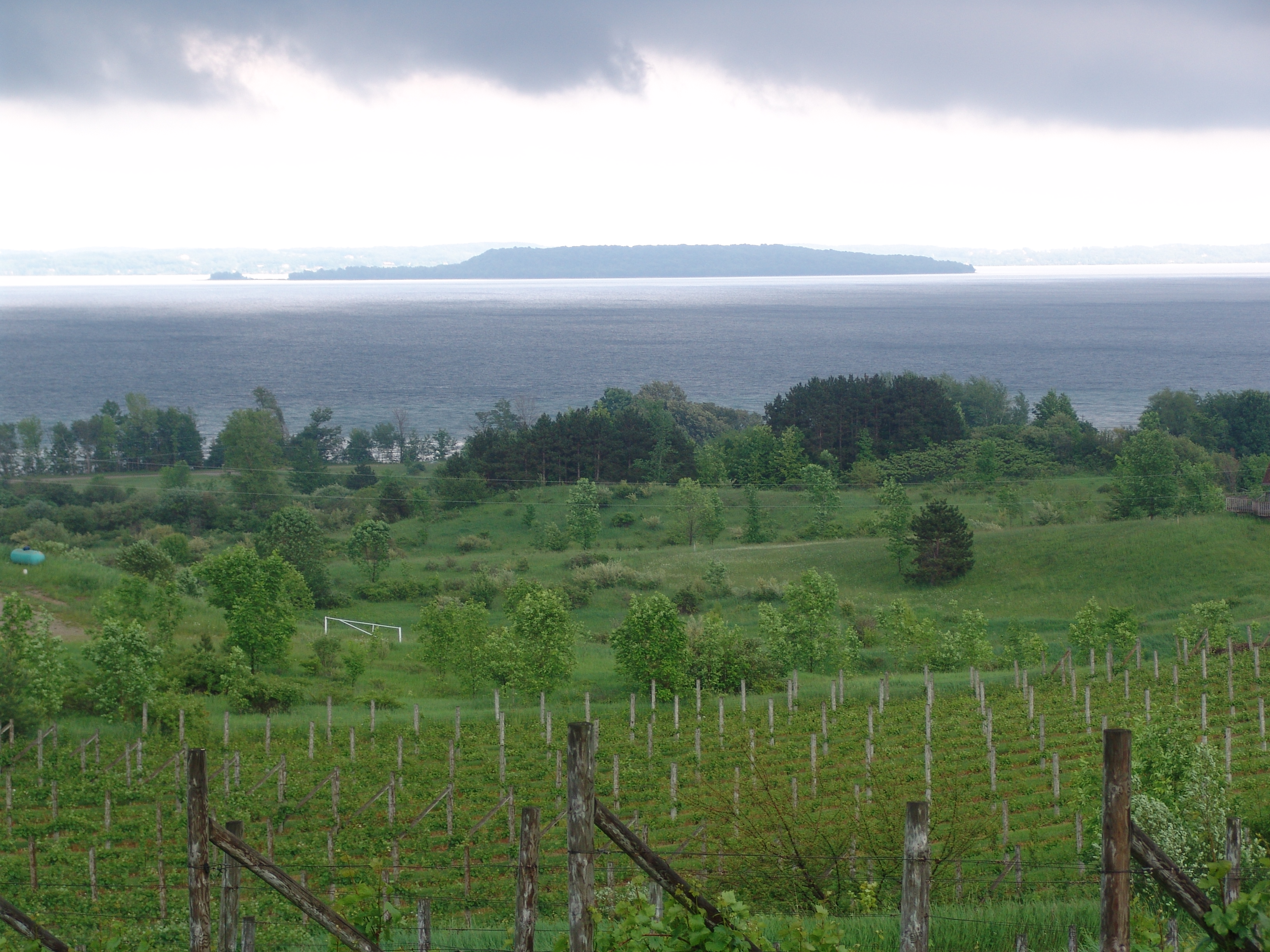
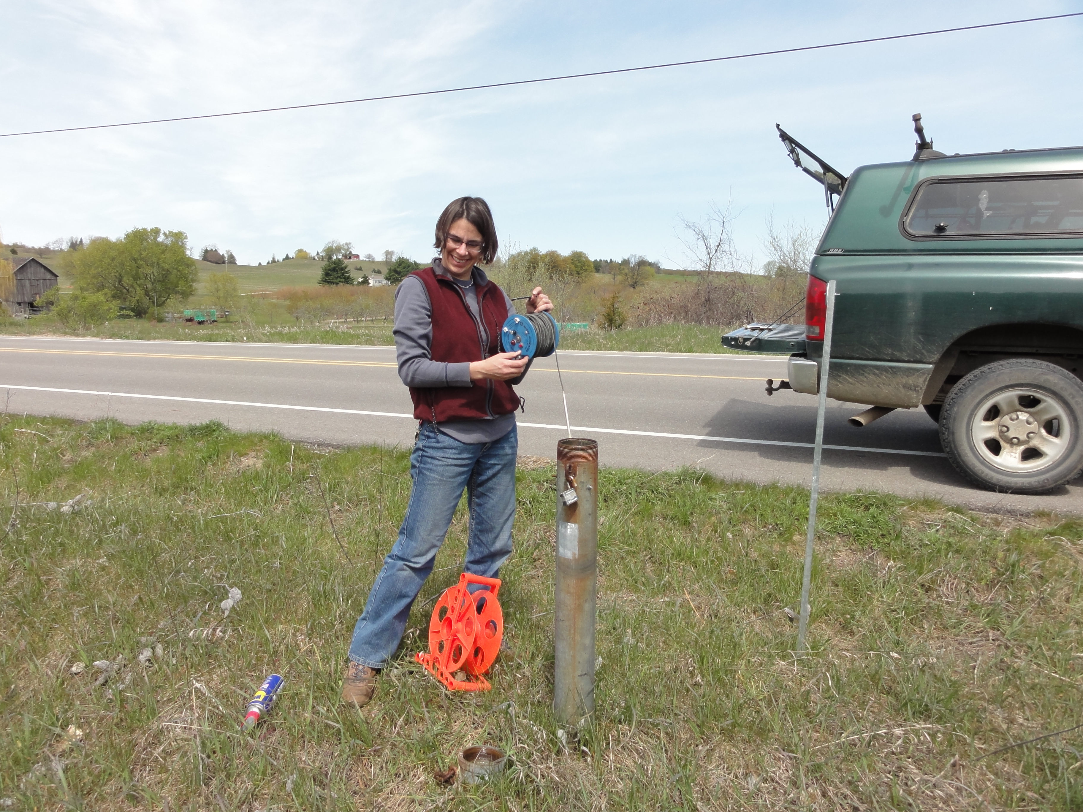
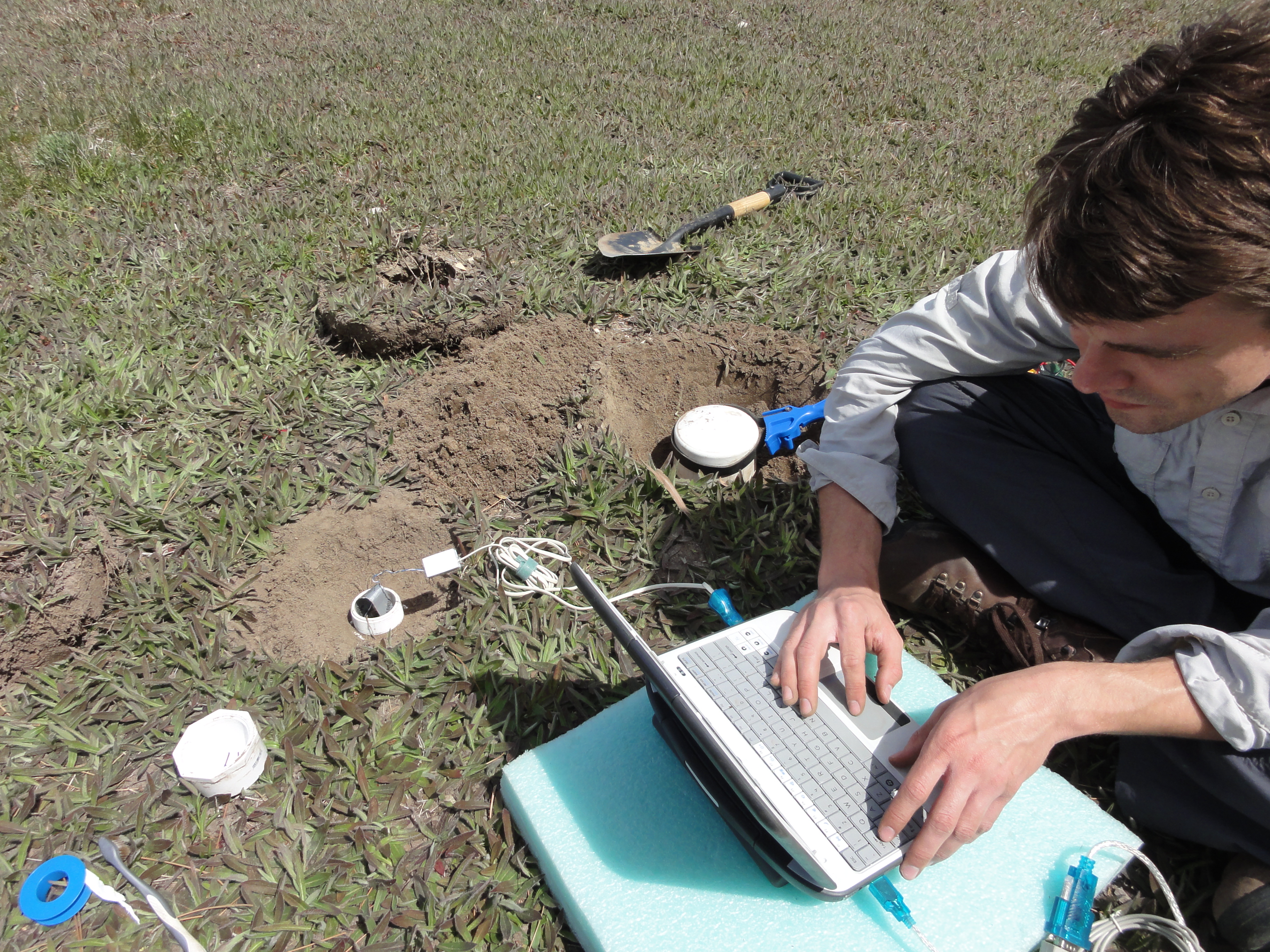
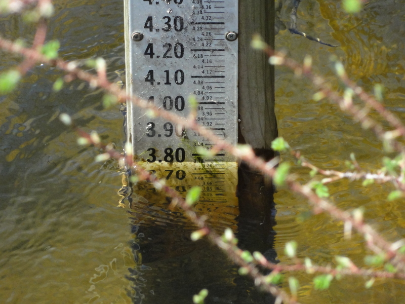
Funding agencies: NOAA Sea Grant program; NSF Multi-Scale Modeling and Monitoring
Projects:
]]>
Projects:
]]>
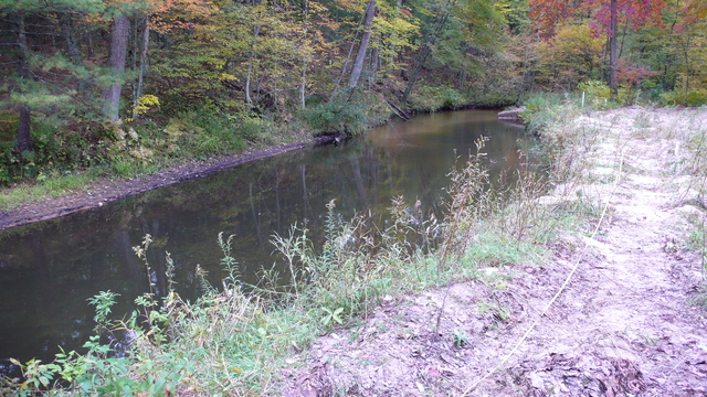

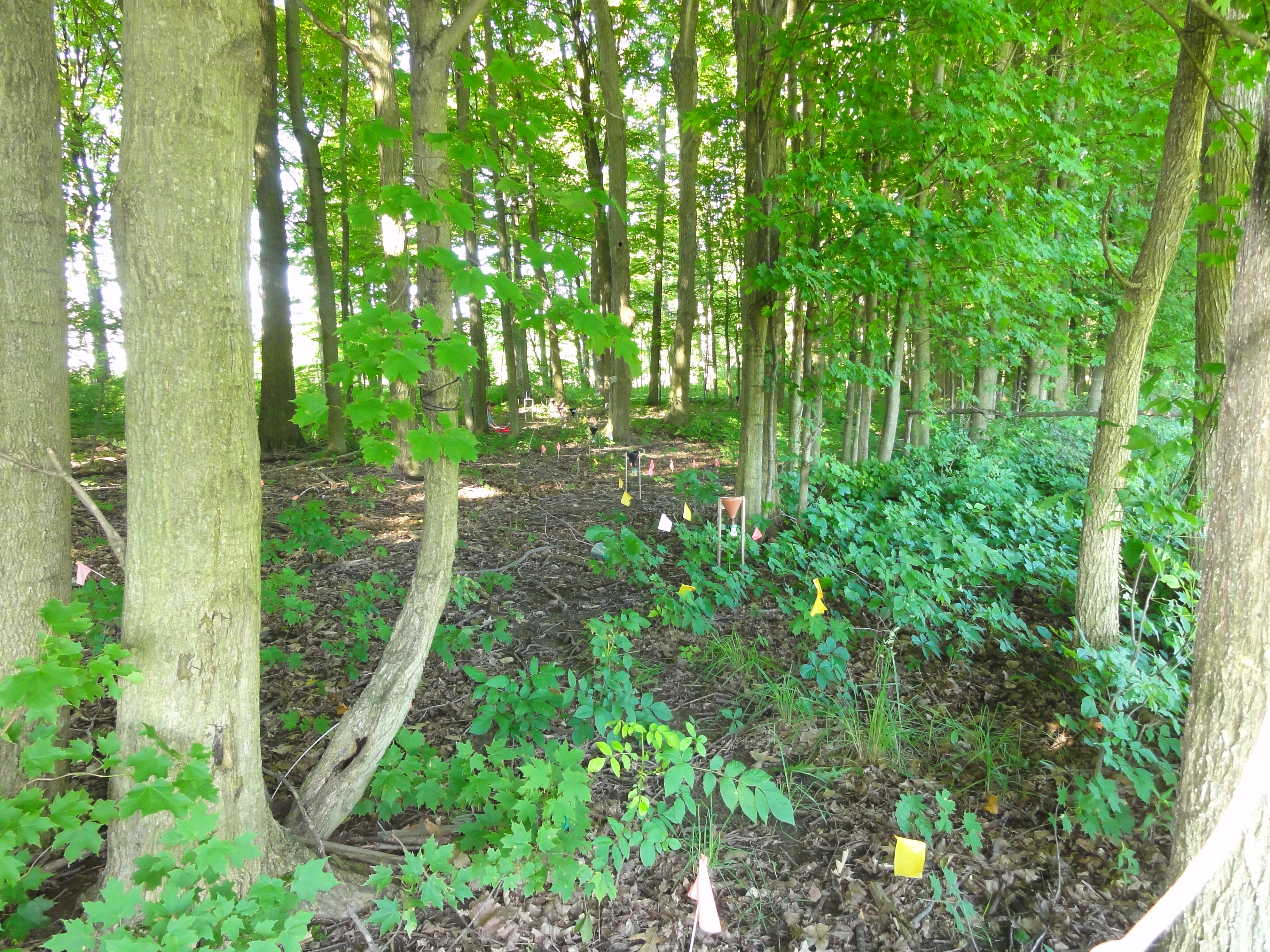
![]()
Projects:
]]>
We have developed a novel hydrologic process model called the Integrated Landscape Hydrology Model (ILHM), which is a framework of existing and novel codes to simulate the entire hydrologic cycle at large watershed scales. ILHM is capable of modeling all the major surface and near-surface hydrologic processes including evapotranspiration, groundwater recharge, and stream discharge. In the first published application of the model, the ILHM-modeled stream flows compared favorably with measured data with a minimum of parameter calibration. It was tested for a small watershed (~130 square kilometers) in Michigan, and is currently being applied to much larger domains.

The figure on the left shows average simulated groundwater recharge over a 27 year period (1980-2006) for the Muskegon River Watershed in central lower Michigan. Calculated groundwater recharge values vary as much as 50% across the watershed within similar land use classes. Recharge also varies significantly between land use types.
The primary ILHM code is written in the MATLAB computing environment with some routines coded in C and FORTRAN. GIS inputs in a variety of formats can be used. Time-series inputs and parameter values are stored in MySQL, and model outputs are written to disk in HDF5 format.
Understanding dynamic watershed processes requires high spatial and temporal resolution simulations coupled to extensive databases of groundwater levels and stream flows. Our groundwater flow simulations are being integrated into a suite of tools to better understand the influence of land use and climate changes on water flows, nutrient fluxes to streams, and the health of aquatic ecosystems.
Related Publications:
- Wiley, M., B. Pijanowski, R. Stevenson, P. Seelbach, P. Richards, C. Riseng, D. Hyndman, and J. Koches, (2008), Integrated Modeling of the Muskegon River: Ecological Risk Assessment in a Great Lakes Watershed. In “Wetland and Water Resource Modeling and Assessment: A Watershed Perspective”, CRC Press.
- Stevenson, R. J., M. J. Wiley, S. H. Gage, V. L. Lougheed, C. M. Riseng, P. Bonnell, T. M. Burton, R. A. Hough, D. W. Hyndman, J. K. Koches, D. T. Long, B. C. Pijanowski, J. Qi, A. D. Steinman, and D. G. Uzarski, (2008), Watershed Science: Essential, Complex, Multidisciplinary and Collaborative. In “Wetland and Water Resource Modeling and Assessment: A Watershed Perspective”, CRC Press.
- Hyndman, DW, AD Kendall, and NRH Welty, (2007), Evaluating Temporal and Spatial Variations in Recharge and Streamflow Using the Integrated Landscape Hydrology Model (ILHM), AGU Monograph, Data Integration in Subsurface Hydrology
- Kendall, AD, and DW Hyndman, (2007), Examining Watershed Processes Using Spectral Analysis of Hydrologic Time Series, AGU Monograph, Data Integration in Subsurface Hydrology
- Jayawickreme, DH, and DW Hyndman, (2007), Evaluating the Influence of Land Cover on Seasonal Water Budgets Using Next Generation Radar (NEXRAD) Rainfall and Streamflow Data, Water Resources Research, 43, W02408
Related Conference Abstracts:
- Kendall, AD, and DW Hyndman, (2007), Simulating Fluxes Through Large Watersheds Using Remotely Sensed and Ground Based Datasets With the Integrated Landscape Hydrology Model ILHM, Geological Society of America, Abstracts with Programs
- Kendall, A, JA Bernstein, and DW Hyndman, (2007), Improving Regional Groundwater Recharge Models With A Network Of High-Resolution Temperature Recording Buttons, Geological Society of America, Abstracts with Programs
- Hyndman, DW, AD Kendall, (2006), The Integrated Landscape Hydrology Model (ILHM), a Fully-Distributed Approach to Simulate Regional Watershed Hydrologic Processes, H11A-1234, Eos Trans AGU
- Kendall, AD, DW Hyndman, (2006), Predicting Streamflow, Groundwater Recharge, and Evapotranspiration at the Regional Scale with the Integrated Landscape Hydrology Model (ILHM), H31H-06, Eos Trans AGU
 Related Publications:
]]>
Related Publications:
]]> Solute transport through heterogeneous environments is often poorly understood because of inadequate definition of aquifer stresses and boundary conditions. One approach to address these concerns is to transport a large, minimally disturbed, highly heterogeneous aquifer mesocosm to a controlled laboratory setting. This approach will bridge the gap between small-scale laboratory studies and large-scale field studies.
]]>
Solute transport through heterogeneous environments is often poorly understood because of inadequate definition of aquifer stresses and boundary conditions. One approach to address these concerns is to transport a large, minimally disturbed, highly heterogeneous aquifer mesocosm to a controlled laboratory setting. This approach will bridge the gap between small-scale laboratory studies and large-scale field studies.
]]> Ground water chemistry is reflective of time-weighted averages of anthropogenic inputs originating from spatial and temporal patterns of land use. We developed an approach to examine potential relationships between land use-derived solutes and baseflow surface water quality using regional ground water and solute transport models linked to GIS. Our first test of this approach estimated chloride concentrations in surface water due to road salt transport through ground water in Michigan’s Grand Traverse Bay watershed.
Further development of watershed-scale groundwater flow and transport models has been undertaken to examine the impacts of various land uses on nitrate concentrations. In Michigan, streams are predominantly groundwater-fed for much of the year. Therefore, understanding groundwater nitrate concentrations and fluxes is vital to understanding stream water quality. The figure on the left shows a preliminary simulation of total N concentrations in Cedar Creek, a small subwatershed of the Muskegon River in central lower Michigan.
Related Publications:
Wood W.W. and Sanford W.E., 2007, Atmospheric bromine flux from the coastal Abu Dhabi sabkhat: A ground-water mass-balance investigation. Geophysical Research Letters, 34(14).
Tyler S.W., Munoz J.F., and Wood W.W., 2006, The response of playa and sabkha hydraulics and mineralogy to climate forcing. Ground Water, 44(3), 329-338.
Wood W.W., Sanford W.E., and Frape S., 2005, Chemical openness and potential for misinterpretation of the solute environment of coastal sabkhat. Chemical Geology, 215(1-4), 361-372.
Related Conference Abstracts:
]]> Ground-water contamination with volatile organic compounds is a significant national and international problem. Waters containing these contaminants are typically pumped from contaminated aquifers and treated by air stripping or sorption onto activated carbon. These methods are costly, do not destroy the contaminants, may require pumping and disposal of large water volumes, and do not effectively remove contaminants sorbed to the aquifer material.Accordingly, there has been a great deal of interest in alternative treatment strategies, such as enhanced in-situ remediation. Our research group in collaboration with the Departments of Civil and Environmental Engineering and the Center for Microbial Ecology designed and installed a cost-effective biocurtain that is currently being used to remove carbon tetrachloride from an aquifer in Schoolcraft, Michigan. Novel aspects of the design are the use of closely-spaced wells to recirculate solutes through a biocurtain, well screens spanning the vertical extent of contamination, and a semi-passive mode of operation, with only six hours of low-level pumping per week.
Related Publications:
]]> A fundamental issue in aquifer biogeochemistry is the means by which solute transport geochemical processes, and microbiological activity combine to produce spatial and temporal variations in redox zonation. Our Hydrogeology and Hydrogeochemistry groups are examining the temporal variability of TEAP conditions in shallow groundwater contaminated with waste fuel and chlorinated solvents.
Related Publications:
]]> New methods of estimating aquifer properties are needed to improve our understanding of the factors that influence the transport and fate of groundwater contaminants, and to better design remediation systems. Geophysical methods have long been applied to characterize oil reservoirs, while their application to characterize aquifers is much more recent. Our research group is developing a novel set of approaches that combine diverse hydrologic and geophysical data sources to estimate flow and transport properties with the highest resolution possible.
Related Publications:
Bridge, JS and DW Hyndman, (2004), Preface: Aquifer Characterization, SEPM Special
]]> Personal History
At the age of 15, I watched the Cuyahoga River burn from my back yard. From that point on, I knew I wanted to be in the environmental field. After thirty years of professional experience and management in the environmental field, I elected to return to school and work on my doctorate so that I could bring real world experiences into the classroom.
Research Interests
As a consultant, I’ve had the opportunity to observe the impact of contaminated groundwater on various surface water bodies. In many cases, the impacts were not as anticipated. Surface water quality should be directly linked to both the sources of contaminants and the water body’s capacity to interact with and adjust to changing environmental (hydrologic and geochemical) conditions. Unfortunately, the dynamics of surface and ground-water interactions are very complex and not well understood.
My research focuses on local-scale hydrology at a point bar system located on a tributary of the Muskegon River, where I am examining the relationships among groundwater, surface water, porosity, soil moisture, and hydraulic conductivity. To determine these local relationships, I developed a network of 20 monitoring wells, 2 stream gauging stations, four soil moisture stations and a weather station to collect the appropriate hydrologic data for my dissertation.
Education
M.Engineer, Geologic Engineering, Colorado School of Mines, Golden, Colorado, 1983.
B.S., Geology, University of Cincinnati, Cincinnati, Ohio, 1975.
Publications
Bove, J. and L. M Cooper, 1990. “An Introduction to Geosynthetics: Fundamentals, Applications, and Design,” Short Course, 33rd Annual Meeting, Association of Engineering Geologists, Pittsburgh, PA.
Cooper, L. M. and R. Hosfeld, 1986. “Investigation and Remediation of a Pond Contaminated by Diesel Fuel,” 7th National Conference on Management of Uncontrolled Hazardous Waste Sites, HMCRI, Washington, D.C.
Cooke, S. D.; Cooper, L. M and C. W Byrer, 1984. “A Site Characterization and Environmental Monitoring Approach for UCG Research and Development in Bituminous Coals,” 10th Annual UCG Symposium, DOE.
Howard, J. F., Komar, C. A. and L. M. Cooper, Editors, 1984. “Workshop on Remote Sensing/ Lineament Applications for Energy Extraction,” U.S. Department of Energy DOE/METC/84-9, Morgantown, WV
Cooper, L. M., 1983, “Applications of Geophysics to Hydrogeologic Studies in Routt and Jackson Counties, Colorado,” Colorado School of Mines, Golden, Colorado, prepared as an open-file report for the U.S. Geological Survey, Lakewood, Colorado. (Master’s Thesis)
Abstracts
Cooper, L. M., 2007, “Remediation of a “Free-Product” Contaminant Plume at a Leaking UST Site using In-Situ Bio-Remediation and SVE,” American Institute of Professional Geologists, Lansing, Michigan.
Cooper, L. M., 2004. “Dancing with Brownfields: The Zephyr Oil Story,” Association of Engineering Geologists Annual Meeting, Dearborn, Michigan.
Cooper, L. M., 1998. “Remediation of a Chlorinated Solvent Plume,” Association of Engineering Geologists Annual Meeting, Seattle, Washington.
Cooper, L. M., 1996. “Quality Control and Quality Assurance in Environmental Consulting,” Association of Engineering Geologists Annual Meeting, New Brunswick, New Jersey.
Complete CV
]]>
I first started my career as geologist knowing that I wanted to major in either environmental geology or hydrogeology in my eighth grade year of middle school at my home town, Spring Lake, MI. I went on through high school never changing what I wanted to be all the way through high school and college by which I eventually graduated from Central Michigan University with a B.S. with a major in Environmental Geology and another major in Environmental Science.
In the fall of 2005 I applied to Michigan State University after being in contact with Dr. Hyndman (my current advisor). I was impressed on how close the research group here was and how closely everyone worked together. There seemed to be an abundance of research topics that I could have worked with ranging from hydrology to near surface geophysics. Two years later I am completing my thesis on Land use effects on sediment and nutrient transport. I have also had the chance to present my research from other projects I have done while at MSU at the American Geophysical Union (held in San Francisco) for three consecutive years and once at GSA in Salt Lake City.
My experience while working in this lab as a hydrologist and Environmental Geophysicist has befitted my career. The skill sets, knowledge, and working synergy that I have come to enjoy have been my number one reason I would recommend this lab to anyone. The unique combinations of modeling capabilities, hydrology related field work, near-surface geophysical methods, and the critical thinking skills that one can develop as a Master’s or PhD will provide a valuable skill set to any company, research group, or institution/agency.
I am currently interviewing for jobs out in the Seattle, Atlanta, and Denver areas. After graduating with my M.S., I hope to work a few years in the consulting industry and then go back for my PhD.
]]> Research Interests
My research has focused on regional-scale landscape hydrology, examining the terrestrial hydrologic cycle and its relationship to climate, vegetation and biogeochemical cycles. I c0-developed the Landscape Hydrology Model (LHM), an integrated modeling tool to study large-scale, fine-resolution hydrologic processes using modest computational tools. Partly due to the challenge of providing fine-resolution inputs at regional scales, and because of the importance of the questions at those scales I have become involved in all aspects of “big data” discovery, processing, and analysis. This includes using machine learning algorithms to yield insights into environmental phenomena and to better prepare inputs for process-based models. I am also (as my photo suggests) actively involved in field data collection, and view this as a critical and foundational aspect of hydrologic sciences.
I have spent most of my research career as part of large, interdisciplinary research teams, working at all levels from undergraduate to Co-PI. Along the way I developed a deep appreciation of the value of interdisciplinary research, and a recognition that most of society’s great questions lie not within the walls of a discipline, but at their intersections. In the last few years I and other members of the Hydrogeology Lab have built strong collaborations with climate scientists, ecologists, agronomists, socio-behavioral scientists, economists, and engineers. These collaborative relationships are driving forward the next generation of research here at MSU and around the world.
Education
- PhD 2009, Michigan State University, Environmental Geosciences
Thesis: Predicting the Impacts of Land Use and Climate Change on Regional-Scale Hydrologic Fluxes
Advisor: Dr. David W. Hyndman - BS 2004, Michigan State University, Mechanical Engineering
- BS 2004, Michigan State University, Astronomy/Astrophysics
Recent Publications
- Deines J.M., Kendall A.D., Hyndman D.W. (2017), Annual irrigation dynamics in the US Northern High Plains derived from Landsat satellite data, Geophysical Research Letters. Early View Available, DOI: 10.1002/2017GL074071
- Hyndman, D.W., T.Xu, J.M. Deines, G. Cao, R. Nagelkirk, A. Vina, W. McConnell, B. Basso, A.D. Kendall, S. Li, L. Luo, F. Lupi, J.A. Winkler, W. Yang, C. Zheng, and J. Liu, (2017), Quantifying changes in water use and groundwater availability in a megacity using novel integrated systems modeling. Geophysical Research Letters. Early View Available, DOI: 10.1002/2017GL074429
- Cotterman, K.A., Kendall, A.D., Basso, B., and D.W. Hyndman, (2017), Groundwater Depletion and Climate Change: Crop Production Declines over the Ogallala Aquifer, Climatic Change: accepted, DOI: 10.1007/s10584-017-1947-7
- Luscz, E.C., Kendall, A.D., and D.W. Hyndman, (2017), A spatially explicit statistical model to quantify nutrient sources, pathways, and delivery at the regional scale, Biogeochemistry: 133(1), 37-57, DOI: 10.1007/s10533-017-0305-1
- Martin, S.L., Hayes, D.B., Kendall, A.D., and D.W. Hyndman, (2017), The land-use legacy effect: Towards a mechanistic understanding of time-lagged water quality responses to land use/cover, Science of the Total Environment 579: 1794-1803, DOI: 10.1016/j.scitotenv.2016.11.158